Forests & woodlands · Yorkshire & the Humber
RSPB Blacktoft Sands
RSPB Blacktoft Sands is a forest or woodland in the United Kingdom.

Wikimedia Commons contributors — see linked file page for photographer and licence licence
Plan your visit
- Typical visit
- 1 h–3 h
- Nearest railway station
- Gilberdyke · 6.0 km
- Free entry
- Family-friendly
- Dog-friendly
About
RSPB Blacktoft Sands is a named forest, woodland or nature reserve in the United Kingdom. Coordinates: 53.6945°, -0.7264°. This entry is part of The Great Britain Guide, a free, ad-free, open-data tourist directory.
Photo gallery
Protected designations
- Site of Special Scientific Interest: Humber Estuary - 2000480 SSSI
- Ramsar wetland: Humber Estuary
Designations sourced from Natural England open data under OGL v3.
From the Wikipedia article
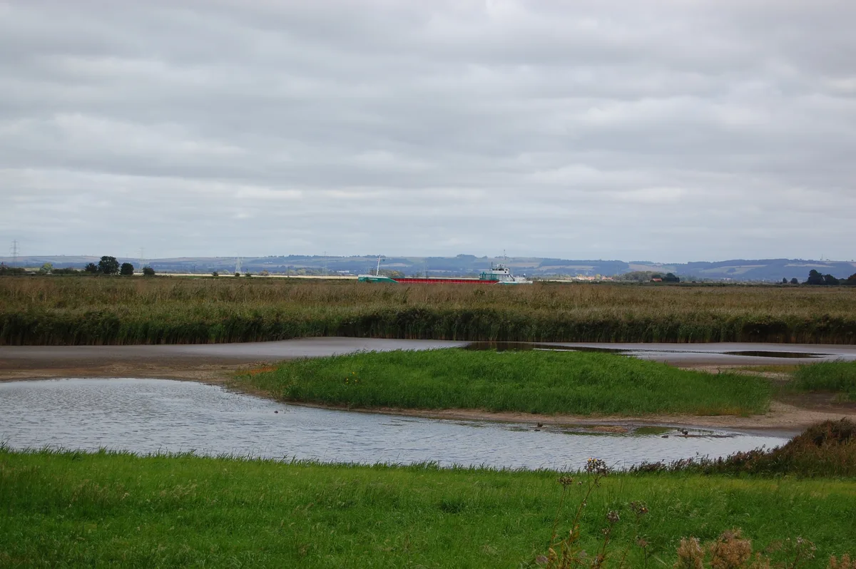
Blacktoft Sands RSPB reserve is a nature reserve in the East Riding of Yorkshire, England. It is managed by the Royal Society for the Protection of Birds, which leases the site from Associated British Ports.
Excerpt from Wikipedia under CC BY-SA 4.0. See the source article linked in Sources below.
Background
Description
The site is on the southern bank of the Ouse, west of its confluence with the River Trent, opposite the village of Blacktoft, and is a wetland. Being at the beginning of the Humber Estuary, the water is slightly saline. The reserve's tidal reedbed is the largest in England. It is managed using a mixture of grazing with our six konik horses, reed cutting and maintaining and excavation of pools within the reedbed.
Sourced from Wikipedia under CC BY-SA 4.0.
- Coordinates
- 53.6945, -0.7264
- District
- East Riding of Yorkshire
- Parish
- Twin Rivers
- Postcode
- DN14 8HR
- Parliamentary constituency
- Goole and Pocklington
- Nearest railway station
- Gilberdyke — 6 km
Sources
- osm: w11651113 (ODbL)
- wikipedia: Blacktoft Sands RSPB reserve (CC BY-SA 4.0)
- commons: Blacktoft Sands RSPB reserve with Ship.JPG (CC BY-SA 4.0)
Other places nearby
Loading nearby places…
Nearby
 📷 3
📷 3Wildlife reserves · Yorkshire & the Humber
Blacktoft Sands RSPB reserve
Blacktoft Sands RSPB reserve — RSPB nature reserve in England.
 📷 5
📷 5Museums · Yorkshire & the Humber
River Trent
River Trent — a museum in england-yorkshire, United Kingdom.
 📷 3
📷 3Lighthouses · Yorkshire & the Humber
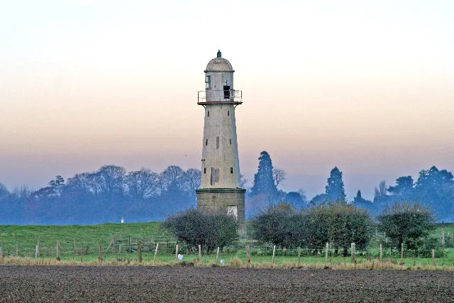
Whitgift Lighthouse
Whitgift Lighthouse — lighthouse in Twin Rivers, East Riding of Yorkshire, England, UK.
 📷 5
📷 5Museums · Yorkshire & the Humber
River Ouse, Yorkshire
River Ouse, Yorkshire — a museum in england-yorkshire, United Kingdom.
 📷 3
📷 3Archaeological sites · Yorkshire & the Humber
Yokefleet Hall
Yokefleet Hall — a archaeological in england-yorkshire, United Kingdom.
Campsites · Yorkshire & the Humber
Whitgift Hall Caravan Site and Fishery
Whitgift Hall Caravan Site and Fishery — a campsite in england yorkshire.
More forests in this region
.JPG?width=1200) 📷 4
📷 4Forests & woodlands · Yorkshire & the Humber
Acaster South Ings SSSI
Acaster South Ings SSSI is a forest or woodland in the United Kingdom.
 📷 3
📷 3Forests & woodlands · Yorkshire & the Humber
Allerthorpe Common
Allerthorpe Common is a forest or woodland in the United Kingdom.
.jpg?width=1200) 📷 5
📷 5Forests & woodlands · Yorkshire & the Humber
Askham Bog
Askham Bog is a forest or woodland in the United Kingdom.
 📷 3
📷 3Forests & woodlands · Yorkshire & the Humber
Beckhead Plantation SSSI
Beckhead Plantation SSSI is a forest or woodland in the United Kingdom.
Frequently asked questions
- Where is RSPB Blacktoft Sands?
- RSPB Blacktoft Sands is in Yorkshire, United Kingdom (postcode DN14 8HR), in the parish of Twin Rivers.
- Is RSPB Blacktoft Sands a protected site?
- Yes — RSPB Blacktoft Sands is part of the Humber Estuary - 2000480 SSSI Site of Special Scientific Interest and the Humber Estuary Ramsar wetland.
- Is RSPB Blacktoft Sands free to visit?
- Yes, RSPB Blacktoft Sands is free to enter.
- How do I get to RSPB Blacktoft Sands?
- The nearest railway station is Gilberdyke, about 6.0 km away. Drivers can navigate to postcode DN14 8HR.