Forests & woodlands · West Midlands
Rothwell Gullet
Rothwell Gullet is a forest or woodland in the United Kingdom.

Wikimedia Commons contributors — see linked file page for photographer and licence licence
Plan your visit
- Typical visit
- 1 h–3 h
- Nearest railway station
- Kettering · 6.9 km
- Free entry
- Family-friendly
- Dog-friendly
- Wheelchair accessible
About
Rothwell Gullet is a named forest, woodland or nature reserve in the United Kingdom. Wheelchair accessible (per OpenStreetMap). Coordinates: 52.4273°, -0.8173°.
Photo gallery
From the Wikipedia article
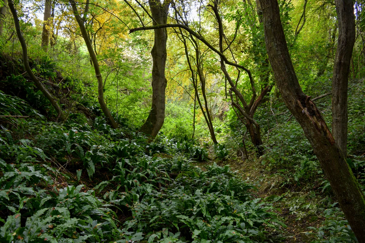
Rothwell Gullet (grid reference SP806818) is a 1.6-hectare (4.0-acre) nature reserve near Rothwell, Northamptonshire. It is owned and managed by the Wildlife Trust for Bedfordshire, Cambridgeshire and Northamptonshire. The reserve is composed of an old ironstone quarry and a grassland area. It is well known for the swathes of hart's-tongue fern that cover the damp bottom of the gullet.
Excerpt from Wikipedia under CC BY-SA 4.0. See the source article linked in Sources below.
- Coordinates
- 52.4273, -0.8173
- District
- North Northamptonshire
- Parish
- Rothwell
- Postcode
- NN14 6GB
- Parliamentary constituency
- Kettering
- Nearest railway station
- Kettering — 6.9 km
- Official site
- www.wildlifebcn.org
Sources
- osm: w259136244 (ODbL)
- wikipedia: Rothwell Gullet (CC BY-SA 4.0)
- commons: Rothwell Gullet.jpg (CC BY-SA 4.0)
Other places nearby
Loading nearby places…
Nearby
 📷 3
📷 3Wildlife reserves · West Midlands
Rothwell Gullet
Rothwell Gullet — nature reserve in the United Kingdom.
 📷 5
📷 5Museums · West Midlands
Rothwell, Northamptonshire
Rothwell, Northamptonshire — a museum in england-west-midlands, United Kingdom.
 📷 3
📷 3Memorials & monuments · West Midlands
Rothwell War Memorial, Northamptonshire
Rothwell War Memorial, Northamptonshire — Grade II listed building-listed memorial in england-west-midlands, United Kingdom.
Campsites · West Midlands
S/T Nunnery Farm
S/T Nunnery Farm — a campsite in england west midlands.
📷 3Museums · West Midlands
Rothwell Arts and Heritage centre
Rothwell Arts and Heritage centre — a museum in england-west-midlands, United Kingdom.
 📷 3
📷 3Follies · West Midlands
Rothwell Bone Crypt
Rothwell Bone Crypt is a folly in the United Kingdom.
More forests in this region
 📷 3
📷 3Forests & woodlands · West Midlands
Abington Meadows Nature Reserve
Abington Meadows Nature Reserve is a forest or woodland in the United Kingdom.
_(geograph_2935627).jpg?width=1200) 📷 3
📷 3Forests & woodlands · West Midlands
Adderbury Lakes
Adderbury Lakes is a forest or woodland in the United Kingdom.
 📷 3
📷 3Forests & woodlands · West Midlands
Alcott Wood
Alcott Wood is a forest or woodland in the United Kingdom.
 📷 3
📷 3Forests & woodlands · West Midlands
Alvecote Meadows Nature Reserve
Alvecote Meadows Nature Reserve is a forest or woodland in the United Kingdom.
Frequently asked questions
- Where is Rothwell Gullet?
- Rothwell Gullet is in the West Midlands, United Kingdom (postcode NN14 6GB), in the parish of Rothwell.
- Who owns Rothwell Gullet?
- Rothwell Gullet is owned by Wildlife Trust for Bedfordshire, Cambridgeshire and Northamptonshire.
- Is Rothwell Gullet free to visit?
- Yes, Rothwell Gullet is free to enter.
- How do I get to Rothwell Gullet?
- The nearest railway station is Kettering, about 6.9 km away. Drivers can navigate to postcode NN14 6GB.