Viewpoints · South West England
Rock stack
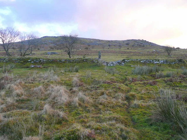
Rock stack — Named viewpoint at 388 m elevation.

Eric Foster — CC BY-SA 2.0 via Wikimedia Commons licence
Plan your visit
- Typical visit
- 20 min–45 min
- Best time of year
- Clear days year-round
- Nearest railway station
- Liskeard · 8.8 km
- Free entry
- Dog-friendly
About
Rock stack is a named viewpoint in South-West England, marked on Ordnance Survey maps for its outlook. The site is within the Cornwall National Landscape (AONB). It sits within the South East Cornwall parliamentary constituency. The nearest railway station is Liskeard, about 8.8 km away. Postcode area PL14.
Photo gallery
Protected designations
- Area of Outstanding Natural Beauty: Cornwall
Designations sourced from Natural England open data under OGL v3.
From the Wikipedia article
Rock balancing (also stone balancing, or stacking) is a form of recreation or artistic expression in which rocks are piled in balanced stacks, often in a precarious manner. Conservationists and park services have expressed concerns that the arrangements of rocks can disrupt animal habitats, accelerate soil erosion, and misdirect hikers in areas that use cairns as navigation waypoints.
Excerpt from Wikipedia under CC BY-SA 4.0. See the source article linked in Sources below.
- Coordinates
- 50.5261, -4.4594
- District
- Cornwall
- Parish
- Linkinhorne
- Postcode
- PL14 5LJ
- Parliamentary constituency
- South East Cornwall
- Nearest railway station
- Liskeard — 8.8 km
Sources
- osm: n2714018875 (ODbL)
- wikipedia: Rock stacking (CC BY-SA 4.0)
Other places nearby
Loading nearby places…
Nearby
 📷 3
📷 3Mountains & hills · South West England
Stowe's Hill
Stowe's Hill — Named summit at 381.0 m.
 📷 4
📷 4Natural landmarks · South West England
Cheesewring
The Cheesewring (Cornish: Keuswask) is a granite tor in Cornwall, England, situated on the eastern flank of Bodmin Moor on Stowe's Hill in the parish of Linkinhorne approximately one mile northwest of
Vineyards · South West England
Earlier Prehistoric hillfort, two cairns, medieval pound and adjacent Prehistoric field systems, hut circles and transhumance hu
Earlier Prehistoric hillfort, two cairns, medieval pound and adjacent Prehistoric field systems, hut circles and transhumance hu — a UK vineyard in england south west, producing English or Welsh wine from cool-climate grape varieties.
 📷 3
📷 3Caves · South West England
Daniel Gumb's Cave
Daniel Gumb's Cave — a cave in england-south-west, United Kingdom.
Campsites · South West England
Cheesewring Farm Campsite
Cheesewring Farm Campsite — a campsite in england south west.
Caravan parks · South West England
Cheesewring Farm Caravan site
Cheesewring Farm Caravan site — a caravan park in england south west.
More viewpoints in this region
 📷 5
📷 5Viewpoints · South West England
199
199 — Named viewpoint at 69.099976 m elevation.
 📷 5
📷 5Viewpoints · South West England
Artists Chair
Artists Chair is a viewpoint in the United Kingdom.
 📷 5
📷 5Viewpoints · South West England
Bass Point
Bass Point is a viewpoint in the United Kingdom.
 📷 5
📷 5Viewpoints · South West England
Beacon
Beacon is a viewpoint in the United Kingdom.
Frequently asked questions
- Where is Rock stack?
- Rock stack is in South-West England, United Kingdom (postcode PL14 5LJ), in the parish of Linkinhorne.
- Is Rock stack a protected site?
- Yes — Rock stack is part of the Cornwall National Landscape (AONB).
- Is Rock stack free to visit?
- Yes, Rock stack is free to enter.
- How do I get to Rock stack?
- Drivers can navigate to postcode PL14 5LJ. It sits within the South East Cornwall parliamentary constituency.