Natural landmarks · South West England
Cheesewring
The Cheesewring (Cornish: Keuswask) is a granite tor in Cornwall, England, situated on the eastern flank of Bodmin Moor on Stowe's Hill in the parish of Linkinhorne approximately one mile northwest of

Gareth James — CC BY-SA 2.0 via Wikimedia Commons licence
Plan your visit
- Typical visit
- 1 h–2 h
- Free entry
- Family-friendly
- Dog-friendly
About
The Cheesewring (Cornish: Keuswask) is a granite tor in Cornwall, England, situated on the eastern flank of Bodmin Moor on Stowe's Hill in the parish of Linkinhorne approximately one mile northwest of the village of Minions and four miles (6 km) north of Liskeard. It is a natural geological formation, a rock outcrop of granite slabs formed by weathering. The name derives from the resemblance of the piled slabs to a stack of "cheeses" in a traditional cider press. Wilkie Collins described the Cheesewring in 1861 in his book Rambles Beyond Railways: If a man dreams of a great pile of stones in a nightmare, he would dream of such a pile as the Cheesewring. All the heaviest and largest of the seven thick slabs of which it is composed are at the top; all the lightest and smallest at the bottom. It rises perpendicularly to a height of thirty-two feet, without lateral support of any kind. The fifth and sixth rocks are of immense size and thickness, and overhang fearfully all round the four lower rocks which support them. All are perfectly irregular; the projections of one do not fit into the interstices of another; they are heaped up loosely in their extraordinary top-heavy form on slanting ground, half way down a steep hill. Located adjacent to the Cheesewring Quarry (which supplied the granite cladding for the structure of Tower Bridge, London) and surrounded by other granite formations, this landmark was threatened with destruction in the late nineteenth century by the proximity…
Photo gallery
From the Wikipedia article
The Cheesewring (Cornish: Keuswask) is a granite tor in Cornwall, England, situated on the eastern flank of Bodmin Moor on Stowe's Hill in the parish of Linkinhorne approximately one mile northwest of the village of Minions and four miles (6 km) north of Liskeard. It is a natural geological formation, a rock outcrop of granite slabs formed by weathering. The name derives from the resemblance of the piled slabs to a stack of "cheeses" in a traditional cider press. Wilkie Collins described the Cheesewring in 1861 in his book Rambles Beyond Railways: If a man dreams of a great pile of stones in a nightmare, he would dream of such a pile as the Cheesewring. All the heaviest and largest of the seven thick slabs of which it is composed are at the top; all the lightest and smallest at the bottom. It rises perpendicularly to a height of thirty-two feet, without lateral support of any kind. The fifth and sixth rocks are of immense size and thickness, and overhang fearfully all round the four lower rocks which support them. All are perfectly irregular; the projections of one do not fit into the interstices of another; they are heaped up loosely in their extraordinary top-heavy form on slanting ground, half way down a steep hill. Located adjacent to the Cheesewring Quarry (which supplied the granite cladding for the structure of Tower Bridge, London) and surrounded by other granite formations, this landmark was threatened with destruction in the late nineteenth century by the proximity of blasting operations, but was saved as a result of local activism.
Excerpt from Wikipedia under CC BY-SA 4.0. See the source article linked in Sources below.
- Coordinates
- 50.5254, -4.4593
- District
- Cornwall
- Parish
- Linkinhorne
- Postcode
- PL14 5LJ
- Parliamentary constituency
- South East Cornwall
Sources
- wikipedia: Cheesewring (CC BY-SA 4.0)
Featured in this guide
Other places nearby
Loading nearby places…
Nearby
 📷 3
📷 3Mountains & hills · South West England
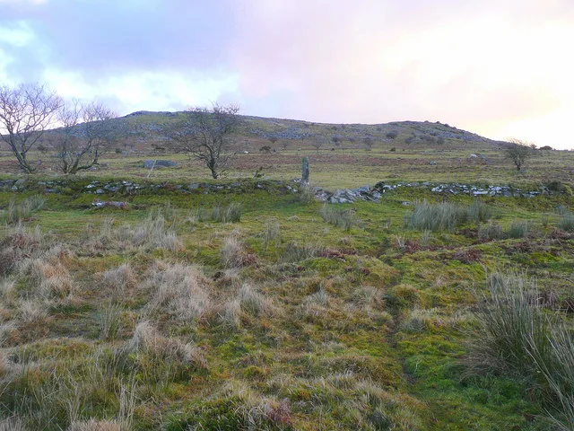
Stowe's Hill
Stowe's Hill — Named summit at 381.0 m.
 📷 3
📷 3Viewpoints · South West England
Rock stack
Rock stack — Named viewpoint at 388 m elevation.
 📷 3
📷 3Caves · South West England
Daniel Gumb's Cave
Daniel Gumb's Cave — a cave in england-south-west, United Kingdom.
Vineyards · South West England
Earlier Prehistoric hillfort, two cairns, medieval pound and adjacent Prehistoric field systems, hut circles and transhumance hu
Earlier Prehistoric hillfort, two cairns, medieval pound and adjacent Prehistoric field systems, hut circles and transhumance hu — a UK vineyard in england south west, producing English or Welsh wine from cool-climate grape varieties.
Campsites · South West England
Cheesewring Farm Campsite
Cheesewring Farm Campsite — a campsite in england south west.
Caravan parks · South West England
Cheesewring Farm Caravan site
Cheesewring Farm Caravan site — a caravan park in england south west.
More natural landmarks in this region
 Flagship📷 10
Natural landmarks · South West England
Becky Falls
Dartmoor's 21-metre waterfall and woodland park, with animal encounters for kids.
 📷 5
📷 5Natural landmarks · South West England
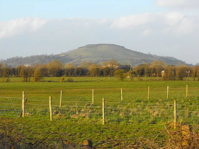
Brent Knoll
Brent Knoll — hill on the Somerset Levels, in Somerset, England.
 📷 5
📷 5Natural landmarks · South West England
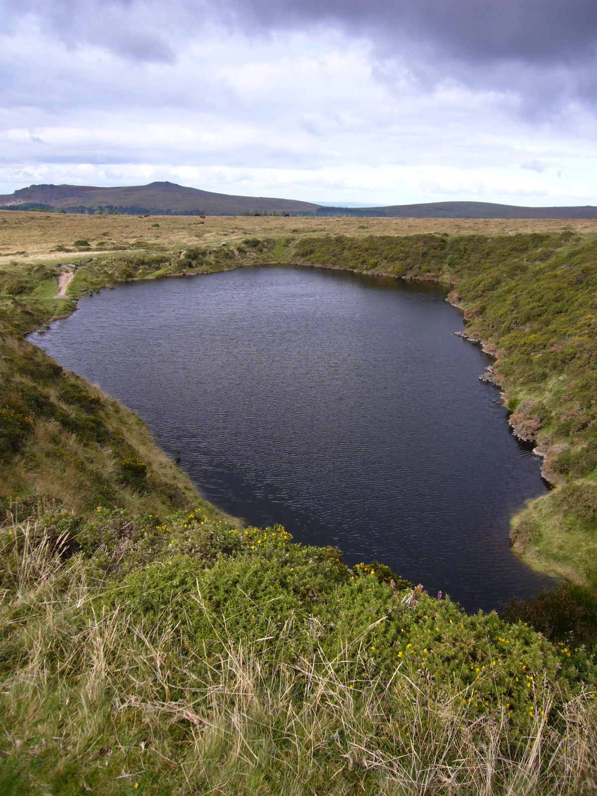
Crazywell Pool
Crazywell Pool — lake in Devon, England, UK.
 📷 5
📷 5Natural landmarks · South West England
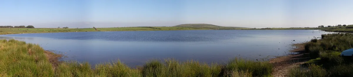
Dozmary Pool
Dozmary Pool — lake in Cornwall, England, UK.
Frequently asked questions
- Where is Cheesewring?
- Cheesewring is in South-West England, United Kingdom (postcode PL14 5LJ), in the parish of Linkinhorne.
- Is Cheesewring free to visit?
- Yes, Cheesewring is free to enter.
- How do I get to Cheesewring?
- Drivers can navigate to postcode PL14 5LJ. It sits within the South East Cornwall parliamentary constituency.