Viewpoints · West Midlands
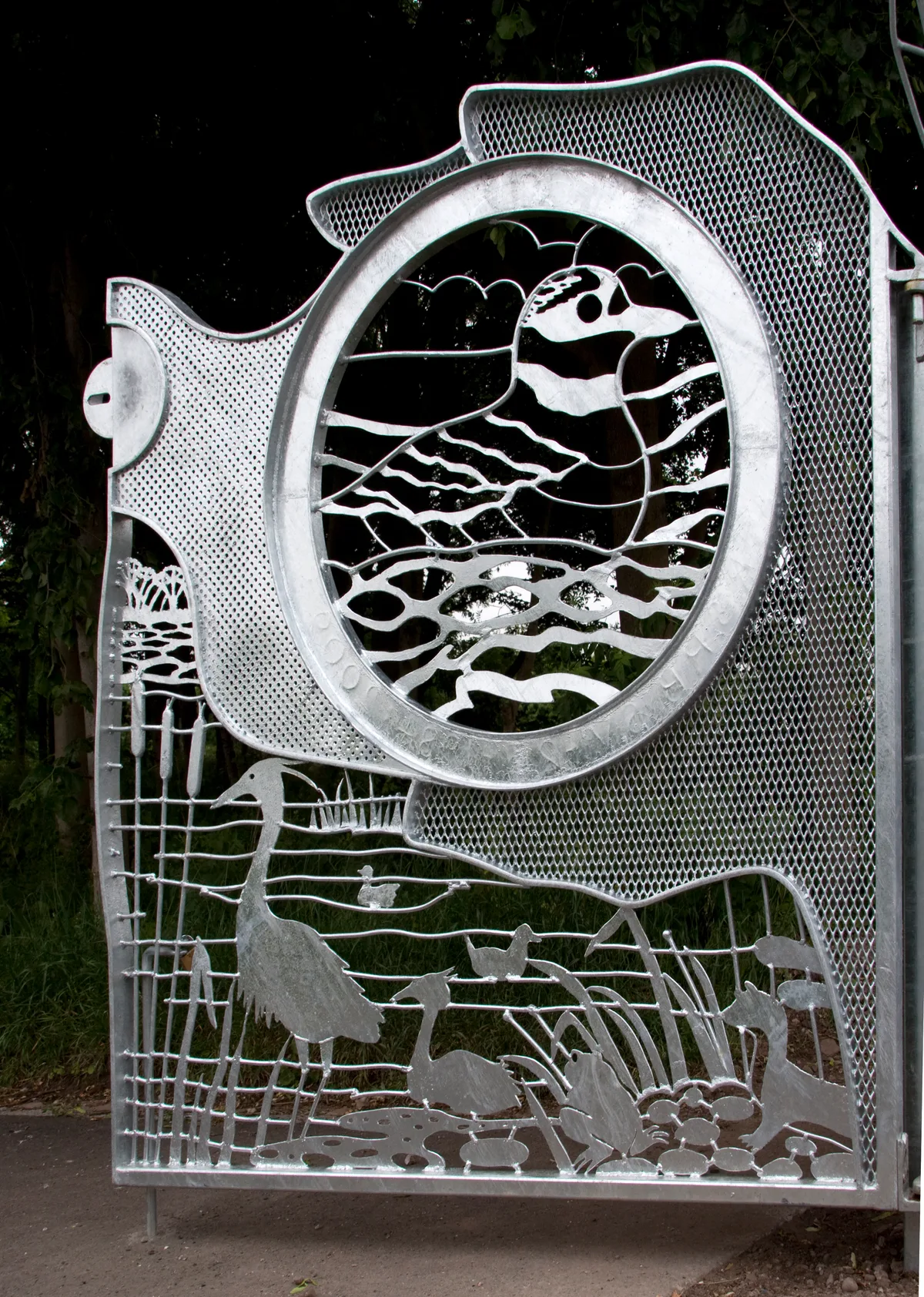
River Tame Flood Gates
River Tame Flood Gates is a viewpoint in the United Kingdom.

Thomas Roberts — CC BY-SA 2.0 via Wikimedia Commons licence
Plan your visit
- Typical visit
- 20 min–45 min
- Best time of year
- Clear days year-round
- Nearest railway station
- Hamstead · 1.1 km
- Free entry
- Dog-friendly
About
River Tame Flood Gates is a named viewpoint in the West Midlands, marked on Ordnance Survey maps for its outlook. It sits within the West Bromwich parliamentary constituency. The nearest railway station is Hamstead, about 1.1 km away. Postcode area B43.
Photo gallery
Place summary
The River Tame Flood Gates are located in the West Midlands, within the unparished area of Sandwell. This viewpoint features flood control structures designed to manage water flow and reduce flooding risks in the region.
AI-generated from the structured facts on this page (operator, designation, listing, era). Not a substitute for visiting.
- Coordinates
- 52.5341, -1.9441
- District
- Sandwell
- Parish
- Sandwell, unparished area
- Postcode
- B43 5DB
- Parliamentary constituency
- West Bromwich
- Nearest railway station
- Hamstead — 1.1 km
Sources
- osm: n8968914384 (ODbL)
Other places nearby
Loading nearby places…
Nearby
📷 3Public art & sculpture · West Midlands
RSPB Gates
RSPB Gates — a public art in england-west-midlands, United Kingdom.
📷 5Historic houses · West Midlands
Hamstead Hall Academy
Hamstead Hall Academy — a school heritage in england-west-midlands, United Kingdom.
 📷 5
📷 5Wildlife reserves · West Midlands
Sandwell Valley RSPB reserve
Sandwell Valley RSPB reserve — RSPB nature reserve in the English West Midlands county.
 📷 3
📷 3Forests & woodlands · West Midlands
Forge Mill Lake Local Nature Reserve Black Country Geosite
Forge Mill Lake Local Nature Reserve Black Country Geosite is a forest or woodland in the United Kingdom.
 📷 3
📷 3Historic bridges · West Midlands
Gerse Farm Bridge At Sp 041 934 Tame Valley Canal
Gerse Farm Bridge At Sp 041 934 Tame Valley Canal — Grade II listed building-listed bridge in england-west-midlands, United Kingdom.
 📷 3
📷 3Aqueducts · West Midlands
Spouthouse Aqueduct, Spouthouse Lane Tame Valley Canal
Spouthouse Aqueduct, Spouthouse Lane Tame Valley Canal — aqueduct in Sandwell, West Midlands, England, UK.
More viewpoints in this region
 📷 4
📷 4Viewpoints · West Midlands
Ambion Hill
Ambion Hill is a viewpoint in the United Kingdom.
 📷 3
📷 3Viewpoints · West Midlands
Apedale Winding Wheel
Apedale Winding Wheel is a viewpoint in the United Kingdom.
 📷 3
📷 3Viewpoints · West Midlands
Baggeridge Toposcope
Baggeridge Toposcope is a viewpoint in the United Kingdom.
 📷 3
📷 3Viewpoints · West Midlands
Barrett Bridge
Barrett Bridge is a viewpoint in the United Kingdom.
Frequently asked questions
- Where is River Tame Flood Gates?
- River Tame Flood Gates is in the West Midlands, United Kingdom (postcode B43 5DB), in the parish of Sandwell, unparished area.
- Is River Tame Flood Gates free to visit?
- Yes, River Tame Flood Gates is free to enter.
- How do I get to River Tame Flood Gates?
- The nearest railway station is Hamstead, about 1.1 km away. Drivers can navigate to postcode B43 5DB.