Natural landmarks · North East England
Red Tarn
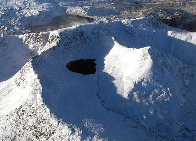
Red Tarn — lake on Helvellyn, Cumbria, United Kingdom.

Wikimedia Commons contributors — see linked file page for photographer and licence licence
Plan your visit
- Typical visit
- 1 h–2 h
- Nearest railway station
- Threlkeld Quarry · 9.2 km
- Free entry
- Dog-friendly
About
Red Tarn is a named natural landmark in the United Kingdom. Wikidata describes it as: "lake on Helvellyn, Cumbria, United Kingdom". Coordinates: 54.5283°, -3.0086°.
Photo gallery
Protected designations
- Site of Special Scientific Interest: River Derwent and Tributaries SSSI
- Site of Special Scientific Interest: Helvellyn & Fairfield SSSI
- Site of Special Scientific Interest: River Eden and Tributaries SSSI
Designations sourced from Natural England open data under OGL v3.
From the Wikipedia article
Red Tarn is a small lake in the eastern region of the English Lake District, in the county of Cumbria. It is high up on the eastern flank of Helvellyn, beneath Striding Edge and Catstye Cam. Red Tarn was formed when the glacier that carved out the eastern side of Helvellyn had melted. The lake along with three others in Lake District is a habitat for the very rare and endangered Schelly fish. Red Tarn was a dam in the nineteenth century that used boulders that raised the water level some eight or nine feet in order to supply power to the Greenside Mine at Glenridding. Today the tarn is a popular rest stop for hikers and nature goers. It lies at an altitude of 718 metres (2,356 feet), with a depth of 25 metres (82 feet). The tarn is one of two of the same name in the Lake District. A second, much smaller Red Tarn lies between Pike of Blisco and Cold Pike, west of the Langdales.
Excerpt from Wikipedia under CC BY-SA 4.0. See the source article linked in Sources below.
- Coordinates
- 54.5283, -3.0086
- Address
- Lake District, Cumbria
- Nearest railway station
- Threlkeld Quarry — 9.2 km
Sources
- wikidata: Q7305159 (CC0)
- wikipedia: Red Tarn (CC BY-SA 4.0)
- commons: Striding Edge and Red Tarn, Helvellyn.jpg (CC BY-SA 4.0)
Other places nearby
Loading nearby places…
Nearby
 📷 3
📷 3Natural landmarks · North East England
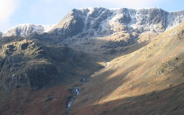
Helvellyn
Helvellyn — mountain in the English Lake District.
 📷 4
📷 4Mountains & hills · North East England
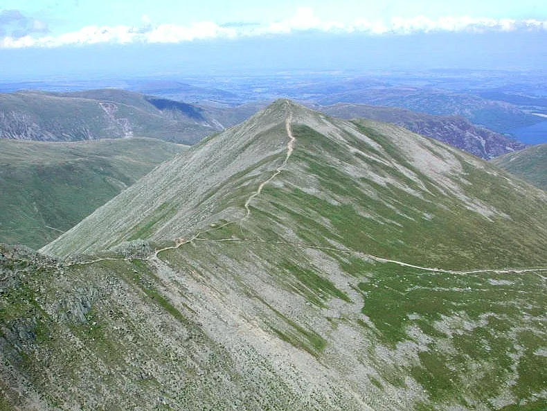
Catstycam
Catstycam — Named summit at 889.6 m.
 📷 3
📷 3Memorials & monuments · North East England
Avro 585 Gosport Plane Landing plaque
Avro 585 Gosport Plane Landing plaque — a memorial in england-north-east, United Kingdom.
 📷 3
📷 3Mountains & hills · North East England
Helvellyn
Helvellyn — Named summit at 949.8 m.
 📷 3
📷 3Mountains & hills · North East England
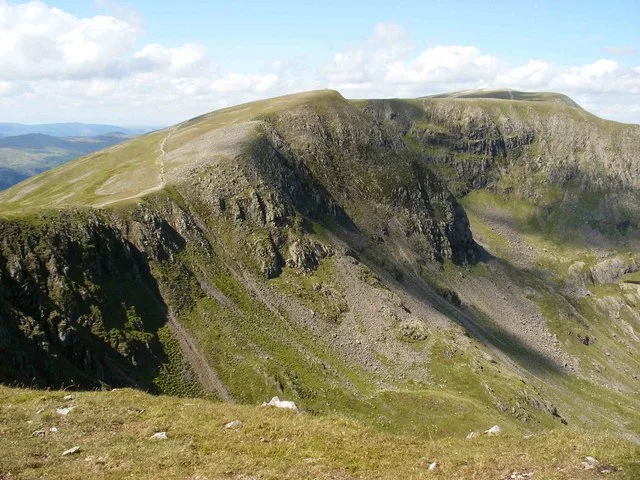
Nethermost Pike
Nethermost Pike — Named summit at 891.3 m.
 📷 4
📷 4Mountains & hills · North East England
High Crag
High Crag — Named summit at 884 m.
More natural landmarks in this region
 Flagship📷 5
Natural landmarks · North East England
Brothers Water
Brothers Water — lake in Cumbria, England, UK.
 📷 5
📷 5Natural landmarks · North East England
Angle Tarn
Angle Tarn — lake near Patterdale, Cumbria, England, United Kingdom.
 📷 3
📷 3Natural landmarks · North East England
Angletarn Pikes
Angletarn Pikes — mountain in United Kingdom.
 📷 3
📷 3Natural landmarks · North East England
Ard Crags
Ard Crags — mountain in United Kingdom.
Frequently asked questions
- Where is Red Tarn?
- Red Tarn is in North-East England, United Kingdom.
- Is Red Tarn a protected site?
- Yes — Red Tarn is part of the River Derwent and Tributaries SSSI Site of Special Scientific Interest and the Helvellyn & Fairfield SSSI Site of Special Scientific Interest.
- Is Red Tarn free to visit?
- Yes, Red Tarn is free to enter.