Castles · South West England
Puriton
Puriton is a village and parish at the westerly end of the Polden Hills, in Somerset, England. The parish has a population of 1,968. The local parish church is dedicated to St Michael and All Angels.

Neil Owen — CC BY-SA 2.0 via Wikimedia Commons licence
Plan your visit
- Typical visit
- 1.5 h–3 h
- Family-friendly
- Limited wheelchair access
About
Puriton is a village and parish at the westerly end of the Polden Hills, in Somerset, England. The parish has a population of 1,968. The local parish church is dedicated to St Michael and All Angels. A chapel on Woolavington Road was converted to a private house some 20 years ago. The parish includes the hamlets of Dunball and Down End. In 1996, the village was described as "now becoming a rural commuter village". The built-up area is mostly between 5 and 50 metres above sea level. The village has a full range of facilities, such as a primary school, parish church, pub, post office, butcher and hairdresser. It started to expand considerably in the 1960s and 1970s when new houses were built on former farm land, a former infilled stone Blue Lias quarry, Puriton Park, and on fields between the existing houses. The old Victorian school near the church was converted into homes and a new school built elsewhere. The Manor House was sold in 1960 and four houses were built on its former tennis courts; the House is in multiple occupancy.
Photo gallery
From the Wikipedia article
Puriton is a village and parish at the westerly end of the Polden Hills, in Somerset, England. The parish has a population of 1,968. The local parish church is dedicated to St Michael and All Angels. A chapel on Woolavington Road was converted to a private house some 20 years ago. The parish includes the hamlets of Dunball and Down End. In 1996, the village was described as "now becoming a rural commuter village". The built-up area is mostly between 5 and 50 metres above sea level. The village has a full range of facilities, such as a primary school, parish church, pub, post office, butcher and hairdresser. It started to expand considerably in the 1960s and 1970s when new houses were built on former farm land, a former infilled stone Blue Lias quarry, Puriton Park, and on fields between the existing houses. The old Victorian school near the church was converted into homes and a new school built elsewhere. The Manor House was sold in 1960 and four houses were built on its former tennis courts; the House is in multiple occupancy.
Excerpt from Wikipedia under CC BY-SA 4.0. See the source article linked in Sources below.
Background
History
There is archaeological evidence of human settlement near Riverton Road, Puriton since the late iron age. In 2020, an archaeological assessment of the Gravity site also found evidence of later Iron Age and Romano- British remains. Puriton was mentioned in the Domesday Book as growing pears, and was held by the Church of St Peter's, Rome. Its parish church was St Michael's. Just north of Dunball is Down End which is the site of Down End Castle, a motte-and-bailey castle, which has been designated as a Scheduled Ancient Monument. The parish was part of the Huntspill and Puriton Hundred,
Sourced from Wikipedia under CC BY-SA 4.0.
- Coordinates
- 51.1720, -2.9730
- District
- Somerset
- Parish
- Puriton
- Postcode
- TA7 8BY
- Parliamentary constituency
- Bridgwater
- Official site
- www.somersetintelligence.org.uk
Sources
- wikipedia: Puriton (CC BY-SA 4.0)
Other places nearby
Loading nearby places…
Nearby
 📷 5
📷 5Historic churches · South West England
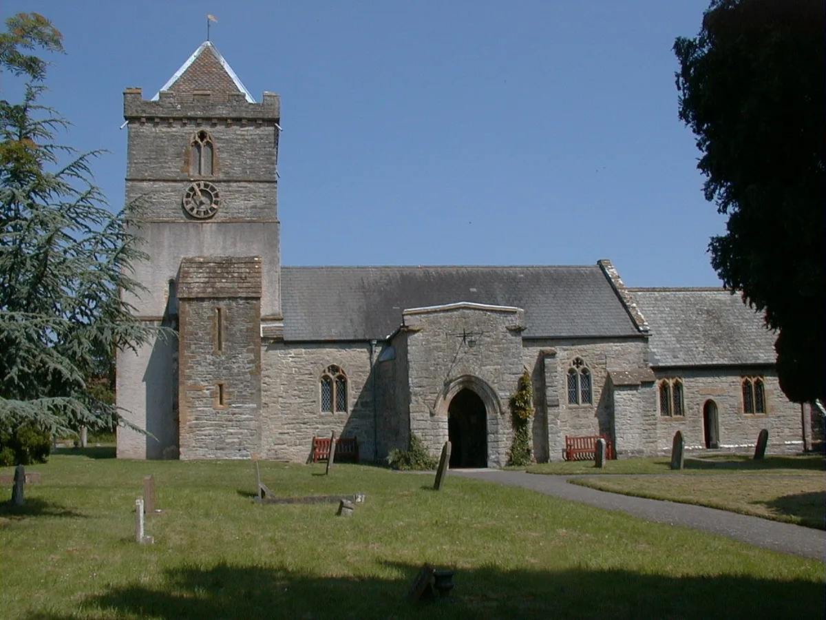
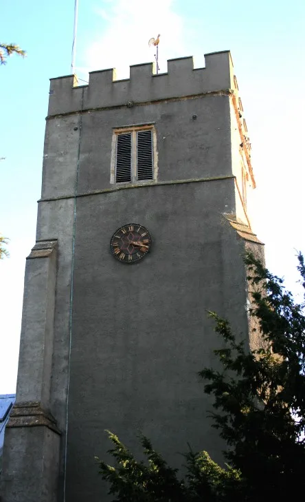
Church of St Michael and All Angels, Puriton
Church of St Michael and All Angels, Puriton — church in Puriton, Somerset, England, UK.
 📷 3
📷 3Archaeological sites · South West England
Caput Montis
Caput Montis — a archaeological in england-south-west, United Kingdom.
 📷 5
📷 5Castles · South West England
Down End Castle
Down End Castle, also known as Downend Castle, Chisley Mount or Chidley Mount, was a motte-and-bailey castle at Down End, north of Dunball in the parish of Puriton, Somerset, England. It has been des
 📷 5
📷 5Castles · South West England
Dunball
Dunball is a small hamlet west of the village of Puriton and close to the town of Bridgwater, Somerset, England. Just north of Dunball is Down End which is the site of Down End Castle a motte-and-bail
 📷 5
📷 5Castles · South West England
River Cary
The River Cary is a river in Somerset, England. It is sourced from the Park Pond in Castle Cary and flows towards the southwest.
 📷 5
📷 5Historic churches · South West England
Church of St John the Baptist, Pawlett
Church of St John the Baptist, Pawlett — church in Pawlett, Somerset, England, UK.
More castles in this region
 📷 5
📷 5Castles · South West England
Acton Castle
Acton Castle — Cornish historic building.
 📷 5
📷 5Castles · South West England
Affeton Castle
Affeton Castle — castle in East Worlington, Devon, England, UK.
 📷 5
📷 5Castles · South West England
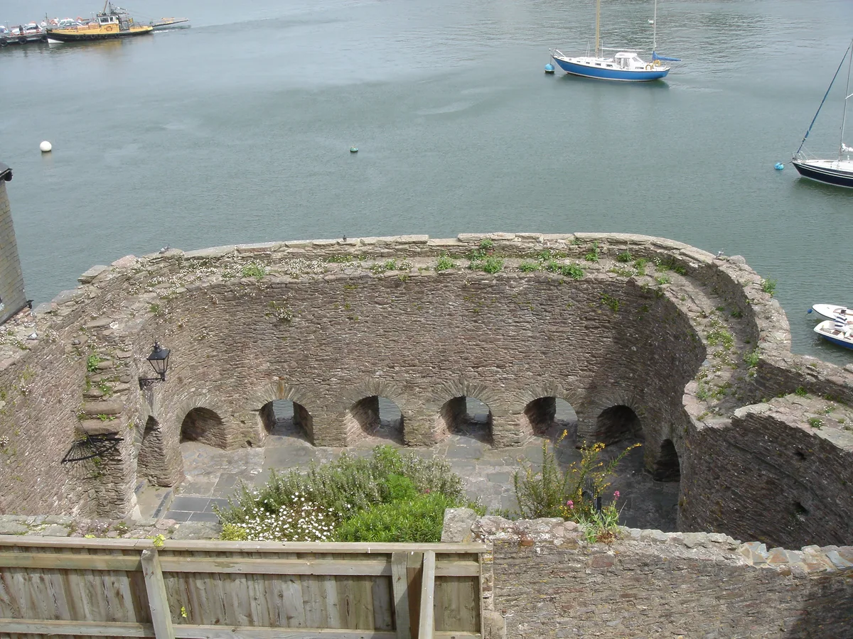
Bayard's Cove Fort
Bayard's Cove Fort — castle in Devon, England, UK.
 📷 5
📷 5Castles · South West England
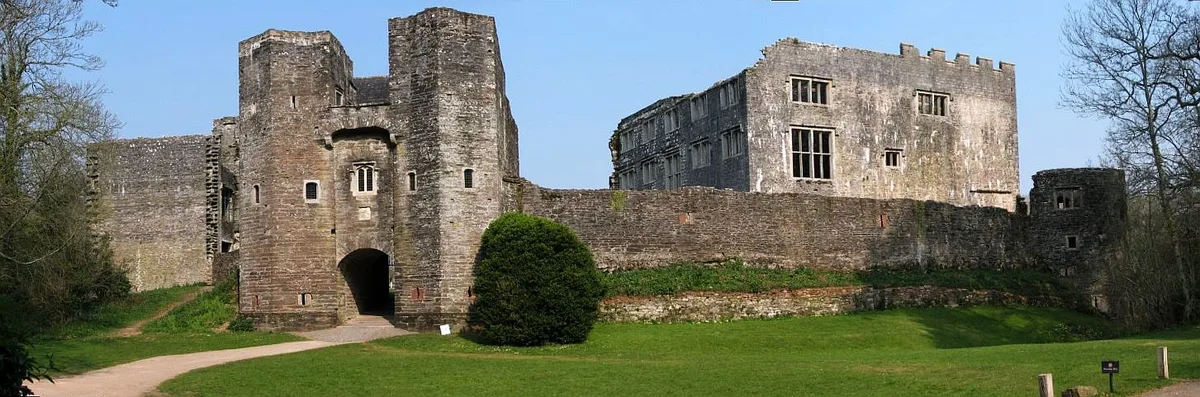
Berry Pomeroy Castle
Berry Pomeroy Castle — Grade I listed English country house in South Hams, United Kingdom.
Frequently asked questions
- Where is Puriton?
- Puriton is in South-West England, United Kingdom (postcode TA7 8BY), in the parish of Puriton.
- Does Puriton charge admission?
- Puriton typically charges admission. Check the official site for current ticket prices and opening hours.
- How do I get to Puriton?
- Drivers can navigate to postcode TA7 8BY. It sits within the Bridgwater parliamentary constituency.