Harbours & ports · East of England
Port of Lowestoft
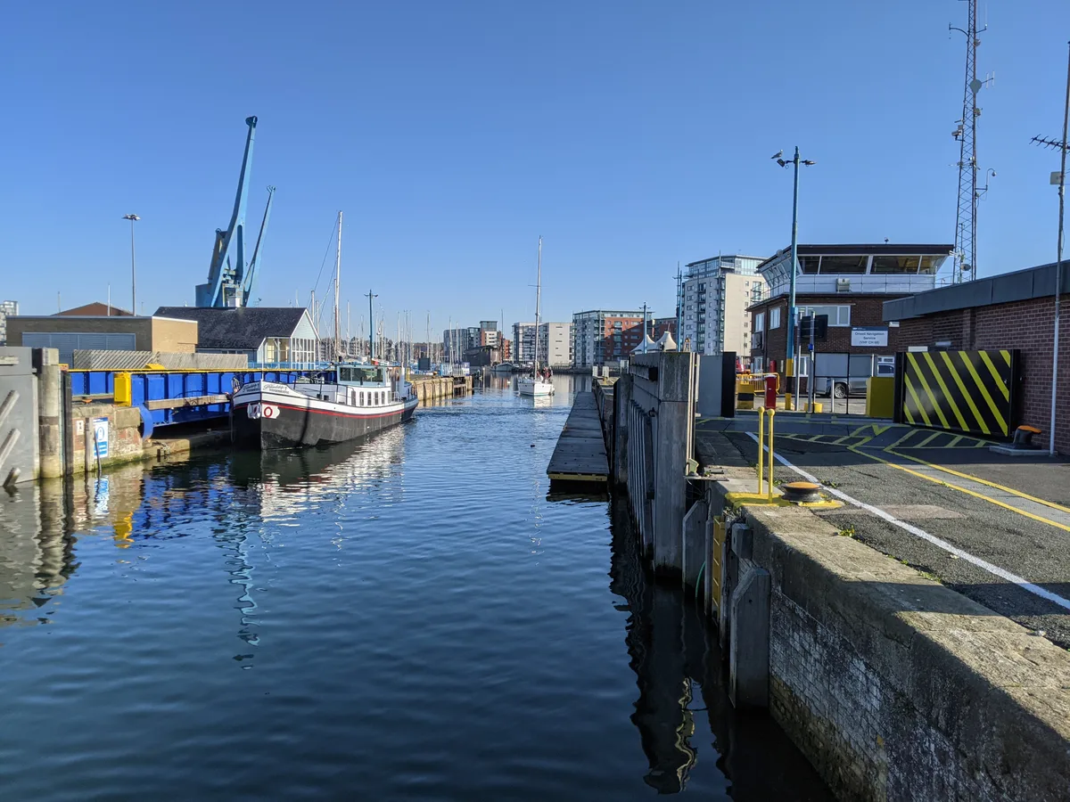
Port of Lowestoft is a harbour in the United Kingdom.

Wikimedia Commons contributors — see linked file page for photographer and licence licence
Plan your visit
- Typical visit
- 45 min–1.5 h
- Nearest railway station
- Lowestoft · 0.5 km
- Family-friendly
- Dog-friendly
About
Port of Lowestoft is a harbour in the United Kingdom. Owned by Associated British Ports. Coordinates: 52.4700°, 1.7500°. This entry is part of The Great Britain Guide, a free, ad-free, open-data tourist directory.
Photo gallery
From the Wikipedia article
The Port of Lowestoft is a harbour and commercial port in Lowestoft in the English county of Suffolk owned by Associated British Ports. It is the most easterly harbour in the United Kingdom and has direct sea access to the North Sea. The harbour is made up of two sections divided by a bascule bridge. The inner harbour is formed by Lake Lothing whilst the outer harbour is constructed from breakwaters. Lowestoft handles around 30,000 tonnes of cargo per year. Traditionally the harbour was the site for an extensive fishing industry as well as engineering and shipbuilding companies such as Brooke Marine, Richards and Boulton and Paul. The offshore oil and gas industry has also operated from the harbour with Shell maintaining their Southern Operations base in the harbour from the mid-1960s until 2003. Today, the Port is a hub for renewable offshore energy generation, with companies including SSE and Scottish Power Renewables having their maintenance & operations bases at Lowestoft.
Excerpt from Wikipedia under CC BY-SA 4.0. See the source article linked in Sources below.
Background
History
The harbour was originally built by the Lowestoft and Norwich Navigation Company and developed by the Norfolk Railway following the construction of the Norwich to Lowestoft railway. The original Inner Harbour was constructed in 1831 when Lake Lothing was joined to the sea, as shown on a chart based on a survey by William Hewett of HMS Fairy dated 1834, while the Outer Harbour was constructed in 1937. The fishing heritage of the harbour is celebrated through the museum ship Mincarlo which is usually berthed in the yacht harbour during the summer. The East Anglian Ice and Cold Storage Company, founded by William Fredrick Cockrell in 1897, purchased a section of quay on south side of Lake…
Description
The port's main entrance can accommodate vessels up to 35 metres in width, with vessels 22 metres wide being able to access the inner harbour through the bascule bridge. The harbour is able to service vessels up to 125 metres in length. Modern transit sheds and a 14,000 tonne silo are available with a range of cranes and other facilities including a container terminal. There are also facilities for ship repairs, including a dry dock and a number of slipways. Mutford Lock links the inner harbour to Oulton Broad from where Oulton Dyke provides access to the River Waveney and Broads system. Lowestoft Lifeboat Station (RNLI) is located at the mouth of the outer harbour and has an all-weather…
Sourced from Wikipedia under CC BY-SA 4.0.
- Coordinates
- 52.4700, 1.7500
- County
- Suffolk
- District
- East Suffolk
- Parish
- Lowestoft
- Postcode
- NR33 0AP
- Parliamentary constituency
- Lowestoft
- Nearest railway station
- Lowestoft — 0.5 km
Sources
- wikidata: Q7231184 (CC0)
- wikipedia: Port of Lowestoft (CC BY-SA 4.0)
- commons: Lowestoft 10-4-2004.jpg (CC BY-SA 4.0)
Other places nearby
Loading nearby places…
Nearby
 📷 4
📷 4Theatres · East of England
Marina Theatre
Marina Theatre in England East, United Kingdom.
 📷 4
📷 4Memorials & monuments · East of England
Lowestoft War Memorial
Lowestoft War Memorial — Grade II listed building-listed memorial in england-east, United Kingdom.
Cinemas · East of England
East Coast Cinema
East Coast Cinema — a cinema in england east.
 📷 3
📷 3Theatres · East of England
East Coast Cinema
East Coast Cinema in England East, United Kingdom.
 📷 5
📷 5Maritime museums · East of England
Mincarlo
Mincarlo in England East, United Kingdom.
_p51b_-_Lake_Lothing.jpg?width=1200) 📷 3
📷 3Natural landmarks · East of England
Lake Lothing
Lake Lothing — lake in the United Kingdom.
More places in this region

Frequently asked questions
- Where is Port of Lowestoft?
- Port of Lowestoft is in Suffolk, East of England, United Kingdom (postcode NR33 0AP), in the parish of Lowestoft.
- Who owns Port of Lowestoft?
- Port of Lowestoft is owned by Associated British Ports.
- How do I get to Port of Lowestoft?
- The nearest railway station is Lowestoft, about 0.5 km away. Drivers can navigate to postcode NR33 0AP.