Harbours & ports · East of England
Great Yarmouth Outer Harbour
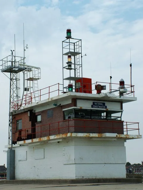
Great Yarmouth Outer Harbour is a harbour in the United Kingdom.

Wikimedia Commons contributors — see linked file page for photographer and licence licence
Plan your visit
- Typical visit
- 45 min–1.5 h
- Nearest railway station
- Great Yarmouth · 4.2 km
- Family-friendly
- Dog-friendly
About
Great Yarmouth Outer Harbour is a harbour in the United Kingdom. Coordinates: 52.5759°, 1.7394°. This entry is part of The Great Britain Guide, a free, ad-free, open-data tourist directory.
Photo gallery
From the Wikipedia article
Great Yarmouth Outer Harbour is a port constructed on the east coast of England at Great Yarmouth. Construction work on the Outer Harbour began in June 2007. The harbour which is built in the South Denes area was planned to bring trade to the area. The plans included a container terminal and a passenger ferry terminal, but with no confirmed contracts these were not built.
Excerpt from Wikipedia under CC BY-SA 4.0. See the source article linked in Sources below.
- Coordinates
- 52.5759, 1.7394
- County
- Norfolk
- District
- Great Yarmouth
- Parish
- Great Yarmouth, unparished area
- Postcode
- NR30 3QD
- Parliamentary constituency
- Great Yarmouth
- Nearest railway station
- Great Yarmouth — 4.2 km
Sources
- wikidata: Q5600304 (CC0)
- wikipedia: Great Yarmouth Outer Harbour (CC BY-SA 4.0)
- commons: Environment Agency 110809 133426.jpg (CC BY-SA 4.0)
Other places nearby
Loading nearby places…
Nearby
 📷 3
📷 3Lighthouses · East of England
Gorleston South Pier Lighthouse
Gorleston South Pier Lighthouse — lighthouse in Norfolk, England.
 📷 3
📷 3Lighthouses · East of England
Gorleston Lighthouse
Gorleston Lighthouse — lighthouse in Great Yarmouth, Norfolk, England, UK.
 📷 3
📷 3Memorials & monuments · East of England
Admiral Horatio Nelson
Admiral Horatio Nelson — a memorial in england-east, United Kingdom.
 📷 3
📷 3Theatres · East of England
Filmland
Filmland in England East, United Kingdom.
📷 3Theatres · East of England
Pavilion Theatre
Pavilion Theatre is a theatre in the United Kingdom.
 📷 3
📷 3Theatres · East of England
Gorleston Pavilion
Gorleston Pavilion — a Grade II*-listed theatre in england-east, United Kingdom.
More places in this region

Frequently asked questions
- Where is Great Yarmouth Outer Harbour?
- Great Yarmouth Outer Harbour is in East of England, in the United Kingdom — coordinates 52.5759°, 1.7394°. The nearest railway station is Great Yarmouth, around 4.2 km away.