Towns & cities · Scottish Lowlands
Plumpton
Also known as: Plumpton, Cumbria
Plumpton — village in Cumbria, England.

Wikimedia Commons contributors — see linked file page for photographer and licence licence
Plan your visit
- Typical visit
- 3 h–6 h
- Nearest railway station
- Lazonby and Kirkoswald · 5.7 km
- Free entry
- Family-friendly
- Dog-friendly
About
Plumpton is a town, city, village or settlement in the United Kingdom. Address: CA11. Wikidata describes it as: "village in Cumbria, England". Coordinates: 54.7273°, -2.7818°.
Photo gallery
Protected designations
- Site of Special Scientific Interest: River Eden and Tributaries SSSI
Designations sourced from Natural England open data under OGL v3.
From the Wikipedia article
Plumpton or Plumpton Wall is a small village and former civil parish, in the parish of Hesket, in the Westmorland and Furness district, in the traditional and historic county of Cumberland but now in the ceremonial county of Cumbria, England. It is about 4 miles (6 km) north of Penrith. In 1931 the parish had a population of 320.
Excerpt from Wikipedia under CC BY-SA 4.0. See the source article linked in Sources below.
Background
Description
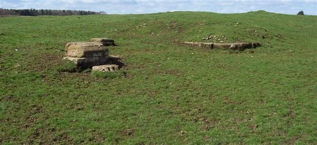
The village is made up of the former separate hamlets of Salkeld Gate and Brockleymoor and consists mainly of houses along a minor road connecting the A6 to the B5305 near Skelton and also a few houses and farms along the A6 itself. Close by are the settlements of Plumpton Head, Plumpton Foot and Plumpton Street. The earthwork remains of a substantial Roman fort can be seen at Castlesteads Farm, alongside the A6 road just north of the village. The fort was known in antiquity as Voreda. The A6 follows the course of the Roman road from Carlisle to Brougham. The village has an Anglican parish church by Robert Lorimer, dedicated to St John the Evangelist, a primary school, café and garden…
Sourced from Wikipedia under CC BY-SA 4.0.
- Coordinates
- 54.7273, -2.7818
- District
- Westmorland and Furness
- Parish
- Hesket
- Postcode
- CA11
- Parliamentary constituency
- Penrith and Solway
- Nearest railway station
- Lazonby and Kirkoswald — 5.7 km
Sources
- wikidata: Q1840961 (CC0)
- wikipedia: Plumpton, Cumbria (CC BY-SA 4.0)
- commons: Plumpton Church. - geograph.org.uk - 146573.jpg (CC BY-SA 4.0)
Other places nearby
Loading nearby places…
Nearby
 📷 3
📷 3Archaeological sites · Scottish Lowlands
Voreda Roman Fort
Voreda Roman Fort — Roman fort in Hesket, Eden, England, UK.
 📷 3
📷 3Memorials & monuments · Scottish Lowlands
The Old Tower
The Old Tower — Grade II listed building-listed memorial in scotland-lowlands, United Kingdom.
 📷 3
📷 3Historic bridges · Scottish Lowlands
Plumptonfoot Bridge
Plumptonfoot Bridge — Grade II listed building-listed bridge in scotland-lowlands, United Kingdom.
 📷 3
📷 3Stone circles · Scottish Lowlands
Stone Circle Remnants
Stone Circle Remnants — a stone circle in scotland-lowlands, United Kingdom.
 📷 5
📷 5Windmills · Scottish Lowlands
Holme Head standing stone 260m north west of Kitchenhill Bridge
Holme Head standing stone 260m north west of Kitchenhill Bridge — a post mill in scotland-lowlands, United Kingdom.
 📷 3
📷 3Historic bridges · Scottish Lowlands
Kitchenhill Bridge
Kitchenhill Bridge — Grade II listed building-listed bridge in scotland-lowlands, United Kingdom.
More towns in this region
 Flagship📷 3
Towns & cities · Scottish Lowlands
Carlisle
Carlisle — city in Cumberland, Cumbria, England.
 Flagship📷 3
Towns & cities · Scottish Lowlands
Durham
Durham — city and the county town of County Durham in North East England.
 Flagship📷 5
Towns & cities · Scottish Lowlands
Newcastle upon Tyne
Newcastle upon Tyne — city in Tyne and Wear, England, UK.
 Flagship📷 3
Towns & cities · Scottish Lowlands
Sunderland
Sunderland — city in Tyne and Wear, North East England.
Frequently asked questions
- Where is Plumpton?
- Plumpton is in the Scottish Lowlands, United Kingdom (postcode CA11), in the parish of Hesket.
- Is Plumpton a protected site?
- Yes — Plumpton is part of the River Eden and Tributaries SSSI Site of Special Scientific Interest.
- Is Plumpton free to visit?
- Yes, Plumpton is free to enter.
- How do I get to Plumpton?
- The nearest railway station is Lazonby and Kirkoswald, about 5.7 km away. Drivers can navigate to postcode CA11.