Natural landmarks · Mid Wales
Pen Pumlumon Arwystli
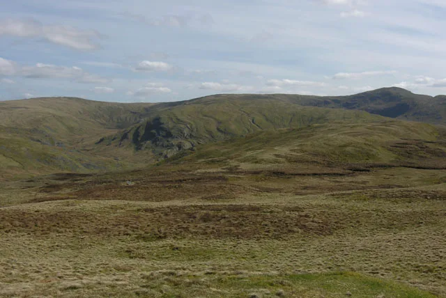
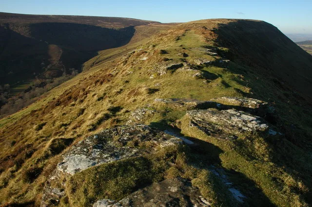
Pen Pumlumon Arwystli — mountain (741m) in Ceredigion.

Wikimedia Commons contributors — see linked file page for photographer and licence licence
Plan your visit
- Typical visit
- 1 h–2 h
- Free entry
- Dog-friendly
About
Pen Pumlumon Arwystli is a named natural landmark in the United Kingdom. Wikidata describes it as: "mountain (741m) in Ceredigion". Coordinates: 52.4748°, -3.7462°.
Photo gallery
From the Wikipedia article
Pen Pumlumon Arwystli is the second highest summit on the Plynlimon massif, a part of the Cambrian Mountains in the county of Ceredigion, Wales. The summit is grassy, and is marked by 3 large ancient cairns. The views include Rhos Fawr, Drygarn Fawr, Pen y Garn to the south and Aran Fawddwy, Glasgwm, Tarrenhendre and Tarren y Gesail to the north. The longest river in Britain, the River Severn, has its source on a lower boggy plateau to the north of the summit.
Excerpt from Wikipedia under CC BY-SA 4.0. See the source article linked in Sources below.
- Coordinates
- 52.4748, -3.7462
- Address
- Ceredigion, Wales
Sources
- wikidata: Q7162102 (CC0)
- wikipedia: Pen Pumlumon Arwystli (CC BY-SA 4.0)
- commons: View south along Carn Hyddgen - geograph.org.uk - 655516.jpg (CC BY-SA 4.0)
Other places nearby
Loading nearby places…
Nearby
 📷 3
📷 3Mountains & hills · Mid Wales
Pen Pumlumon Arwystli
Pen Pumlumon Arwystli — Named summit at 741 m.
 📷 3
📷 3Memorials & monuments · Mid Wales
WWW
WWW — a memorial in wales-mid, United Kingdom.
 📷 3
📷 3Mountains & hills · Mid Wales
Pen Pumlumon Llygad-bychan [Plynlimon East Top]
Pen Pumlumon Llygad-bychan [Plynlimon East Top] — a mountain in wales-mid, United Kingdom, 724 m.
📷 5National landscapes (AONB) · Mid Wales
River Wye
River Wye in Wales Mid, United Kingdom.
 📷 3
📷 3Mountains & hills · Mid Wales
Pen Cerrig Tewion
Pen Cerrig Tewion — a mountain in wales-mid, United Kingdom, 680 m.
 📷 3
📷 3Archaeological sites · Mid Wales
Carreg Wen
Carreg Wen — a archaeological in wales-mid, United Kingdom.
More natural landmarks in this region
 Flagship📷 3
Natural landmarks · Mid Wales
Bomere Pool
Bomere Pool — lake in Shropshire, England, UK.
 📷 3
📷 3Natural landmarks · Mid Wales
Craig-y-llyn
Craig-y-llyn — mountain (622m) in Gwynedd, Wales.
 📷 3
📷 3Natural landmarks · Mid Wales
Bache Hill
Bache Hill — mountain (610m) in Powys.
 📷 3
📷 3Natural landmarks · Mid Wales
Black Hill
Black Hill — mountain in Herefordshire, England, United Kingdom.
Frequently asked questions
- Where is Pen Pumlumon Arwystli?
- Pen Pumlumon Arwystli is in Mid Wales, in the United Kingdom — coordinates 52.4748°, -3.7462°.
- Is Pen Pumlumon Arwystli free to visit?
- Yes — admission to Pen Pumlumon Arwystli is free.