
Climbing & bouldering crags · North East England
Peel Crags
In or near Bardon Mill.
Peel Crags — a climbing crag in scotland lowlands.

Michael Garlick — CC BY-SA 2.0 via Wikimedia Commons licence

Plan your visit
- Typical visit
- 1 h–2 h
- Nearest railway station
- Bardon Mill · 3.9 km
About
Peel Crags is a climbing crag located in scotland lowlands, mapped by OpenStreetMap contributors. Detailed amenities and visitor information may vary; check the OSM page for the latest tagged metadata.
Photo gallery
Protected designations
- Site of Special Scientific Interest: River Eden and Tributaries SSSI
- Site of Special Scientific Interest: Roman Wall Escarpments SSSI
Designations sourced from Natural England open data under OGL v3.
Place summary
Peel Crags is a climbing crag located in the Scottish Lowlands. It offers a variety of routes suitable for climbers of different skill levels. The crag's rugged rock faces provide challenging climbs amidst a scenic backdrop. Visitors can expect a mix of traditional and sport climbing options in this natural setting.
AI-generated from the structured facts on this page (operator, designation, listing, era). Not a substitute for visiting.
- Coordinates
- 55.0027, -2.3815
- District
- Northumberland
- Parish
- Henshaw
- Postcode
- NE47 7AL
- Parliamentary constituency
- Hexham
- Nearest railway station
- Bardon Mill — 3.9 km
Sources
- osm: w156818376 (ODbL)
Other places nearby

Steel Rigg
Viewpoints · 0.2 km

Once Brewed
Archaeological sites · 0.3 km

Milecastle 39 (Castle Nick)
Castles · 0.4 km

Milecastle 39
Castles · 0.4 km

Robin Hood Tree
Natural landmarks · 0.5 km
Sycamore Gap Tree
Natural landmarks · 0.5 km

Hound Hill
Mountains & hills · 0.8 km

The Sill: National Landscape Discovery Centre
Science centres · 0.9 km

YHA The Sill
Hostels · 0.9 km

The vallum and a British settlement between the field boundary west of turret 37a and the road to Steel Rigg car park, in wall miles 37, 38 and 39
Archaeological sites · 1.0 km
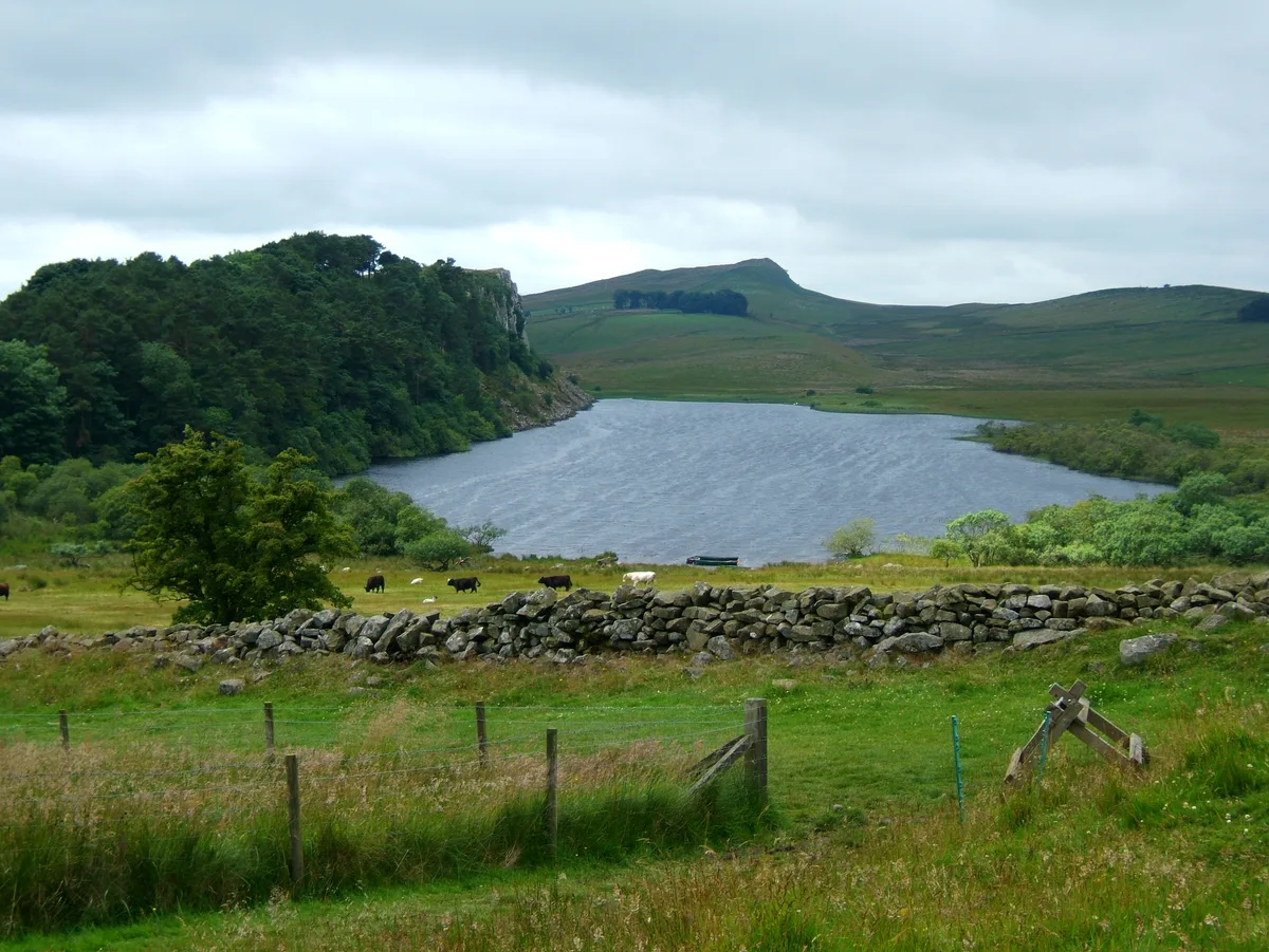
Crag Lough
Natural landmarks · 1.1 km

Twice Brewed Roman temporary camp
Archaeological sites · 1.1 km
Nearby
📷 3📷 5Archaeological sites · North East England
Once Brewed
Once Brewed in England North East, United Kingdom.
📷 3Castles · North East England
Milecastle 39 (Castle Nick)
Milecastle 39 (Castle Nick) — a castle in scotland-lowlands, United Kingdom.
📷 4📷 3Natural landmarks · North East England
Robin Hood Tree
Robin Hood Tree — a other in scotland-lowlands, United Kingdom.
📷 5Natural landmarks · North East England
Sycamore Gap Tree
Sycamore Gap Tree in England North East, United Kingdom.
Where to eat & stay near Peel Crags
Places to stay
📷 5 📷 5
📷 5Campsites · North East England
Winshields Farm Campsite
Winshields Farm Campsite — a campsite in scotland lowlands.
 📷 5
📷 5Campsites · North East England
Hadrian's Wall Campsite
Hadrian's Wall Campsite — a campsite in scotland lowlands.
 📷 5
📷 5Caravan parks · North East England
Herding Hill Farm Camping
Herding Hill Farm Camping — a caravan park in scotland lowlands.
 📷 5
📷 5Caravan parks · North East England
Seldom Seen Caravan Park
Seldom Seen Caravan Park — a caravan park in scotland lowlands.
 📷 5
📷 5Hotels · North East England
Centre of Britain
Centre of Britain — a hotel in scotland lowlands.
Places to eat & drink
 📷 7
📷 7Historic pubs · North East England
Anchor Hotel
Anchor Hotel in Scotland Lowlands, United Kingdom.
 📷 5
📷 5 📷 4
📷 4 📷 5
📷 5 📷 6
📷 6 📷 4
📷 4Historic pubs · North West England
Hallbankgate
Hallbankgate in England North East, United Kingdom.
More places in this region
 📷 5
📷 5Climbing & bouldering crags · North East England
Pathside
Pathside — a climbing crag in scotland lowlands.
Frequently asked questions
- Where is Peel Crags?
- Peel Crags is in North-East England, United Kingdom (postcode NE47 7AL), in the parish of Henshaw.
- What is Peel Crags?
- Peel Crags — a climbing crag in scotland lowlands.
- How do I get to Peel Crags?
- The nearest railway station is Bardon Mill, about 3.9 km away. The nearest town is Bardon Mill. Drivers can use postcode NE47 7AL.
- Is Peel Crags a protected site?
- Yes — Peel Crags is part of the River Eden and Tributaries SSSI Site of Special Scientific Interest and the Roman Wall Escarpments SSSI Site of Special Scientific Interest.
- How do I get to Peel Crags?
- The nearest railway station is Bardon Mill, about 3.9 km away. Drivers can navigate to postcode NE47 7AL.