Natural landmarks · South Wales
Pant
Pant — a other in wales-south, United Kingdom.

Christine Matthews — CC BY-SA 2.0 via Wikimedia Commons licence
Plan your visit
- Typical visit
- 1 h–2 h
- Free entry
- Family-friendly
- Dog-friendly
- Wheelchair accessible
About
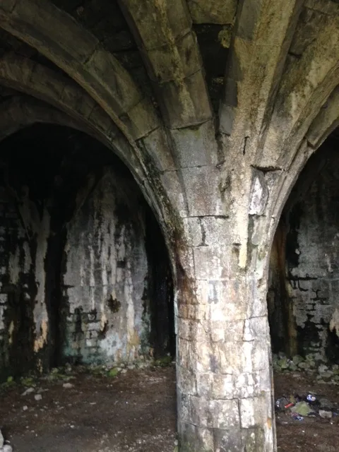
Pant is a other located in wales-south, United Kingdom. Sourced from OpenStreetMap (ODbL licence); see local listings for visitor information, opening hours and admission details.
Photo gallery
Heritage listing
http://cadwpublic-api.azurewebsites.net/reports/listedbuilding/FullReport?lang=en&id=17301
From Cadw under OGL v3.
Place summary
Pant is a village located in South Wales. It is known for its residential character and serves as a commuter hub for nearby towns. The area features a mix of local amenities and access to surrounding natural landscapes.
AI-generated from the structured facts on this page (operator, designation, listing, era). Not a substitute for visiting.
- Coordinates
- 51.7779, -3.3644
- District
- Merthyr Tydfil
- Parish
- Pant
- Postcode
- CF48 3SS
- Parliamentary constituency
- Merthyr Tydfil and Aberdare
- Official site
- www.breconmountainrailway.co.uk
Sources
- osm: node/258653345 (ODbL)
Other places nearby
Loading nearby places…
Nearby
 📷 3
📷 3Cemeteries · South Wales
Pant Cemetery
Pant Cemetery is a cemetery in the United Kingdom.
 📷 5
📷 5Memorials & monuments · South Wales
The War Memorial, screen walls and surrounding railings
The War Memorial, screen walls and surrounding railings — Grade II listed building-listed memorial in wales-south, United Kingdom.
 📷 3
📷 3Castles · South Wales
Morlais Castle
Morlais Castle — hillfort in Merthyr Tydfil County Borough, Wales.
 📷 5
📷 5Historic churches · South Wales
Tower of old church of St Gwynno
Tower of old church of St Gwynno — Grade II listed building-listed church in wales-south, United Kingdom.
 📷 5
📷 5Historic bridges · South Wales
White Gate Road Bridge and Aqueduct
White Gate Road Bridge and Aqueduct — Grade II listed building-listed bridge in wales-south, United Kingdom.
 📷 5
📷 5Historic bridges · South Wales
Pont-sarn
Pont-sarn — Grade II listed building-listed bridge in wales-south, United Kingdom.
More natural landmarks in this region
 📷 3
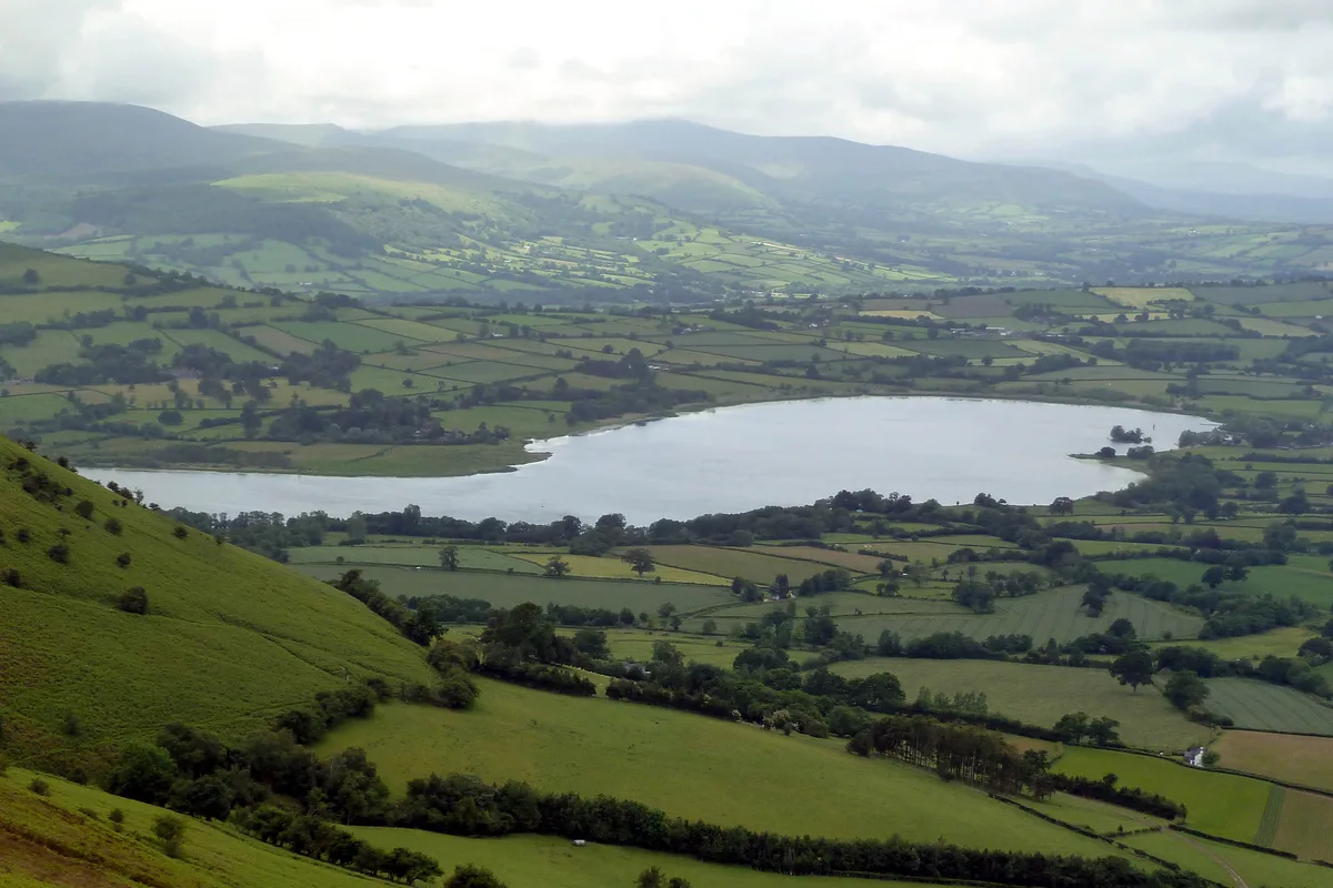
📷 3Natural landmarks · South Wales
Llangorse Lake
Llangorse Lake — lake near Brecon, Powys, Wales, UK.
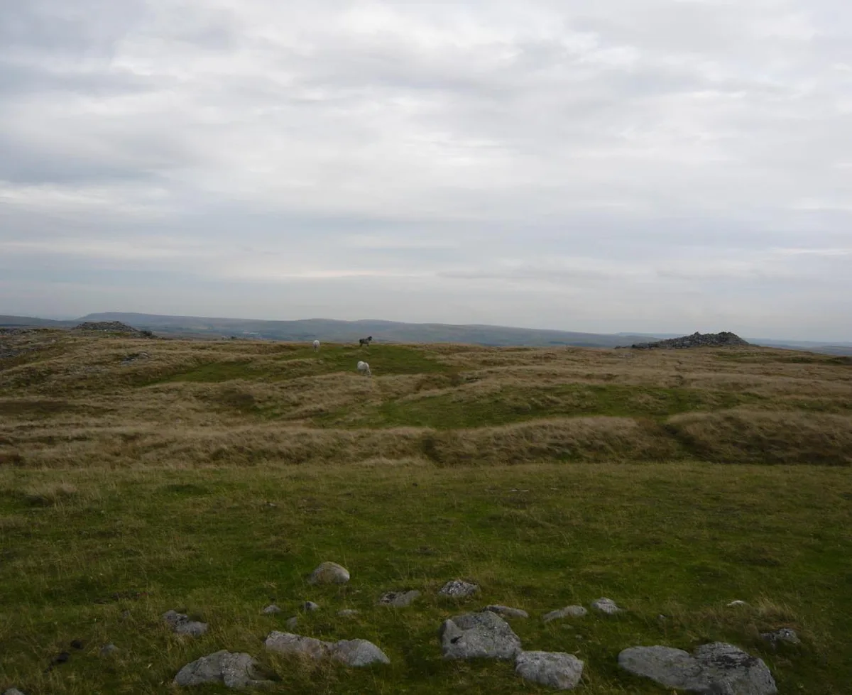 📷 3
📷 3Natural landmarks · South Wales
Cefn yr Ystrad
Cefn yr Ystrad — mountain (619m) in Powys.
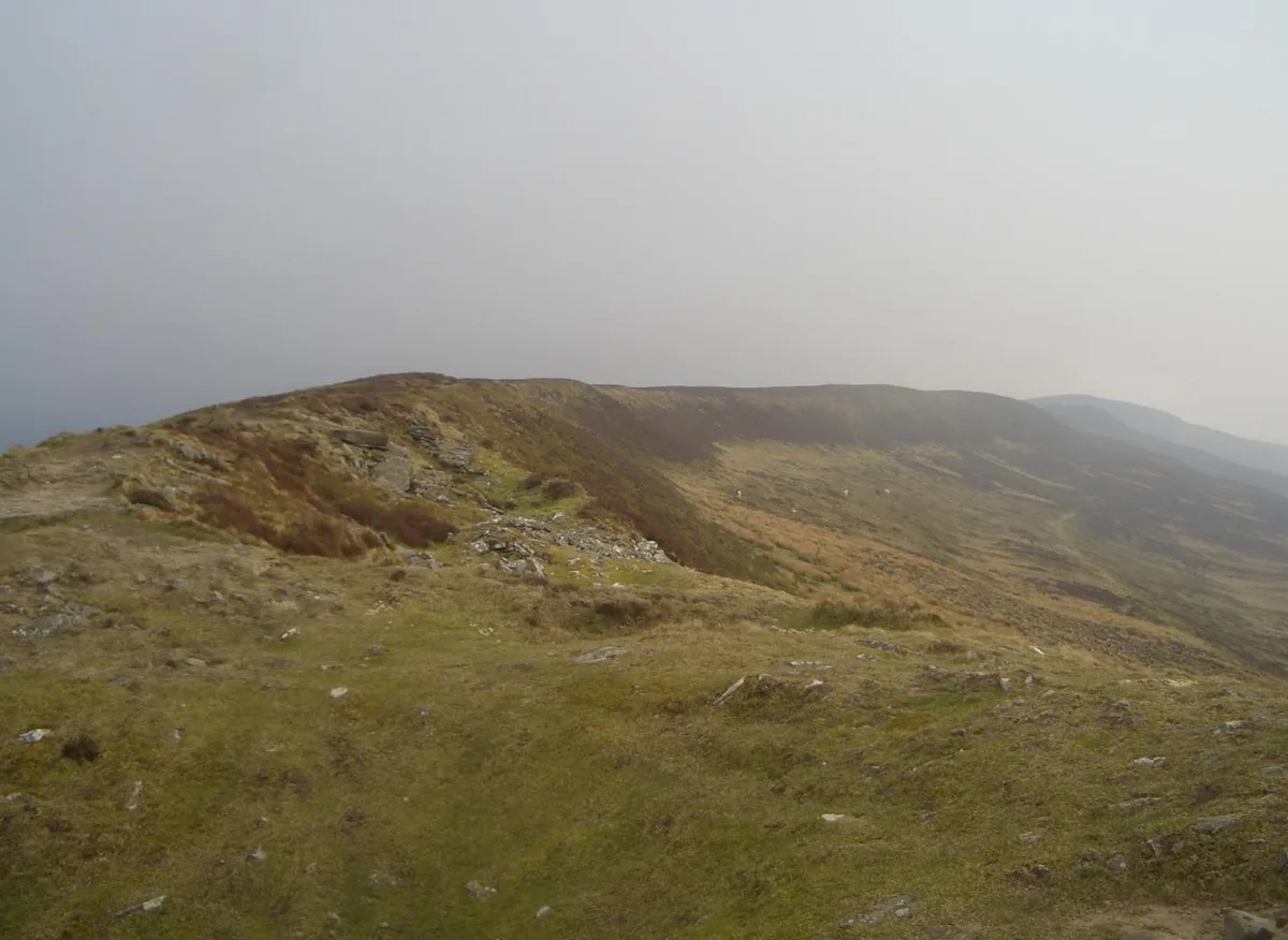 📷 3
📷 3Natural landmarks · South Wales
Chwarel y Fan
Chwarel y Fan — mountain (679m) in Monmouthshire.
.jpg?width=1200) 📷 3
📷 3Natural landmarks · South Wales
Copper Flame
Copper Flame — Public artwork (installation) by Robin Campbell (designer), Martin Williams (sculptor), Andrew Rowe, Theo Grunewald (metal workers).
Frequently asked questions
- Where is Pant?
- Pant is in South Wales, United Kingdom (postcode CF48 3SS), in the parish of Pant.
- Is Pant a listed building?
- Pant is officially recognised as II listed.
- Is Pant free to visit?
- Yes, Pant is free to enter.
- How do I get to Pant?
- Drivers can navigate to postcode CF48 3SS. It sits within the Merthyr Tydfil and Aberdare parliamentary constituency.