Towns & cities · Scottish Lowlands
Otterburn
Also known as: Otterburn, Northumberland
Otterburn — village and civil parish in Northumberland, England, UK.

Wikimedia Commons contributors — see linked file page for photographer and licence licence
Plan your visit
- Typical visit
- 3 h–6 h
- Free entry
- Family-friendly
- Dog-friendly
About
Otterburn is a town, city, village or settlement in the United Kingdom. Recent population estimates put it at around 550 people. Address: NE19. Wikidata describes it as: "village and civil parish in Northumberland, England, UK". Coordinates: 55.2333°, -2.1833°.
Photo gallery
From the Wikipedia article
Otterburn is a village and civil parish in Northumberland, England, 31 miles (50 km) northwest of Newcastle upon Tyne on the banks of the River Rede, near its confluence with the Otter Burn, from which the village derives its name. It lies within the Cheviot Hills about 16 miles (26 km) from the Scottish border. The parish of Otterburn is at the heart of Redesdale, a Northumbrian upland valley. In 2011 the parish had a population of 654.
Excerpt from Wikipedia under CC BY-SA 4.0. See the source article linked in Sources below.
Background
History
view of Blakehope Roman fort and camp two miles to the north-west of Otterburn]] Otterburn was the site of a major battle in 1388 between English and Scottish armies. The engagement, in which the Scots took Sir Henry Percy captive, is the subject of the English Ballad of Chevy Chase and the Scots ballad Otterburn. The battle of Otterburn ended in an English rout. Despite James Douglas, 2nd Earl of Douglas being killed, Percy was captured and over a thousand of the English were taken, left dead on the field or slain as they fled. The dead were carried to Elsdon church, 3 mi from Otterburn, where they were buried. The modern village grew up around a coaching inn and Otterburn Tower. It was…
Sourced from Wikipedia under CC BY-SA 4.0.
- Coordinates
- 55.2333, -2.1833
- District
- Northumberland
- Parish
- Otterburn
- Postcode
- NE19
- Parliamentary constituency
- Hexham
- Population
- 550
- Official site
- www.neighbourhood.statistics.gov.uk
Sources
- wikidata: Q1009668 (CC0)
- wikipedia: Otterburn, Northumberland (CC BY-SA 4.0)
- commons: Otterburn - geograph.org.uk - 1409182.jpg (CC BY-SA 4.0)
Other places nearby
Loading nearby places…
Nearby
 📷 3
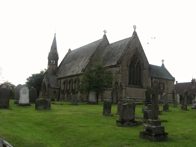
📷 3Historic churches · Scottish Lowlands
St John the Evangelist's Church, Otterburn
St John the Evangelist's Church, Otterburn — church in Otterburn, Northumberland, England, UK.
Hotels · Scottish Lowlands
William de Percy
William de Percy — a hotel in scotland lowlands.
 📷 4
📷 4Castles · North East England
Otterburn Tower
Otterburn Tower in England North East, United Kingdom.
 📷 4
📷 4National parks · North East England
Redesdale
Redesdale in England North East, United Kingdom.
 📷 4
📷 4Mills · Scottish Lowlands
Otterburn Mill
Otterburn Mill — mill in Otterburn, Northumberland, England, UK.
 📷 3
📷 3Memorials & monuments · Scottish Lowlands
Percy's Cross
Percy's Cross is a memorial in the United Kingdom.
More towns in this region
 Flagship📷 3
Towns & cities · Scottish Lowlands
Carlisle
Carlisle — city in Cumberland, Cumbria, England.
 Flagship📷 3
Towns & cities · Scottish Lowlands
Durham
Durham — city and the county town of County Durham in North East England.
 Flagship📷 5
Towns & cities · Scottish Lowlands
Newcastle upon Tyne
Newcastle upon Tyne — city in Tyne and Wear, England, UK.
 Flagship📷 3
Towns & cities · Scottish Lowlands
Sunderland
Sunderland — city in Tyne and Wear, North East England.
Frequently asked questions
- Where is Otterburn?
- Otterburn is in the Scottish Lowlands, United Kingdom (postcode NE19), in the parish of Otterburn.
- Is Otterburn free to visit?
- Yes, Otterburn is free to enter.
- How do I get to Otterburn?
- Drivers can navigate to postcode NE19. It sits within the Hexham parliamentary constituency.