Viewpoints · Scottish Islands
Orientation Table
Orientation Table is a viewpoint in the United Kingdom.

Chris Downer — CC BY-SA 2.0 via Wikimedia Commons licence
Plan your visit
- Typical visit
- 20 min–45 min
- Best time of year
- Clear days year-round
- Free entry
- Dog-friendly
About
Orientation Table is a named viewpoint in the United Kingdom. Coordinates: 59.1424°, -2.9276°. This entry is part of The Great Britain Guide, a free, ad-free, open-data tourist directory.
Photo gallery
From the Wikipedia article
A toposcope, topograph, or orientation table is a kind of graphic display erected at viewing points on hills, mountains or other high places which indicates the direction, and usually the distance, to notable landscape features which can be seen from that point. They are often placed in public parks, country parks, the grounds of stately homes, at popular vantage points (especially accompanying or built into triangulation stations) or places of historical note, such as battlefields. Toposcopes usually show the points of the compass, or at least North. Smaller toposcopes usually consist of a circular plaque, or a plaque with a circle marked on it, mounted horizontally on a plinth. They will have radiating lines indicating the direction to various landmarks, together with the distance and often a pictorial representation of the landmark. They are frequently constructed of a metal such as bronze, cast or etched, set on top of a concrete or stone block, which provides weather- and vandal-resistance. Large toposcopes may be circular paved areas, with numerous plaques around the perimeter, each indicating a particular feature of the landscape.
Excerpt from Wikipedia under CC BY-SA 4.0. See the source article linked in Sources below.
- Coordinates
- 59.1424, -2.9276
- District
- Orkney Islands
- Postcode
- KW17 2QD
- Parliamentary constituency
- Orkney and Shetland
Sources
- osm: n11930793003 (ODbL)
- wikipedia: Orientation table (CC BY-SA 4.0)
Other places nearby
Loading nearby places…
Nearby
 📷 3
📷 3Archaeological sites · Scottish Islands
The Hubbit (old habour)
The Hubbit (old habour) — a archaeological in scotland-islands, United Kingdom.
 📷 2
📷 2Archaeological sites · Scottish Islands
Laird's House (C17)
Laird's House (C17) — a archaeological in scotland-islands, United Kingdom.
 📷 3
📷 3Burial mounds & barrows · Scottish Islands
Hillocks of the Graand (Chambered cairn - Neolithic)
Hillocks of the Graand (Chambered cairn - Neolithic) — a burial mound in scotland-islands, United Kingdom.
 Flagship📷 5
Islands · Scottish Islands
Egilsay
Egilsay — island of the Orkney Islands, Scotland, UK.
 📷 3
📷 3Memorials & monuments · Scottish Islands
St Magnus' Cenotaph
St Magnus' Cenotaph — a memorial in scotland-islands, United Kingdom.
 📷 5
📷 5Historic churches · Scottish Islands
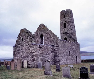
St Magnus Church (Egilsay)
St Magnus Church (Egilsay) — church in Egilsay, UK.
More viewpoints in this region
 📷 3
📷 3Viewpoints · Scottish Islands
Arch Viewpoint
Arch Viewpoint is a viewpoint in the United Kingdom.
 📷 3
📷 3Viewpoints · Scottish Islands
Beginning section 1
Beginning section 1 is a viewpoint in the United Kingdom.
 📷 3
📷 3Viewpoints · Scottish Islands
Beginning section 1
Beginning section 1 is a viewpoint in the United Kingdom.
 📷 3
📷 3Viewpoints · Scottish Islands
Bettyhill Viewpoint
Bettyhill Viewpoint is a viewpoint in the United Kingdom.
Frequently asked questions
- Where is Orientation Table?
- Orientation Table is in the Scottish Islands, United Kingdom (postcode KW17 2QD).
- Is Orientation Table free to visit?
- Yes, Orientation Table is free to enter.
- How do I get to Orientation Table?
- Drivers can navigate to postcode KW17 2QD. It sits within the Orkney and Shetland parliamentary constituency.