Country parks · London
Norwood Grove
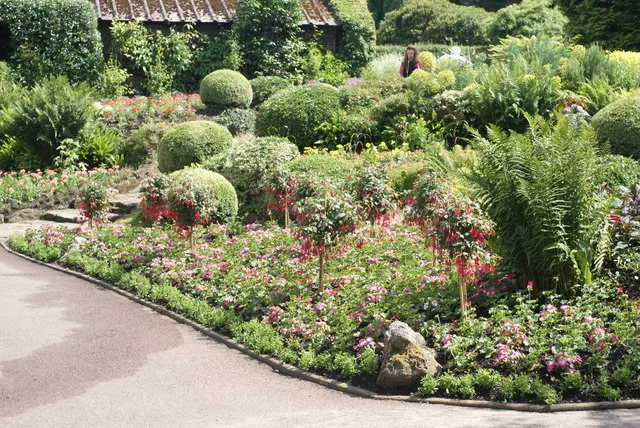
Norwood Grove — grade II listed urban park in London, England, UK.

Wikimedia Commons contributors — see linked file page for photographer and licence licence
Plan your visit
- Typical visit
- 1.5 h–3 h
- Nearest railway station
- Norbury · 0.9 km
- Free entry
- Family-friendly
- Dog-friendly
About
Norwood Grove is a country park in the United Kingdom. It covers approximately 14 km². Heritage designation: Grade II listed park and garden. Wikidata describes it as: "grade II listed urban park in London, England, UK". Coordinates: 51.4179°, -0.1150°.
Photo gallery
From the Wikipedia article
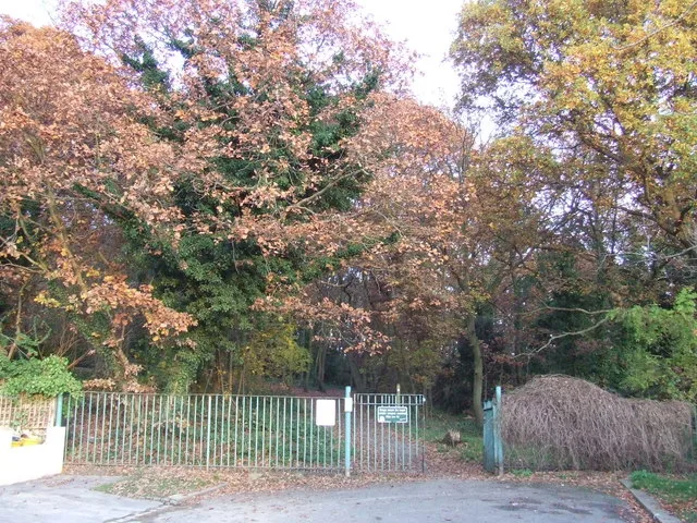
Norwood Grove is an ornamental urban park in the northern extent of the London Borough of Croydon, by whom it is managed, although the most westerly part lies within the London Borough of Lambeth. It is bordered to the south-west by Covington Way, to the south-east by Gibson's Hill and to the north-east by Copgate Path, itself also referred to as 'Norwood Grove', and also by Ryecroft Road. To the north-west the grounds adjoin those of The Rookery (managed by the Borough of Lambeth) which itself adjoins Streatham Common of which Norwood Grove was once a part. The main entrances are on Covington Way and Gibson's Hill but access is also available from Copgate Path as it effectively forms part of the park for much of its length.
Excerpt from Wikipedia under CC BY-SA 4.0. See the source article linked in Sources below.
Background
History
The site was formerly part of the Great Streatham Common, recorded in the Domesday Book of 1086 as 'Lime Common' which occupied much of the land between Norbury and Tulse Hill. It was partly enclosed in 1635 to form an estate around a 'shooting box', In 1746, a house known as 'Copgate' had been established on the site and by 1800, the estate was known as 'Norbury Grove' and was owned by a Mr. T Mills. Nettlefold is commemorated, as a result of his charitable works, by a blue plaque on the south elevation of the house. The Nettlefold family sold the mansion and grounds to Croydon Corporation in 1913 and by 1924 it was proposed that it be used for housing.
Description
The build date of the current house is uncertain but its style and finish suggests that it is from the early 19th-century. From October 1987 the building has been Grade II listed. In the past, although the date is uncertain, the house was enlarged with a similar bow frontage to the west of the current building but this was bombed in World War II <gallery widths="200px" heights="170px"> The White House at Norwood Grove in September 2019.jpg|The White House at Norwood Grove in September 2019 Orangery at Norwood Grove.jpg|Orangery at Norwood Grove </gallery>
Sourced from Wikipedia under CC BY-SA 4.0.
- Coordinates
- 51.4179, -0.1150
- District
- Croydon
- Parish
- Croydon, unparished area
- Postcode
- SW16 3AQ
- Parliamentary constituency
- Streatham and Croydon North
- Nearest railway station
- Norbury — 0.9 km
- Official site
- streathamcommon.org
Sources
- wikidata: Q86750678 (CC0)
- wikipedia: Norwood Grove (CC BY-SA 4.0)
- commons: The White House at Norwood Grove in September 2019.jpg (CC BY-SA 4.0)
Other places nearby
Loading nearby places…
Nearby
 📷 5
📷 5Memorials & monuments · London
Will Hay
Will Hay — a memorial in england-london, United Kingdom.
 Flagship📷 10
Wildlife reserves · London
Biggin Wood
Biggin Wood — preserved ancient woodland.
 📷 5
📷 5Memorials & monuments · London
Metropolitan Drinking Fountain Trough
Metropolitan Drinking Fountain Trough — a memorial in england-london, United Kingdom.
 📷 5
📷 5Country parks · London
Norbury Park
Norbury Park — urban park in London Borough of Croydon, United Kingdom.
 📷 5
📷 5Natural landmarks · London
Silburn Reid
Silburn Reid — a school heritage in england-london, United Kingdom.
 📷 5
📷 5Parks · London
Streatham Common
Streatham Common — park in Streatham, south London.
More places in this region
 Flagship📷 10
Country parks · London
Brockwell Park
Brockwell Park — park in south London, England, UK.
 Flagship📷 10
Country parks · London
Clissold Park
Clissold Park — park in Stoke Newington, London.
 Flagship📷 10
Country parks · London
Coombe Wood
Coombe Wood — woodland and garden area in the London Borough of Croydon.
 Flagship📷 10
Country parks · London
Croham Hurst
Croham Hurst — woodland in Croydon, Greater London, England, United Kingdom.
Frequently asked questions
- Where is Norwood Grove?
- Norwood Grove is in London, United Kingdom (postcode SW16 3AQ), in the parish of Croydon, unparished area.
- Who owns Norwood Grove?
- Norwood Grove is owned by London Borough of Croydon.
- Is Norwood Grove a listed building?
- Norwood Grove is officially recognised as Grade II listed park and garden listed.
- Is Norwood Grove free to visit?
- Yes, Norwood Grove is free to enter.
- How do I get to Norwood Grove?
- The nearest railway station is Norbury, about 0.9 km away. Drivers can navigate to postcode SW16 3AQ.