Country parks · London
Croham Hurst
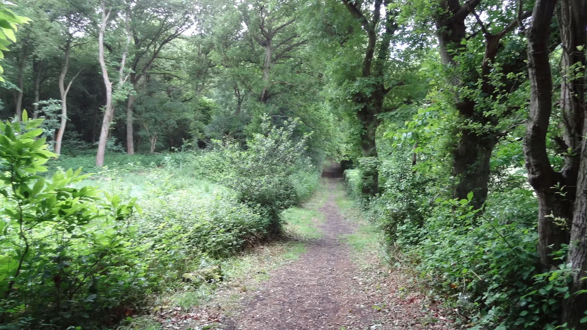
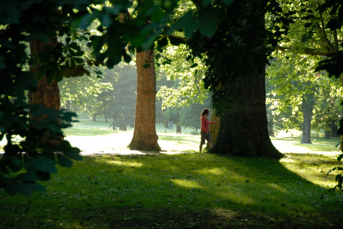
Croham Hurst — woodland in Croydon, Greater London, England, United Kingdom.

Wikimedia Commons contributors — see linked file page for photographer and licence licence
Plan your visit
- Typical visit
- 1.5 h–3 h
- Nearest railway station
- Sanderstead · 1.2 km
- Free entry
- Family-friendly
- Dog-friendly
About
Croham Hurst is a country park in the United Kingdom. It covers approximately 34 km². Heritage designation: Site of Special Scientific Interest. Managed by Croydon Council. Wikidata describes it as: "woodland in Croydon, Greater London, England, United Kingdom". Coordinates: 51.3509°, -0.0773°.
Photo gallery
Protected designations
- Site of Special Scientific Interest: Croham Hurst SSSI
Designations sourced from Natural England open data under OGL v3.
From the Wikipedia article
Croham Hurst is a 33.6 hectare (83.02 acre) biological Site of Special Scientific Interest (SSSI) and a Site of Metropolitan Importance for Nature Conservation in South Croydon in the London Borough of Croydon. Its SSSI designation is due to its importance for nature conservation, but it is also a Regionally Important Geological Site. The site is a steep hill, which is ancient woodland, although there are few very old trees because until the railways made cheap coal available, the timber was used for fuel. On the lower slopes there is a diverse community of plants dominated by oak and hazel on rich soils overlying chalk. Further up the trees are mainly beech on Thanet Sands, and towards the top the main trees are oak and birch on the acidic Blackheath pebble beds. The Thanet Sands have eroded, but the Blackheath beds are bound by a natural cement, and this has resisted erosion to make a natural cap to the hill. The top is mainly bare of trees, with rounded pebbles made when the area was the base of shallow seas in the Eocene epoch around 50 million years ago. The sparse vegetation at the top is mainly wavy hair-grass, heather and bilberry.
Excerpt from Wikipedia under CC BY-SA 4.0. See the source article linked in Sources below.
Background
History
Its human occupation goes back thousands of years. In 1968 two hut sites were discovered with low turf walls, which were part of a Mesolithic settlement around 5,000 to 3,000 years BC. Neolithic flint tools show that settlement continued into the later Stone Age. There is also a Bronze Age round barrow, which is a Scheduled Ancient Monument, with a plaque marking the site. In the medieval period Croham was one of the four manors in the parish of Sanderstead. In the late sixteenth century its then owner, Sir Olliphe Leigh of Addington, sold it to John Whitgift, the Archbishop of Canterbury. Croham Hurst then became part of his Whitgift Foundation, an educational and nursing charity which is…
Sourced from Wikipedia under CC BY-SA 4.0.
- Coordinates
- 51.3509, -0.0773
- District
- Croydon
- Parish
- Croydon, unparished area
- Postcode
- CR2 0DY
- Parliamentary constituency
- Croydon South
- Nearest railway station
- Sanderstead — 1.2 km
- Official site
- www.croydon.gov.uk
Sources
- wikidata: Q5187511 (CC0)
- wikipedia: Croham Hurst (CC BY-SA 4.0)
- commons: Croham Hurst path.jpg (CC BY-SA 4.0)
Other places nearby
Loading nearby places…
Nearby
 📷 5
📷 5Burial mounds & barrows · London
Croham Hurst round barrow
Croham Hurst round barrow — a burial mound in england-london, United Kingdom.
 📷 5
📷 5Memorials & monuments · London
Croydon Parish 1901
Croydon Parish 1901 — a memorial in england-london, United Kingdom.
 📷 5
📷 5Natural landmarks · London
Rutherford School
Rutherford School — a school heritage in england-london, United Kingdom.
 📷 5
📷 5Natural landmarks · London
Royal Russell School
Royal Russell School — a school heritage in england-london, United Kingdom.
 Flagship📷 10
Parks · London
Littleheath Woods
Littleheath Woods is a park in the United Kingdom.
 📷 5
📷 5Forests & woodlands · London
Littleheath Woods
Littleheath Woods is a forest or woodland in the United Kingdom.
More places in this region
 Flagship📷 10
Country parks · London
Brockwell Park
Brockwell Park — park in south London, England, UK.
 Flagship📷 10
Country parks · London
Clissold Park
Clissold Park — park in Stoke Newington, London.
 Flagship📷 10
Country parks · London
Coombe Wood
Coombe Wood — woodland and garden area in the London Borough of Croydon.
 Flagship📷 10
Country parks · London
Finsbury Park
Finsbury Park — public park in the London Borough of Haringey, England.
Frequently asked questions
- Where is Croham Hurst?
- Croham Hurst is in London, United Kingdom (postcode CR2 0DY), in the parish of Croydon, unparished area.
- Who runs Croham Hurst?
- Croham Hurst is operated by Croydon Council.
- Is Croham Hurst a listed building?
- Croham Hurst is officially recognised as Site of Special Scientific Interest listed.
- Is Croham Hurst a protected site?
- Yes — Croham Hurst is part of the Croham Hurst SSSI Site of Special Scientific Interest.
- Is Croham Hurst free to visit?
- Yes, Croham Hurst is free to enter.
- How do I get to Croham Hurst?
- The nearest railway station is Sanderstead, about 1.2 km away. Drivers can navigate to postcode CR2 0DY.