Mountains & hills · Scottish Highlands
North Goatfell
Also known as: Gaoda-Bheinn a Tuath, Gaoda Bheinn (Goatfell), Gaoda Bheinn
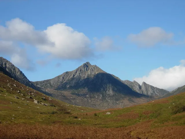
North Goatfell — Named summit at 810 m.

Wikimedia Commons contributors — see linked file page for photographer and licence licence
Plan your visit
- Typical visit
- 3 h–8 h
- Best time of year
- Late spring – early autumn (May–Oct)
- Free entry
- Dog-friendly
About
North Goatfell is a named summit in the United Kingdom. Also known as: Gaoda-Bheinn a Tuath. Wikidata describes it as: "Named summit at 810 m.". Coordinates: 55.6326°, -5.1946°.
Photo gallery
From the Wikipedia article
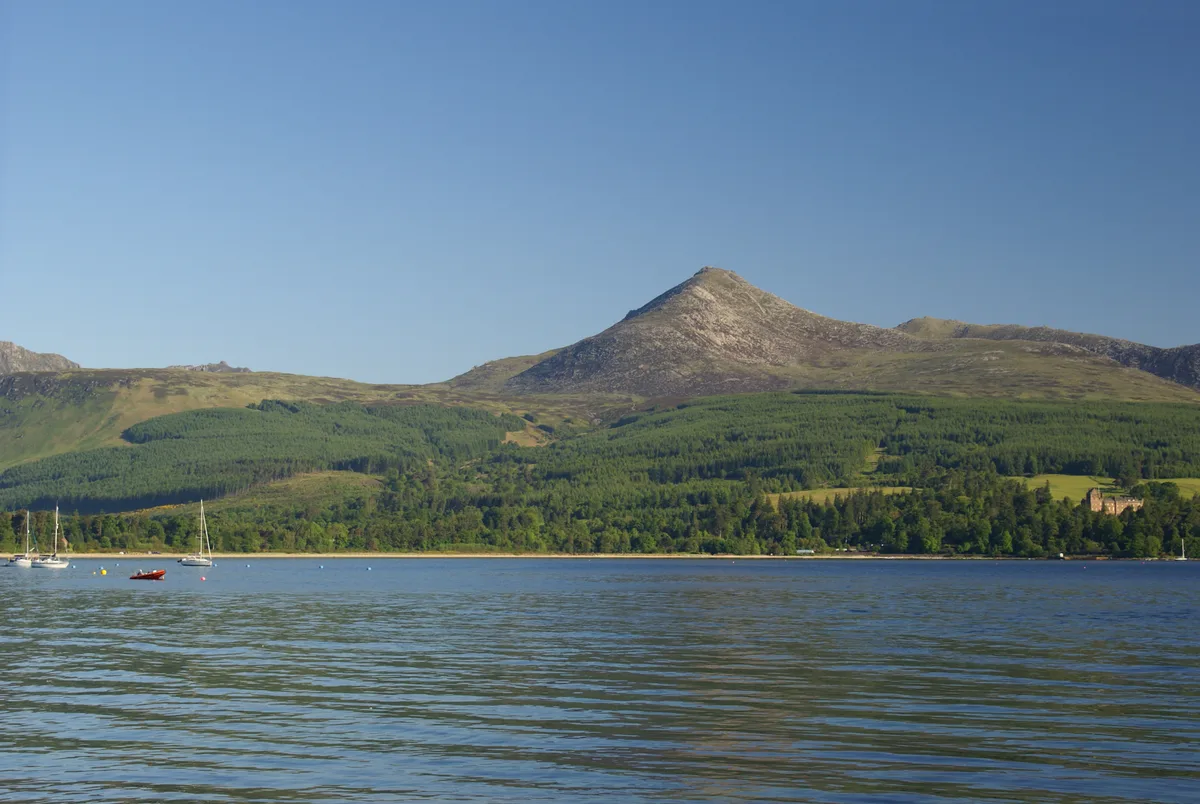
Goat Fell (Scottish Gaelic: Gaoitbheinn) is the highest point on the Isle of Arran. At 875 metres (2,871 ft), it is one of four Corbetts on the island. The mountain, along with nearby Brodick Castle, is now owned by the National Trust for Scotland.
Excerpt from Wikipedia under CC BY-SA 4.0. See the source article linked in Sources below.
- Coordinates
- 55.6326, -5.1946
- Address
- Isle of Arran, North Ayrshire, Scotland
Sources
- osm: n2318452007 (ODbL)
- wikipedia: Goat Fell (CC BY-SA 4.0)
- commons: Goatfell from Brodick Harbour.jpg (CC BY-SA 4.0)
Other places nearby
Loading nearby places…
Nearby
 📷 3
📷 3Natural landmarks · Scottish Highlands
Goat Fell
Goat Fell — Mountain in North Ayrshire, Scotland, UK.
 📷 3
📷 3Mountains & hills · Scottish Highlands
Goat Fell
Goat Fell — Named summit at 874 m.
 📷 3
📷 3Mountains & hills · Scottish Highlands
Cioch na h-Oighe
Cioch na h-Oighe — a mountain in scotland-highlands, United Kingdom.
 📷 4
📷 4Viewpoints · Scottish Highlands
The Saddle
The Saddle is a viewpoint in the United Kingdom.
 📷 3
📷 3Natural landmarks · Scottish Highlands
Cìr Mhòr
Cìr Mhòr — mountain in North Ayrshire, Scotland, UK.
 📷 3
📷 3Mountains & hills · Scottish Highlands
Cìr Mhòr
Cìr Mhòr — Named summit at 799 m.
More mountains in this region
 📷 3
📷 3Mountains & hills · Scottish Highlands
A' Bhuidheanach Bheag
A' Bhuidheanach Bheag — Named summit at 936 m.
 📷 3
📷 3Mountains & hills · Scottish Highlands
A' Chailleach
A' Chailleach — Named summit at 997 m.
 📷 3
📷 3Mountains & hills · Scottish Highlands
A' Chailleach
A' Chailleach — Named summit at 930 m.
 📷 3
📷 3Mountains & hills · Scottish Highlands
A' Chaoirnich
A' Chaoirnich — Named summit at 875 m.
Frequently asked questions
- Where is North Goatfell?
- North Goatfell is in Scottish Highlands, in the United Kingdom — coordinates 55.6326°, -5.1946°.
- Is North Goatfell free to visit?
- Yes — admission to North Goatfell is free.