Harbours & ports · South East England
Newtown River
Newtown River — river in the United Kingdom.

Wikimedia Commons contributors — see linked file page for photographer and licence licence
Plan your visit
- Typical visit
- 45 min–1.5 h
- Nearest railway station
- Lymington Pier · 9.4 km
- Family-friendly
- Dog-friendly
About
Newtown River is a harbour in the United Kingdom. Heritage designation: Site of Special Scientific Interest. Wikidata describes it as: "river in the United Kingdom". Coordinates: 50.7189°, -1.4107°.
Photo gallery
Protected designations
- Site of Special Scientific Interest: Newtown Harbour SSSI
- National Nature Reserve: NEWTOWN HARBOUR
- Area of Outstanding Natural Beauty: Isle Of Wight
- Ramsar wetland: Solent & Southampton Water
Designations sourced from Natural England open data under OGL v3.
From the Wikipedia article
Newtown River is a large natural inland harbour located on the Isle of Wight's northwestern coast, named after the nearby village of Newtown. It is sometimes also referred to as Newtown Creek. Newtown Harbour is the name given by Natural England to the River and surrounding land, and this area is the only national nature reserve on the island. It is owned and managed by the National Trust. Newtown River consists of a number of estuaries of small rivers, known locally as "lakes", and has the form of several finger-like indentations in the coastline. They are Clamerkin Lake, Spur Lake, Ningwood Lake, Western Haven, Corf Lake, Shalfleet Lake and Causeway Lake. The narrow entrance to Newtown River is 3/4 of a mile east of Hamstead Point, in the centre of Newtown Bay. The entrance needs navigating with care as there is a bar across the entrance, strong cross tides and a fair flow of water in and out of the entrance channel at mid-tide. Although, much mud is exposed in the harbour at low water, there are a number of moorings in the deeper parts of the creeks and lakes and the anchorage can become crowded at weekends during the main sailing season. Scouts from nearby Corf Camp often make use of the Estuary for expeditions from the jetty on the shore. The harbour is loved for its unspoilt beauty and tranquility. The River and adjoining land are regarded as one of the best examples of an undisturbed natural harbour on the south coast of England with its varied habitats ranging from woodland, ancient meadows, mudflats and marshland. It supports a number of rare species, but its primary importance is as a wintering ground for seabirds. The River is part of the Isle of Wight's Area of Outstanding Natural Beauty (AONB), and is part of the Hamstead Heritage Coast. The area is also part of a 619.3-hectare (1,530-acre) biological Site of Special Scientific Interest (SSSI). It was notified in 1951. Two major landowners own most of the area designated as Newton Harbour SSSI; the…
Excerpt from Wikipedia under CC BY-SA 4.0. See the source article linked in Sources below.
- Coordinates
- 50.7189, -1.4107
- District
- Isle of Wight
- Parish
- Calbourne, Newtown and Porchfield
- Postcode
- PO30 4PA
- Parliamentary constituency
- Isle of Wight West
- Nearest railway station
- Lymington Pier — 9.4 km
Sources
- wikidata: Q7020750 (CC0)
- wikipedia: Newtown River (CC BY-SA 4.0)
- commons: Newtown Bay.jpg (CC BY-SA 4.0)
Other places nearby
Loading nearby places…
Nearby
 📷 5
📷 5Viewpoints · South East England
Mercia Seabroke Bird Hide
Mercia Seabroke Bird Hide is a viewpoint in the United Kingdom.
 📷 5
📷 5Historic churches · South East England
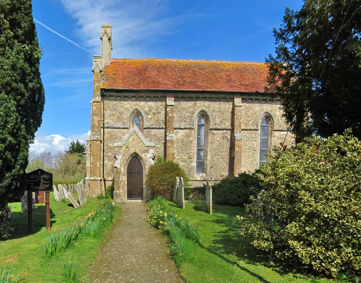
Holy Spirit Church, Newtown
Holy Spirit Church, Newtown — church in Newtown, Isle of Wight, England, UK.
 📷 5
📷 5Natural landmarks · South East England
National Trust Gift Shop
National Trust Gift Shop — a other in england-south-east, United Kingdom.
 📷 5
📷 5Historic houses · South East England
Newtown Old Town Hall
Newtown Old Town Hall — a other in england-south-east, United Kingdom.
 📷 5
📷 5Viewpoints · South East England
East Bird Hide
East Bird Hide is a viewpoint in the United Kingdom.
Vineyards · South East England
Medieval settlement and cultivation remains at Newtown
human settlement in Calbourne, Newtown and Porchfield, Isle of Wight, England, UK
More places in this region
 Flagship📷 10
Harbours & ports · South East England
Shoreham-by-Sea
Shoreham-by-Sea — seaside town and port in West Sussex, England.
 📷 5
📷 5Harbours & ports · South East England
Chichester Harbour
Chichester Harbour — Harbour & Site of Special Scientific Interest in Chichester, West Sussex.
 📷 5
📷 5Harbours & ports · South East England
Colt Hill Wharf
Colt Hill Wharf is a harbour in the United Kingdom.
_2025-03-02.jpg?width=1200) 📷 5
📷 5Harbours & ports · South East England
Cormorant
Cormorant — Public artwork (sculpture) by Christian Funnell.
Frequently asked questions
- Where is Newtown River?
- Newtown River is in South-East England, United Kingdom (postcode PO30 4PA), in the parish of Calbourne, Newtown and Porchfield.
- Is Newtown River a listed building?
- Newtown River is officially recognised as Site of Special Scientific Interest listed.
- Is Newtown River a protected site?
- Yes — Newtown River is part of the Newtown Harbour SSSI Site of Special Scientific Interest and the NEWTOWN HARBOUR National Nature Reserve.
- How do I get to Newtown River?
- Drivers can navigate to postcode PO30 4PA. It sits within the Isle of Wight West parliamentary constituency.