Towns & cities · London
Netherne-on-the-Hill
Netherne-on-the-Hill — village in Surrey, England, UK.

Wikimedia Commons contributors — see linked file page for photographer and licence licence
Plan your visit
- Typical visit
- 3 h–6 h
- Nearest railway station
- Coulsdon South · 2.7 km
- Free entry
- Family-friendly
- Dog-friendly
About
Netherne-on-the-Hill is a town, city, village or settlement in the United Kingdom. Recent population estimates put it at around 1,458 people. Wikidata describes it as: "village in Surrey, England, UK". Coordinates: 51.2919°, -0.1428°.
Photo gallery
Protected designations
- National Nature Reserve: SOUTH LONDON DOWNS
- Area of Outstanding Natural Beauty: Surrey Hills
Designations sourced from Natural England open data under OGL v3.
From the Wikipedia article
Netherne-on-the-Hill is a village in Surrey, England, occupying a plateau once home to Netherne Hospital. The village is across a narrow valley from Hooley in north of the borough of Reigate and Banstead; through the valley runs the Hooley Tunnel cutting and A23, the only road from which the village can be accessed, from two designated side roads; a few metres south of the southern T-junction, the road divides into two grades: the A23 to Redhill, 3 miles (4.8 km) south, and the M23 motorway which has a junction with the M25 motorway within Merstham's boundaries, the former village of the hilltop land. The post town, Coulsdon in Greater London is centred 1.8 miles (2.9 km) due north.
Excerpt from Wikipedia under CC BY-SA 4.0. See the source article linked in Sources below.
Background
History
Unlike Hooley which was mostly part of Coulsdon manor and parish, the land here was within the traditional boundaries of Merstham as a village, that is within its ecclesiastical parish. The property called Netherne – 'Lez Nedder' in 1522 – was acquired in the first decade of the 20th century by the Surrey County Council for an asylum; the quit-rent payable yearly for the land of a little over half of one pound sterling recorded in 1522 was enfranchised from the land by the Council paying its owner.
Sourced from Wikipedia under CC BY-SA 4.0.
- Coordinates
- 51.2919, -0.1428
- County
- Surrey
- District
- Reigate and Banstead
- Parish
- Reigate and Banstead, unparished area
- Postcode
- CR5 1NZ
- Parliamentary constituency
- East Surrey
- Population
- 1,458
- Nearest railway station
- Coulsdon South — 2.7 km
Sources
- wikidata: Q1978624 (CC0)
- wikipedia: Netherne-on-the-Hill (CC BY-SA 4.0)
- commons: Netherne-Hill-Appartements.JPG (CC BY-SA 4.0)
Other places nearby
Loading nearby places…
Nearby
Caravan parks · London
Alderstead Heath
Alderstead Heath — a caravan park in england london.
 📷 5
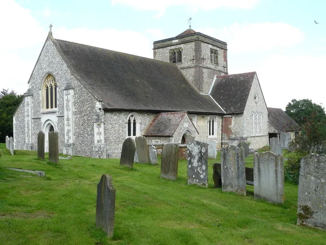
📷 5Historic churches · London
Church of St Margaret, Hooley
Church of St Margaret, Hooley — church in Reigate and Banstead, UK.
 📷 5
📷 5Memorials & monuments · London
Chipstead War Memorial
Chipstead War Memorial — Grade II listed building-listed memorial in england-london, United Kingdom.
 📷 5
📷 5Natural landmarks · London
Southernmost Point of Gtr London
Southernmost Point of Gtr London — a other in england-london, United Kingdom.
 📷 5
📷 5Historic churches · London
Church of St Peter and St Paul
Church of St Peter and St Paul — church at Chaldon, Surrey, England, UK.
 📷 5
📷 5Public art & sculpture · London
Chaldon Church Mural
Chaldon Church Mural — a public art in england-london, United Kingdom.
More towns in this region
 Flagship📷 10
Towns & cities · London
Aldenham
Aldenham — village and civil parish in Hertfordshire, England.
 Flagship📷 10
Towns & cities · London
Ashdon
Ashdon — village and civil parish in Essex, UK.
 Flagship📷 10
Towns & cities · London
Betchworth
Betchworth — village and civil parish in the Mole Valley district of Surrey, England.
 Flagship📷 10
Towns & cities · London
Boxley
Boxley — village and civil parish in Maidstone District, Kent, England, UK.
Frequently asked questions
- Where is Netherne-on-the-Hill?
- Netherne-on-the-Hill is in Surrey, London, United Kingdom (postcode CR5 1NZ), in the parish of Reigate and Banstead, unparished area.
- Is Netherne-on-the-Hill a protected site?
- Yes — Netherne-on-the-Hill is part of the SOUTH LONDON DOWNS National Nature Reserve and the Surrey Hills National Landscape (AONB).
- Is Netherne-on-the-Hill free to visit?
- Yes, Netherne-on-the-Hill is free to enter.
- How do I get to Netherne-on-the-Hill?
- The nearest railway station is Coulsdon South, about 2.7 km away. Drivers can navigate to postcode CR5 1NZ.