Mountains & hills · North Wales
Mynydd Pant
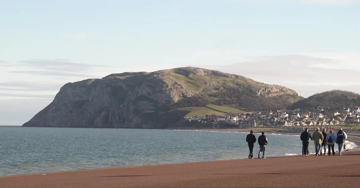
Mynydd Pant — a mountain in wales-north, United Kingdom, 131 m.

Ceri Thomas — CC BY-SA 2.0 via Wikimedia Commons licence
Plan your visit
- Typical visit
- 3 h–8 h
- Best time of year
- Late spring – early autumn (May–Oct)
- Free entry
- Dog-friendly
About
Mynydd Pant is a named summit in wales-north, United Kingdom, with an elevation of approximately 131 metres. Listed in the Wikidata register of UK peaks; see the Wikipedia article for further details on the mountain's location, geology and walking routes.
Photo gallery
Place summary
Mynydd Pant is a mountain located in North Wales. It is known for its distinctive landscape and elevation, contributing to the natural beauty of the region.
AI-generated from the structured facts on this page (operator, designation, listing, era). Not a substitute for visiting.
- Coordinates
- 53.3183, -3.7873
- District
- Conwy
- Parish
- Llandudno
- Postcode
- LL30 3BA
- Parliamentary constituency
- Bangor Aberconwy
Sources
- wikidata: Q106710295 (CC0)
Other places nearby
Loading nearby places…
Nearby
 📷 5
📷 5Caves · North Wales
Ogof Pant-y-Wennol
Ogof Pant-y-Wennol — a cave broad in wales-north, United Kingdom.
Caravan parks · North Wales
Penrhyn Hall Farm Caravan Park
Penrhyn Hall Farm Caravan Park — a caravan park in wales north.
 📷 3
📷 3Farms (open to visitors) · North Wales
Bodafon Farm and Owls Trust
Bodafon Farm and Owls Trust — a other in wales-north, United Kingdom.
 📷 3
📷 3Mountains & hills · North Wales
Creigiau Rhiwledyn
Creigiau Rhiwledyn — a mountain in wales-north, United Kingdom, 141 m.
 📷 3
📷 3Galleries · North Wales
Jen Art
Jen Art — a gallery in wales-north, United Kingdom.
 📷 3
📷 3Mountains & hills · North Wales
Little Orme
Little Orme — Named summit at 141 m.
More mountains in this region
 📷 5
📷 5Mountains & hills · North Wales
Cemlyn Bay and lagoon
Cemlyn Bay and lagoon — Site of Special Scientific Interest in Wales.
 📷 3
📷 3Mountains & hills · North Wales
Aberffraw Bay
Aberffraw Bay — bay on the west coast of Anglesey, in Wales, UK.
 📷 3
📷 3Mountains & hills · North Wales
Allt-fawr
Allt-fawr — Named summit at 698 m.
 📷 3
📷 3Mountains & hills · North Wales
Aran Benllyn
Aran Benllyn — Named summit at 884 m.
Frequently asked questions
- Where is Mynydd Pant?
- Mynydd Pant is in North Wales, United Kingdom (postcode LL30 3BA), in the parish of Llandudno.
- Is Mynydd Pant free to visit?
- Yes, Mynydd Pant is free to enter.
- How do I get to Mynydd Pant?
- Drivers can navigate to postcode LL30 3BA. It sits within the Bangor Aberconwy parliamentary constituency.