Mountains & hills · North Wales
Mynydd Nodol
Mynydd Nodol — Named summit at 539 m.

Wikimedia Commons contributors — see linked file page for photographer and licence licence
Plan your visit
- Typical visit
- 3 h–8 h
- Best time of year
- Late spring – early autumn (May–Oct)
- Nearest railway station
- Bala (Penybont) · 7.8 km
- Free entry
- Dog-friendly
About
Mynydd Nodol is a named summit in the United Kingdom. Wikidata describes it as: "Named summit at 539 m.". Coordinates: 52.9394°, -3.6902°.
Photo gallery
From the Wikipedia article
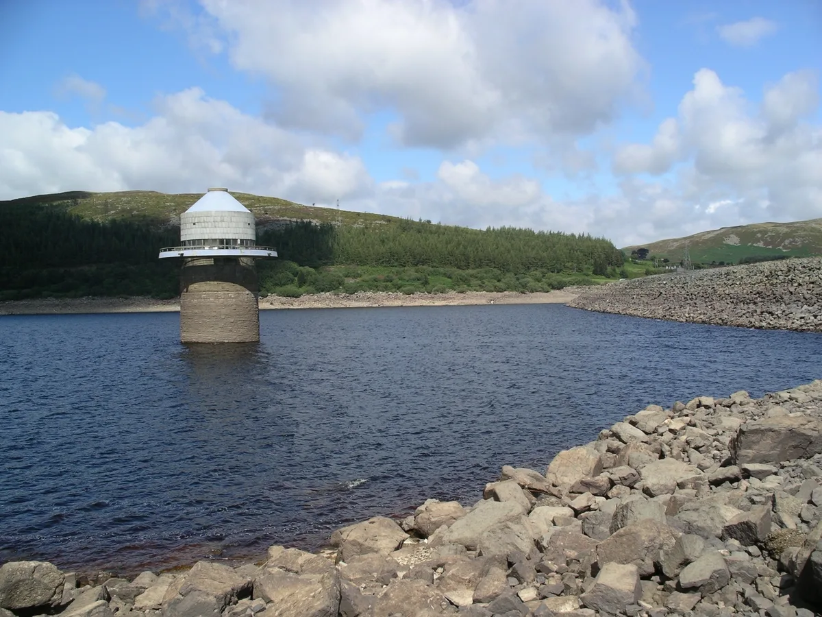
Mynydd Nodol is a 539m high hill in Snowdonia National Park and lying within the community of Llanycil in the county of Gwynedd in North Wales. It rises above the southern shores of the reservoir Llyn Celyn about 4 km northeast of its higher neighbour Arenig Fawr. Mynydd Nodol forms the backdrop in views from the A4212 car park by the dam. The hill throws down a broad shoulder to the east.
Excerpt from Wikipedia under CC BY-SA 4.0. See the source article linked in Sources below.
Background
Visiting
Almost the entire hill is mapped as open country under the Countryside and Rights of Way Act 2000 thereby giving members of the public the right to walk across it more or less freely. An unfenced minor public road running northwest from Bala fringes the southwestern edge of the hill.
Sourced from Wikipedia under CC BY-SA 4.0.
- Coordinates
- 52.9394, -3.6902
- District
- Gwynedd
- Parish
- Llanycil
- Postcode
- LL23 7SG
- Parliamentary constituency
- Dwyfor Meirionnydd
- Nearest railway station
- Bala (Penybont) — 7.8 km
Sources
- osm: n29763536 (ODbL)
- wikipedia: Mynydd Nodol (CC BY-SA 4.0)
- commons: Llanycil - Mynydd Nodol seen across Llyn Celyn - geograph.org.uk - 1612297.jpg (CC BY-SA 4.0)
Other places nearby
Loading nearby places…
Nearby
 📷 5
📷 5Reservoirs & lochs · North Wales
Llyn Celyn
Llyn Celyn — reservoir lake in Wales.
 📷 5
📷 5Historic churches · North Wales
Llidiardau
Llidiardau — a church in wales-north, United Kingdom.
 📷 3
📷 3Memorials & monuments · North Wales
Hafod Fadog Memorial
Hafod Fadog Memorial — a memorial in wales-north, United Kingdom.
 📷 5
📷 5Historic churches · North Wales
Capel Celyn
Capel Celyn — a church in wales-north, United Kingdom.

Mountains & hills · North Wales
Pen Garneddwen
Pen Garneddwen — a mountain in wales-north, United Kingdom, 479 m.
 📷 3
📷 3Reservoirs & lochs · North Wales
Llyn Arenig Fawr
Llyn Arenig Fawr is a reservoir in the United Kingdom.
More mountains in this region
 📷 5
📷 5Mountains & hills · North Wales
Cemlyn Bay and lagoon
Cemlyn Bay and lagoon — Site of Special Scientific Interest in Wales.
 📷 3
📷 3Mountains & hills · North Wales
Aberffraw Bay
Aberffraw Bay — bay on the west coast of Anglesey, in Wales, UK.
 📷 3
📷 3Mountains & hills · North Wales
Allt-fawr
Allt-fawr — Named summit at 698 m.
 📷 3
📷 3Mountains & hills · North Wales
Aran Benllyn
Aran Benllyn — Named summit at 884 m.
Frequently asked questions
- Where is Mynydd Nodol?
- Mynydd Nodol is in North Wales, United Kingdom (postcode LL23 7SG), in the parish of Llanycil.
- Is Mynydd Nodol free to visit?
- Yes, Mynydd Nodol is free to enter.
- How do I get to Mynydd Nodol?
- The nearest railway station is Bala (Penybont), about 7.8 km away. Drivers can navigate to postcode LL23 7SG.