Mountains & hills · Mid Wales
Mynydd Esgair Weddan
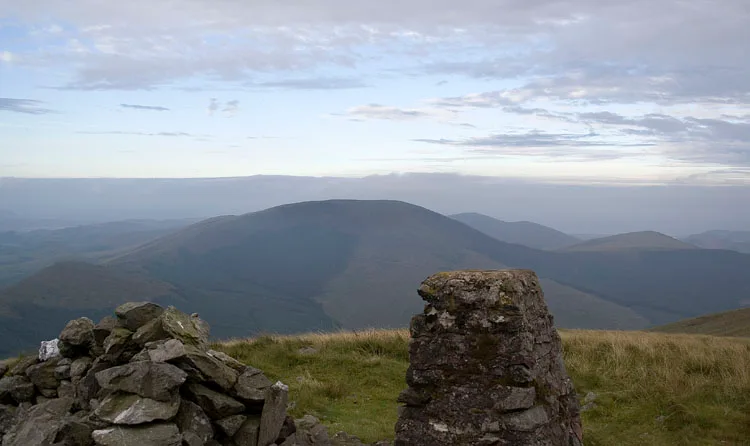
Mynydd Esgair Weddan — Named summit at 512 m.

Wikimedia Commons contributors — see linked file page for photographer and licence licence
Plan your visit
- Typical visit
- 3 h–8 h
- Best time of year
- Late spring – early autumn (May–Oct)
- Nearest railway station
- Dolgoch · 3.2 km
- Free entry
- Dog-friendly
About
Mynydd Esgair Weddan is a named summit in the United Kingdom. Wikidata describes it as: "Named summit at 512 m.". Coordinates: 52.6075°, -3.9531°.
Photo gallery
From the Wikipedia article
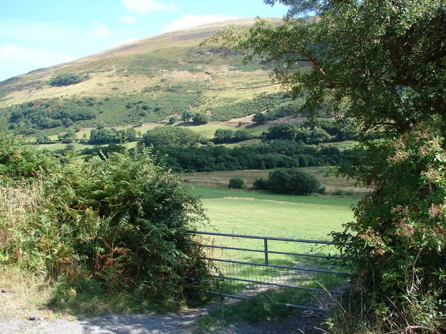
Mynydd Esgairweddan is a hill near Pennal in southern Gwynedd, Wales (grid reference SH6702). Nearby is the tiny settlement of Esgairweddan. It is very close to the site of the old Roman fort of Cefn Caer (Pennal). The area was described in the Topographical Dictionary of Wales by Samuel Lewis (published 1833) as; "A tract of hilly and rocky ground but little adapted for purposes of agriculture. The soil is thin and poor, but, in some of the lower grounds, not altogether unproductive; the declivities of the hills afford only a scanty pasturage for sheep and young cattle: peat, which forms the principal fuel of the inhabitants, is found in various parts."
Excerpt from Wikipedia under CC BY-SA 4.0. See the source article linked in Sources below.
Background
History
The name Esgairweddan is most associated with the site of the ancestral demesne of the Price of Esgairweddan family, the senior branch of the Royal House of Gwynedd that survived the English conquest of Wales from 1282. Their ancestral home was known during the Middle Ages as Plas yn y Rofft. It was probably located at the place now named Cwrt (meaning Court) close to Esgairweddan. The line of Price of Esgairweddan became extinct with Robert Price, Esq. (died 1702), who left two daughters; Mary and Anne (Anne died in 1750). The estates, at the demise of the former, passed to the Edwardses of Talgarth and formed part of the Pennal Towers Estate. Frances Edwards (c. 1790–1828) married Captain…
Sourced from Wikipedia under CC BY-SA 4.0.
- Coordinates
- 52.6075, -3.9531
- Nearest railway station
- Dolgoch — 3.2 km
Sources
- osm: n3469981611 (ODbL)
- wikipedia: Mynydd Esgairweddan (CC BY-SA 4.0)
- commons: Mynydd Esgairweddan.jpg (CC BY-SA 4.0)
Other places nearby
Loading nearby places…
Nearby
 📷 3
📷 3Mountains & hills · Mid Wales
Ffridd Esgairweddan
Ffridd Esgairweddan — a mountain in wales-mid, United Kingdom, 326 m.
 📷 3
📷 3Mountains & hills · Mid Wales
Tarrenhendre
Tarrenhendre — Named summit at 634 m.
_in_Cwm_Ebol_-_geograph.org.uk_-_594897.jpg?width=1200) 📷 3
📷 3Quarries · Mid Wales
Cwm Ebol quarry
Cwm Ebol quarry — former slate quarry in Mid-Wales.
 📷 3
📷 3Mountains & hills · Mid Wales
Tarren Cwm-ffernol
Tarren Cwm-ffernol — a mountain in wales-mid, United Kingdom, 551 m.
 📷 3
📷 3Mountains & hills · Mid Wales
Pen Trum-gŵr
Pen Trum-gŵr — Named summit at 512 m.
 📷 3
📷 3Mountains & hills · Mid Wales
Mynydd Rhyd-galed East Top
Mynydd Rhyd-galed East Top — a mountain in wales-mid, United Kingdom, 475 m.
More mountains in this region
 📷 3
📷 3Mountains & hills · Mid Wales
Black Hill
Black Hill — Named summit at 640 m.
 📷 3
📷 3Mountains & hills · Mid Wales
Black Mixen
Black Mixen — Named summit at 650 m.
 📷 5
📷 5Mountains & hills · Mid Wales
Cadair Idris
Cadair Idris — Named summit at 893 m.
 📷 3
📷 3Mountains & hills · Mid Wales
Caer Caradoc
Caer Caradoc — Named summit at 459 m.
Frequently asked questions
- Where is Mynydd Esgair Weddan?
- Mynydd Esgair Weddan is in Mid Wales, United Kingdom.
- Is Mynydd Esgair Weddan free to visit?
- Yes, Mynydd Esgair Weddan is free to enter.
- How do I get to Mynydd Esgair Weddan?
- The nearest railway station is Dolgoch, about 3.2 km away.