Mountains & hills · Northern Ireland
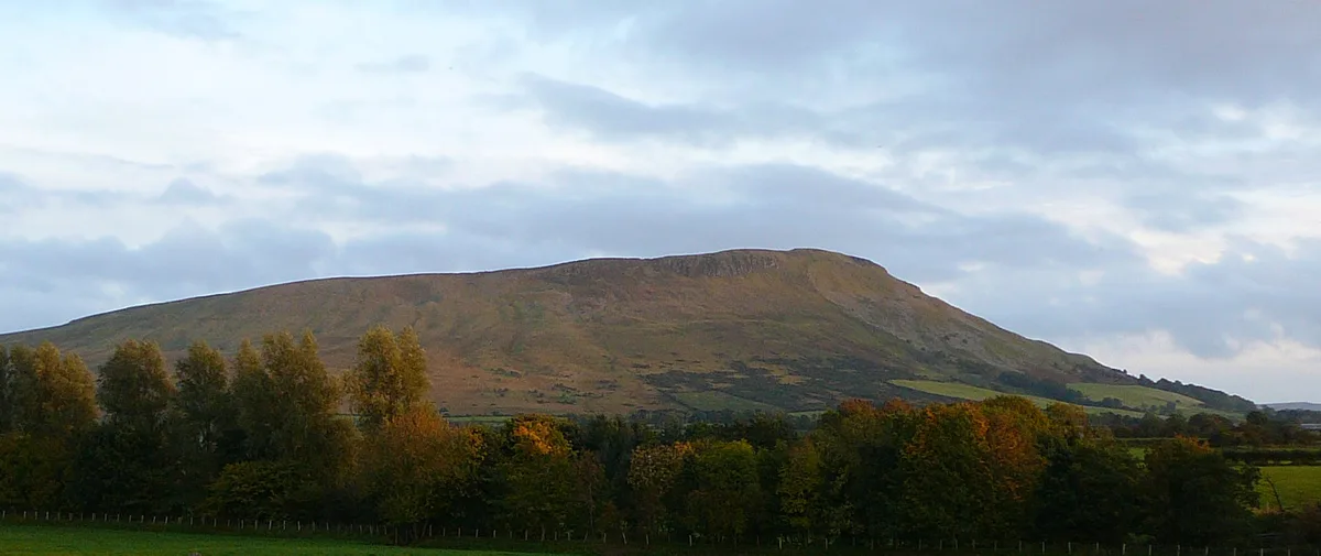
Mullaghcarn
Also known as: Mullach Cairn
Mullaghcarn — Named summit at 542 m.

Wikimedia Commons contributors — see linked file page for photographer and licence licence
Plan your visit
- Typical visit
- 3 h–8 h
- Best time of year
- Late spring – early autumn (May–Oct)
- Free entry
- Dog-friendly
About
Mullaghcarn is a named summit in the United Kingdom. Also known as: Mullach Cairn. Wikidata describes it as: "Named summit at 542 m.". Coordinates: 54.6743°, -7.2094°.
Photo gallery
From the Wikipedia article
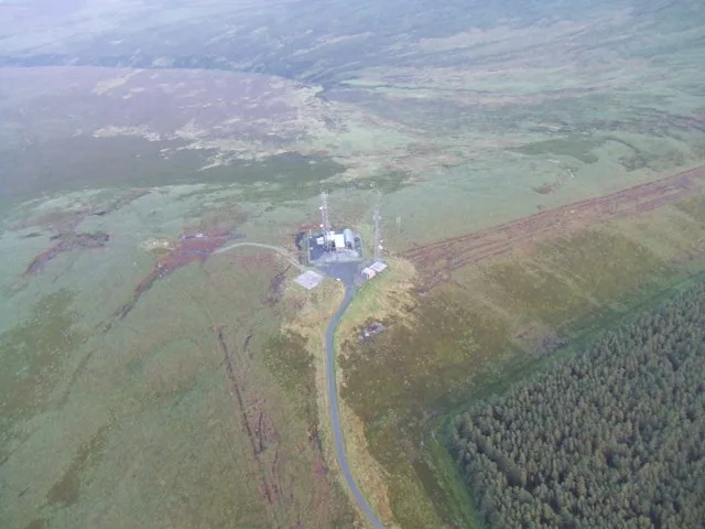
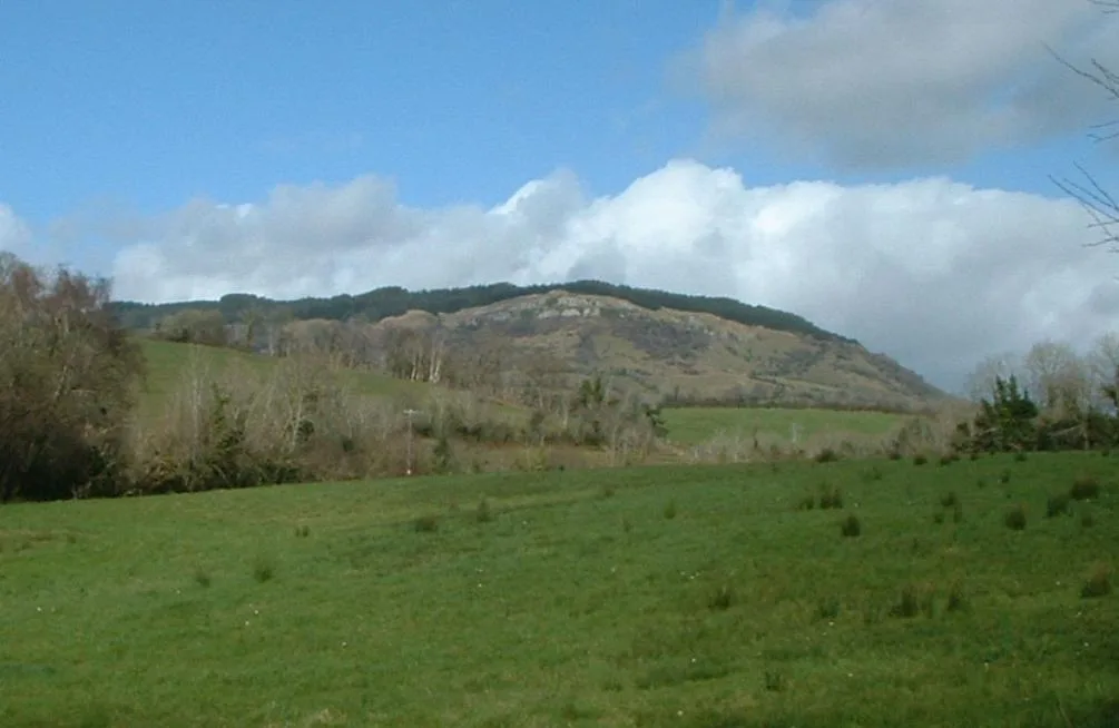
Mullaghcarn (from Irish Mullach Cairn, meaning 'peak of the cairns') is a mountain in the southwest Sperrins, County Tyrone, Northern Ireland. The peak reaches a height of 542 m (1778 ft), and is the 370th highest in Ireland. Mullaghcarn is in the Fermanagh and Omagh District Council area, on the edge of Gortin Glen Forest Park, and is the most southerly peak in the Sperrins. It is 5 miles (8.0 km) northeast of Omagh, and is 3.1 miles (5.0 km) south of Gortin.
Excerpt from Wikipedia under CC BY-SA 4.0. See the source article linked in Sources below.
Background
History
Mullaghcarn was home to firing ranges during World War II. These were used by the police and US Army soldiers stationed in the area.
Sourced from Wikipedia under CC BY-SA 4.0.
- Coordinates
- 54.6743, -7.2094
- Address
- County Tyrone, Northern Ireland
Sources
- osm: n332372884 (ODbL)
- wikipedia: Mullaghcarn (CC BY-SA 4.0)
- commons: Mullaghcarn Summit- detail - geograph.org.uk - 556867.jpg (CC BY-SA 4.0)
Other places nearby
Loading nearby places…
Nearby
 📷 4
📷 4Natural landmarks · Northern Ireland
Mullaghcarn
Mullaghcarn — mountain in County Tyrone, Northern Ireland, UK.
 📷 3
📷 3Parks · Northern Ireland
Gortin Glen Forest Park
Gortin Glen Forest Park — a other in northern-ireland, United Kingdom.
 📷 5
📷 5Natural landmarks · Northern Ireland
Glenmacoffer
Glenmacoffer in Northern Ireland, United Kingdom.
 📷 4
📷 4Natural landmarks · Northern Ireland
Gortin
Gortin in Northern Ireland, United Kingdom.
 📷 5
📷 5Mountains & hills · Northern Ireland
Curraghchosaly Mountain
Curraghchosaly Mountain — a mountain in northern-ireland, United Kingdom.
 📷 3
📷 3Natural landmarks · Northern Ireland
Gortin St. Patrick's GAC
Gortin St. Patrick's GAC in Northern Ireland, United Kingdom.
More mountains in this region
 📷 5
📷 5Mountains & hills · Northern Ireland
Belfast Lough
Belfast Lough — intertidal inlet in Northern Ireland.
 📷 5
📷 5Mountains & hills · Northern Ireland
Belmore Mountain
Belmore Mountain — Named summit at 398 m.
 📷 4
📷 4Mountains & hills · Northern Ireland
Ben Crom
Ben Crom — Named summit at 526 m.
 📷 3
📷 3Mountains & hills · Northern Ireland
Benbradagh
Benbradagh — Named summit at 465 m.
Frequently asked questions
- Where is Mullaghcarn?
- Mullaghcarn is in Northern Ireland, in the United Kingdom — coordinates 54.6743°, -7.2094°.
- Is Mullaghcarn free to visit?
- Yes — admission to Mullaghcarn is free.