Quarries · London
Moor Mill Quarry, West
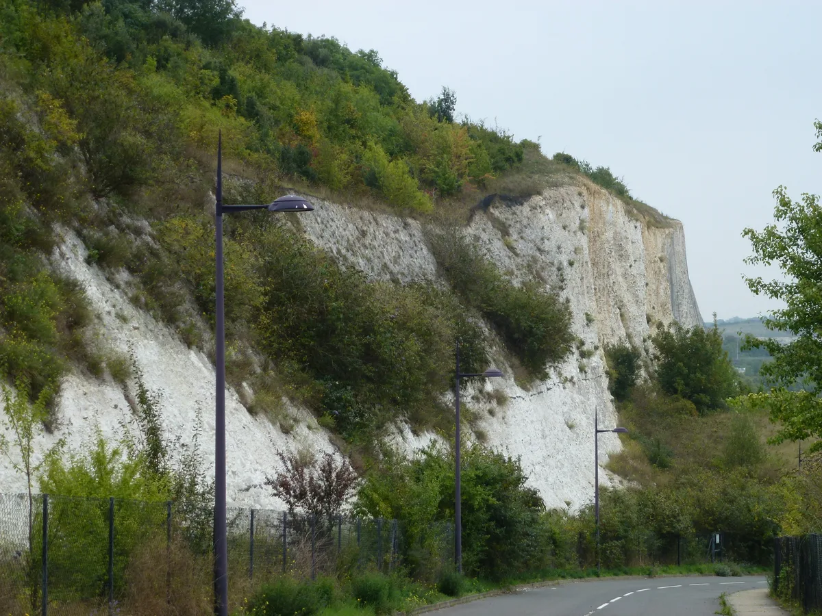
Moor Mill Quarry, West — Site of Special Scientific Interest in Hertfordshire.

Wikimedia Commons contributors — see linked file page for photographer and licence licence
Plan your visit
- Typical visit
- 45 min–1.5 h
- Nearest railway station
- How Wood · 0.7 km
About
Moor Mill Quarry, West is a quarry in the United Kingdom. Heritage designation: Site of Special Scientific Interest. Wikidata describes it as: "Site of Special Scientific Interest in Hertfordshire". Coordinates: 51.7118°, -0.3506°.
Photo gallery
Protected designations
- Site of Special Scientific Interest: Moor Mill Quarry, West SSSI
- Area of Outstanding Natural Beauty: Chilterns
Designations sourced from Natural England open data under OGL v3.
From the Wikipedia article
Moor Mill Quarry, West is a 0.16-hectare (0.40-acre) geological Site of Special Scientific Interest in How Wood in Hertfordshire. The local planning authority is St Albans City and District Council. It was notified in 1992 as representing the former Moor Mill Quarry SSSI, which was lost to landfill operations. It is listed by the Geological Conservation Review. The pit shows a sequence of Pleistocene Anglian and pre-Anglian deposits. It displays an early blocking of the pre-Anglian Thames Valley, at a time when the River Thames followed a more northerly course, resulting in the formation of a lake. This was overrun by a second advance of ice during the Anglian glaciation around 450,000 years ago, which diverted the Thames to its present course and initiated Colne drainage in the area. The site is regarded by Natural England as of fundamental importance as the only one which demonstrates the diversion of the Thames from its pre-Anglian course. There is no access to the deep quarry, which is partly filled with water, but it can be viewed by crossing the railway line at How Wood station and turning south to follow the east side of the Abbey Line.
Excerpt from Wikipedia under CC BY-SA 4.0. See the source article linked in Sources below.
- Coordinates
- 51.7118, -0.3506
- County
- Hertfordshire
- District
- St Albans
- Parish
- St Stephen
- Postcode
- AL2 2BG
- Parliamentary constituency
- St Albans
- Nearest railway station
- How Wood — 0.7 km
Sources
- wikidata: Q20740388 (CC0)
- wikipedia: Moor Mill Quarry, West (CC BY-SA 4.0)
- commons: Moor Mill Quarry, West.jpg (CC BY-SA 4.0)
Other places nearby
Loading nearby places…
Nearby
 📷 3
📷 3Forests & woodlands · East of England
Spielplatz
Spielplatz (German for playground) is the longest-operating naturist resort in United Kingdom, and consists of 12 acres (4.9 ha) located in the village of Bricket Wood, in the English county of Hertfo
 📷 5
📷 5Manor houses · London
Hanstead House
Hanstead House — a manor in england-london, United Kingdom.
 📷 5
📷 5Towns & cities · London
Bricket Wood
Bricket Wood — village in the county of Hertfordshire, England.
B&Bs · London
Rose Cottage
Rose Cottage — a bed-and-breakfast in england london.
Caravan parks · London
Watling Street Caravan Park
Watling Street Caravan Park — a caravan park in england london.
 📷 4
📷 4Natural landmarks · East of England
Butterfly World, Hertfordshire
The Butterfly World Project was a visitor attraction in the village of Chiswell Green, on the outskirts of St Albans in Hertfordshire, UK, dedicated to showcasing and promoting learning about butterfl
More places in this region

Frequently asked questions
- Where is Moor Mill Quarry, West?
- Moor Mill Quarry, West is in Hertfordshire, London, United Kingdom (postcode AL2 2BG), in the parish of St Stephen.
- Is Moor Mill Quarry, West a listed building?
- Moor Mill Quarry, West is officially recognised as Site of Special Scientific Interest listed.
- Is Moor Mill Quarry, West a protected site?
- Yes — Moor Mill Quarry, West is part of the Moor Mill Quarry, West SSSI Site of Special Scientific Interest and the Chilterns National Landscape (AONB).
- How do I get to Moor Mill Quarry, West?
- The nearest railway station is How Wood, about 0.7 km away. Drivers can navigate to postcode AL2 2BG.