Towns & cities · London
Bricket Wood
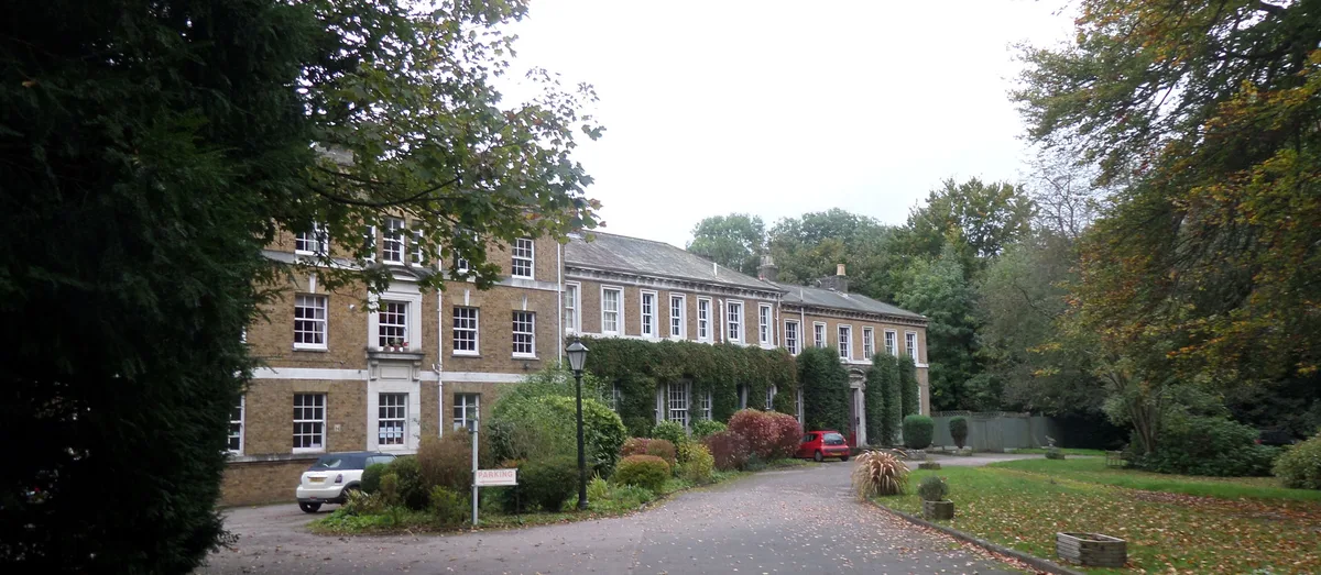
Bricket Wood — village in the county of Hertfordshire, England.

Wikimedia Commons contributors — see linked file page for photographer and licence licence
Plan your visit
- Typical visit
- 3 h–6 h
- Nearest railway station
- Bricket Wood · 0.7 km
- Free entry
- Family-friendly
- Dog-friendly
About
Bricket Wood is a town, city, village or settlement in the United Kingdom. Recent population estimates put it at around 4,095 people. Address: AL2. Wikidata describes it as: "village in the county of Hertfordshire, England". Coordinates: 51.7067°, -0.3686°.
Photo gallery
Protected designations
- Area of Outstanding Natural Beauty: Chilterns
Designations sourced from Natural England open data under OGL v3.
From the Wikipedia article
Bricket Wood is a village in the county of Hertfordshire, England, 4.2 miles (6.8 km) south of St Albans city centre (though in the city's contiguous built-up area) and 4.2 miles (6.8 km) north-northeast of Watford.
Excerpt from Wikipedia under CC BY-SA 4.0. See the source article linked in Sources below.
Background
History
The area of Bricket Wood was mostly occupied by farmers until Bricket Wood railway station was built in 1861. In 1889, brothers Henry Gray and William Gray bought up land in the area and built Woodside Retreat Fairground. The fairground attracted hordes of visitors to the area from London and nearby towns and a small village developed around the station. In 1923, a rival fairground named Joyland was built nearby by R.B Christmas. Both resorts were closed in 1929, and Christmas used his leftover land for building bungalows. During the 1930s, the area became popular with naturists after Charles Macaskie set up the naturist camp Spielplatz on the outskirts of the village. Naturists bought up…
Sourced from Wikipedia under CC BY-SA 4.0.
- Coordinates
- 51.7067, -0.3686
- County
- Hertfordshire
- District
- St Albans
- Parish
- St Stephen
- Postcode
- AL2
- Parliamentary constituency
- St Albans
- Population
- 4,095
- Nearest railway station
- Bricket Wood — 0.7 km
- Official site
- web.archive.org
Sources
- wikidata: Q19886 (CC0)
- wikipedia: Bricket Wood (CC BY-SA 4.0)
- commons: Bricket Wood Common - geograph.org.uk - 71828.jpg (CC BY-SA 4.0)
Other places nearby
Loading nearby places…
Nearby
 📷 5
📷 5Gardens · London
INTEGER Millennium House
INTEGER Millennium House — a garden in england-london, United Kingdom.
 📷 3
📷 3Forests & woodlands · East of England
Spielplatz
Spielplatz (German for playground) is the longest-operating naturist resort in United Kingdom, and consists of 12 acres (4.9 ha) located in the village of Bricket Wood, in the English county of Hertfo
 📷 5
📷 5Quarries · London
Moor Mill Quarry, West
Moor Mill Quarry, West — Site of Special Scientific Interest in Hertfordshire.
 📷 5
📷 5Manor houses · London
Hanstead House
Hanstead House — a manor in england-london, United Kingdom.
 📷 5
📷 5Stately homes · London
High Elms Manor
High Elms Manor — manor house in Abbots Langley, Three Rivers, Hertfordshire, England, UK.
 📷 5
📷 5Parks · London
Garston Park
Garston Park — Watford suburb recreation.
More towns in this region
 Flagship📷 10
Towns & cities · London
Aldenham
Aldenham — village and civil parish in Hertfordshire, England.
 Flagship📷 10
Towns & cities · London
Ashdon
Ashdon — village and civil parish in Essex, UK.
 Flagship📷 10
Towns & cities · London
Betchworth
Betchworth — village and civil parish in the Mole Valley district of Surrey, England.
 Flagship📷 10
Towns & cities · London
Boxley
Boxley — village and civil parish in Maidstone District, Kent, England, UK.
Frequently asked questions
- Where is Bricket Wood?
- Bricket Wood is in Hertfordshire, London, United Kingdom (postcode AL2), in the parish of St Stephen.
- Is Bricket Wood a protected site?
- Yes — Bricket Wood is part of the Chilterns National Landscape (AONB).
- Is Bricket Wood free to visit?
- Yes, Bricket Wood is free to enter.
- How do I get to Bricket Wood?
- The nearest railway station is Bricket Wood, about 0.7 km away. Drivers can navigate to postcode AL2.