Stately homes · Scottish Highlands
Montgreenan
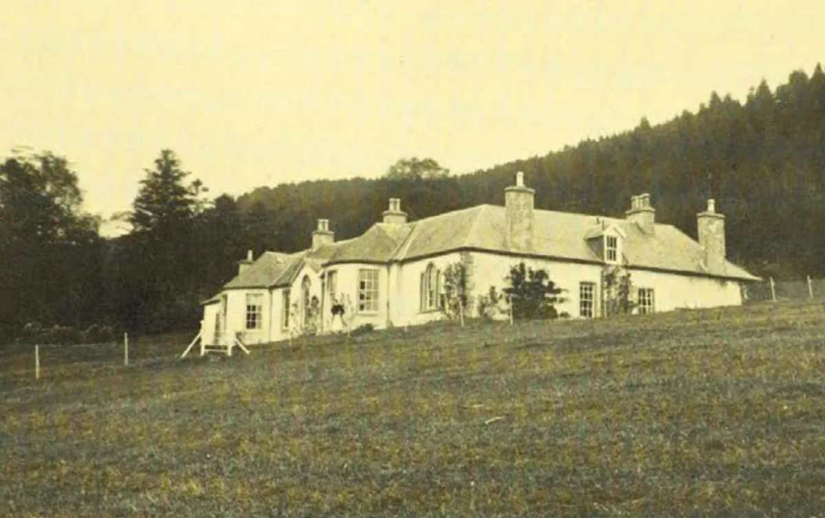
Montgreenan — manor house in North Ayrshire, Scotland, UK.

Wikimedia Commons contributors — see linked file page for photographer and licence licence
Plan your visit
- Typical visit
- 2 h–4 h
- Nearest railway station
- Kilwinning · 4.8 km
- Family-friendly
- Limited wheelchair access
About
Montgreenan is a stately home in the United Kingdom. Heritage designation: category A listed building. Owned by Robert Glasgow. Wikidata describes it as: "manor house in North Ayrshire, Scotland, UK". Coordinates: 55.6658°, -4.6356°.
Photo gallery
Heritage listing
Montgreenan is an estate in North Ayrshire, Parish of Kilwinning, Scotland. The Lugton Water runs through the policies and farmland of Montgreenan. Nearby are the hamlets of Torranyard and Auchentiber.
From Historic Environment Scotland under OGL v3.
From the Wikipedia article
Montgreenan is an estate in North Ayrshire, Parish of Kilwinning, Scotland. The Lugton Water runs through the policies and farmland of Montgreenan. Nearby are the hamlets of Torranyard and Auchentiber.
Excerpt from Wikipedia under CC BY-SA 4.0. See the source article linked in Sources below.
Background
Description
The name 'Grenane' is recorded in 1480, however the first detailed reference to Montgreenan is contained in the description of the ancient county of Cuninghame by Timothy Pont in the period 1604–1608. In it he describes 'Mongrynen Castle' as "…ane old strong Dunijon veil and pleasantly planted ye inheritance of Cuninghame Laird thereof sone to the abott of Kilwinin quho wes brother to James Earle of Glencairne". The 10 merk land of Montgreenan was held in the 15th century by the Ross family, who had many lands in Ayrshire, such as those of Dunlop and its castle. The Rosses held their lands as vassals of the De Morvilles. {|style="float:left; margin:1em 1em 1em 1em; width:27em; border: 1px…
Sourced from Wikipedia under CC BY-SA 4.0.
- Coordinates
- 55.6658, -4.6356
- District
- North Ayrshire
- Postcode
- KA13 7QZ
- Parliamentary constituency
- Central Ayrshire
- Nearest railway station
- Kilwinning — 4.8 km
Sources
- wikidata: Q6905852 (CC0)
- wikipedia: Montgreenan (CC BY-SA 4.0)
- commons: Montgreenan House, Kilwinning.jpg (CC BY-SA 4.0)
Other places nearby
Loading nearby places…
Nearby
Caravan parks · Scottish Highlands
Viewfield Manor Leisure Park
Viewfield Manor Leisure Park — a caravan park in scotland highlands.
Caravan parks · Scottish Highlands
Arran Hills
Arran Hills — a caravan park in scotland highlands.
 📷 5
📷 5Historic houses · Scottish Highlands
Monkredding House
Monkredding House — house in Kilwinning, North Ayrshire, Scotland, UK.
 📷 3
📷 3Wildlife reserves · Central Scotland
Irvine New Town Trail
The Irvine New Town Trail is a recreational cycleway and footpath around Irvine, North Ayrshire, Scotland. The route is 19 kilometres (12 mi) long. The trail is used by many dog walkers and cyclists i
 📷 3
📷 3Historic houses · Scottish Highlands
Annick Lodge
Annick Lodge — estate house in North Ayrshire, Scotland, UK.
 📷 5
📷 5Historic bridges · Scottish Highlands
Eglinton Tournament Bridge
Eglinton Tournament Bridge — category B listed building-listed bridge in scotland-highlands, United Kingdom.
More places in this region
 📷 3
📷 3Stately homes · Scottish Highlands
Balinakill House
Balinakill House — architectural structure in Argyll and Bute, Scotland, UK.
 📷 3
📷 3Stately homes · Scottish Highlands
Boleskine House
Boleskine House — Manor on the south-east side of Loch Ness in the Scottish Highlands.
 📷 3
📷 3Stately homes · Scottish Highlands
Culbin House
Culbin House — former Scottish manor house.
 Flagship📷 4
Stately homes · Scottish Highlands
Dirnanean House
Dirnanean House — manor house in Perth and Kinross, Scotland, UK.
Frequently asked questions
- Where is Montgreenan?
- Montgreenan is in the Scottish Highlands, United Kingdom (postcode KA13 7QZ).
- Who owns Montgreenan?
- Montgreenan is owned by Robert Glasgow.
- Is Montgreenan a listed building?
- Montgreenan is officially recognised as category A listed building listed.
- How do I get to Montgreenan?
- The nearest railway station is Kilwinning, about 4.8 km away. Drivers can navigate to postcode KA13 7QZ.