Mountains & hills · North Wales
Moel Sych
Moel Sych — Named summit at 827 m.

Wikimedia Commons contributors — see linked file page for photographer and licence licence
Plan your visit
- Typical visit
- 3 h–8 h
- Best time of year
- Late spring – early autumn (May–Oct)
- Free entry
- Dog-friendly
About
Moel Sych is a named summit in the United Kingdom. Wikidata describes it as: "Named summit at 827 m.". Coordinates: 52.8761°, -3.3888°.
Photo gallery
From the Wikipedia article
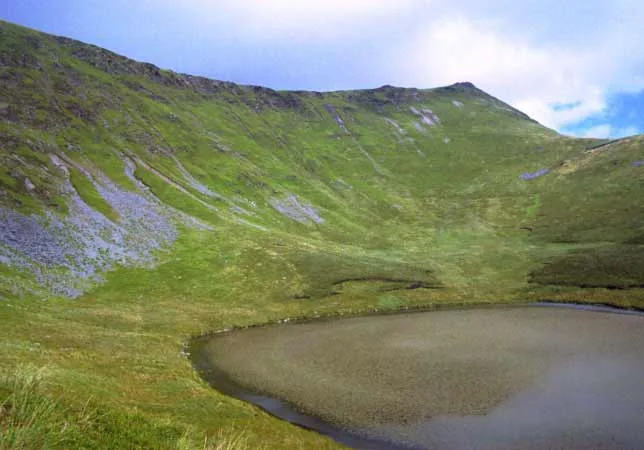
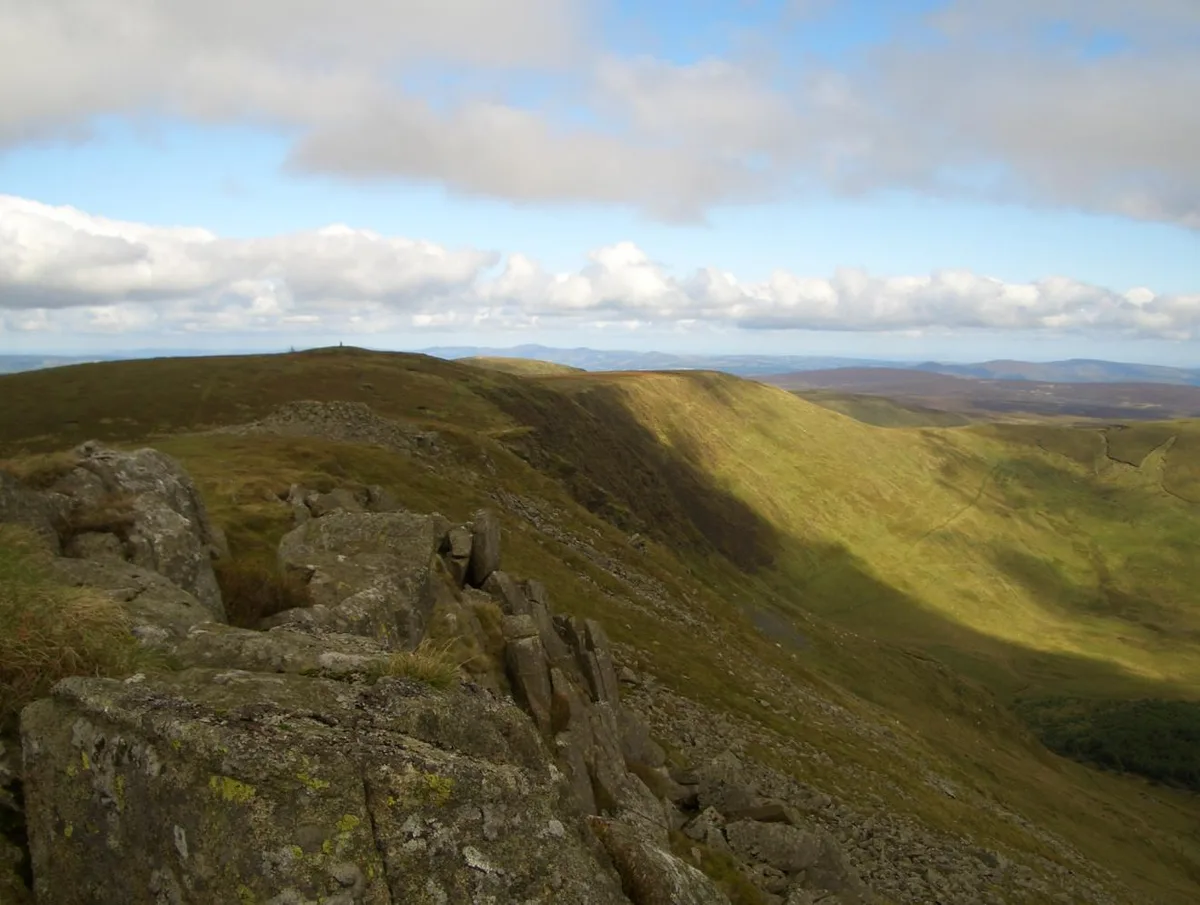
Moel Sych (pronounced [mɔi̯l sɨːχ]) with a height of 826.7 metres (2,712 ft) is a subsidiary summit of Cadair Berwyn in north east Wales. It is the third highest summit in the Berwyn range after Cadair Berwyn and Cadair Berwyn North Top. The summit lies at the triple historic county boundary point of Montgomeryshire, Denbighshire and Merionethshire. It is the highest point (historic county top) of Montgomeryshire. The summit was often considered to be the highest summit in the Berwyns (and therefore the county top of Denbighshire as well as Montgomeryshire) until the Cadair Berwyn North Top, then known as Cadair Berwyn was found to be of the same height. Later on the OS discovered a new top in between the two, which was 5m higher at 832m. This top, now known as Cadair Berwyn, is listed as Cadair Berwyn New Top on the Nuttall list. The summit has a cairn, and overlooks Llyn Lluncaws in the southern Cwm.
Excerpt from Wikipedia under CC BY-SA 4.0. See the source article linked in Sources below.
- Coordinates
- 52.8761, -3.3888
- Address
- Denbighshire / Powys, Wales
Sources
- osm: n2161110203 (ODbL)
- wikipedia: Moel Sych (CC BY-SA 4.0)
- commons: Moel Sych.jpg (CC BY-SA 4.0)
Other places nearby
Loading nearby places…
Nearby
 📷 4
📷 4Mountains & hills · North Wales
Cyrniau Nod
Cyrniau Nod — a mountain in wales-north, United Kingdom, 667 m.
 📷 3
📷 3Mountains & hills · North Wales
Cadair Berwyn
Cadair Berwyn — Named summit at 832 m.
 📷 3
📷 3Natural landmarks · North Wales
Cadair Berwyn
Cadair Berwyn — mountain (832m) in Powys.
 📷 3
📷 3Mountains & hills · North Wales
Cadair Berwyn North Top
Cadair Berwyn North Top — Named summit at 827 m.
 📷 3
📷 3Mountains & hills · North Wales
Moel yr Ewig
Moel yr Ewig — a mountain in wales-north, United Kingdom, 695 m.
 📷 3
📷 3Mountains & hills · North Wales
Craig Berwyn
Craig Berwyn — a mountain in wales-north, United Kingdom, 790 m.
More mountains in this region
 📷 5
📷 5Mountains & hills · North Wales
Cemlyn Bay and lagoon
Cemlyn Bay and lagoon — Site of Special Scientific Interest in Wales.
 📷 3
📷 3Mountains & hills · North Wales
Aberffraw Bay
Aberffraw Bay — bay on the west coast of Anglesey, in Wales, UK.
 📷 3
📷 3Mountains & hills · North Wales
Allt-fawr
Allt-fawr — Named summit at 698 m.
 📷 3
📷 3Mountains & hills · North Wales
Aran Benllyn
Aran Benllyn — Named summit at 884 m.
Frequently asked questions
- Where is Moel Sych?
- Moel Sych is in North Wales, in the United Kingdom — coordinates 52.8761°, -3.3888°.
- Is Moel Sych free to visit?
- Yes — admission to Moel Sych is free.