Mountains & hills · Scottish Highlands
Meall Mhèinnidh
Meall Mhèinnidh — Named summit at 722 m.

Wikimedia Commons contributors — see linked file page for photographer and licence licence
Plan your visit
- Typical visit
- 3 h–8 h
- Best time of year
- Late spring – early autumn (May–Oct)
- Free entry
- Dog-friendly
About
Meall Mhèinnidh is a named summit in the United Kingdom. Wikidata describes it as: "Named summit at 722 m.". Coordinates: 57.7166°, -5.4352°.
Photo gallery
From the Wikipedia article
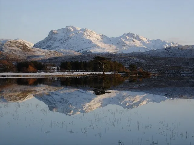
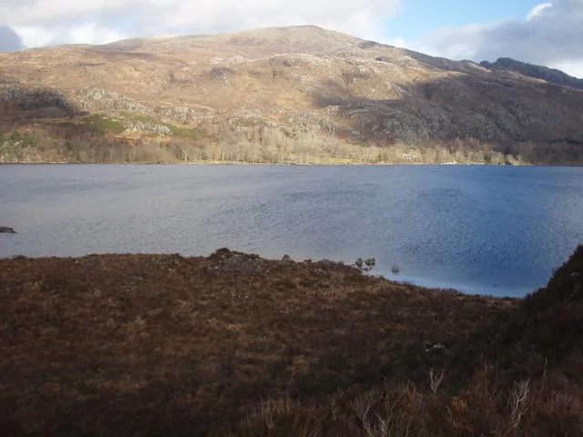
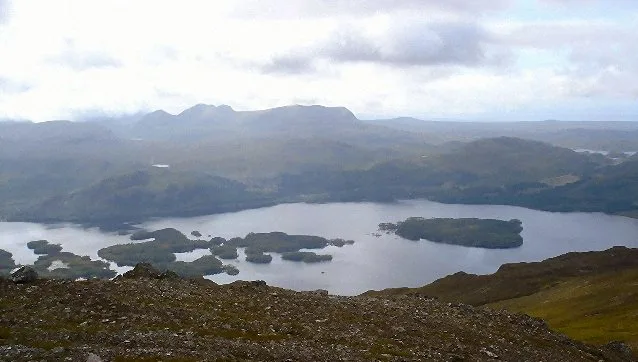
Meall Mheinnidh (722 m) is a mountain in the Northwest Highlands of Scotland. It lies in the Wester Ross region, north of Loch Maree. A very remote peak, it is characterised by its very steep northern face, like its neighbours Beinn Lair and Beinn Airigh Charr. The nearest village is Poolewe to the west.
Excerpt from Wikipedia under CC BY-SA 4.0. See the source article linked in Sources below.
- Coordinates
- 57.7166, -5.4352
- Address
- Wester Ross, Scotland
- Official site
- www.hill-bagging.co.uk
Sources
- osm: n2700244158 (ODbL)
- wikipedia: Meall Mheinnidh (CC BY-SA 4.0)
- commons: Loch an Doire Crionaich - geograph.org.uk - 1289593.jpg (CC BY-SA 4.0)
Other places nearby
Loading nearby places…
Nearby
 📷 3
📷 3Mountains & hills · Scottish Highlands
Beinn Airigh Charr
Beinn Airigh Charr — Named summit at 791 m.
 📷 3
📷 3Mountains & hills · Scottish Highlands
Beinn Làir
Beinn Làir — Named summit at 859 m.
 Flagship📷 5
Natural landmarks · Scottish Highlands
Loch Maree
Loch Maree — lake in Highland, Scotland, UK, outflows to the River Ewe.
 📷 3
📷 3Mountains & hills · Scottish Highlands
Spidean nan Clach
Spidean nan Clach — a mountain in scotland-highlands, United Kingdom.
 📷 5
📷 5Islands · Scottish Highlands
Isle Maree
Isle Maree — island in Highland, Scotland, UK.
 📷 3
📷 3Mountains & hills · Scottish Highlands
Beinn Tharsuinn Chaol
Beinn Tharsuinn Chaol — a mountain in scotland-highlands, United Kingdom.
More mountains in this region
 📷 3
📷 3Mountains & hills · Scottish Highlands
A' Bhuidheanach Bheag
A' Bhuidheanach Bheag — Named summit at 936 m.
 📷 3
📷 3Mountains & hills · Scottish Highlands
A' Chailleach
A' Chailleach — Named summit at 997 m.
 📷 3
📷 3Mountains & hills · Scottish Highlands
A' Chailleach
A' Chailleach — Named summit at 930 m.
 📷 3
📷 3Mountains & hills · Scottish Highlands
A' Chaoirnich
A' Chaoirnich — Named summit at 875 m.
Frequently asked questions
- Where is Meall Mhèinnidh?
- Meall Mhèinnidh is in Scottish Highlands, in the United Kingdom — coordinates 57.7166°, -5.4352°.
- Is Meall Mhèinnidh free to visit?
- Yes — admission to Meall Mhèinnidh is free.