Canals · West Midlands
Manchester Ship Canal
Manchester Ship Canal — UK canal linking Manchester to the coast.

Wikimedia Commons contributors — see linked file page for photographer and licence licence
Plan your visit
- Typical visit
- 1 h–2 h
- Nearest railway station
- Glazebrook · 2.8 km
- Free entry
- Dog-friendly
About
Manchester Ship Canal is a canal in the United Kingdom. Managed by Manchester Ship Canal Company. Wikidata describes it as: "UK canal linking Manchester to the coast". Coordinates: 53.4035°, -2.4624°.
Photo gallery
From the Wikipedia article
The Manchester Ship Canal is a 36-mile-long (58 km) inland waterway in the North West of England linking Manchester to the Irish Sea. Starting at the Mersey Estuary at Eastham, near Ellesmere Port, Cheshire, it generally follows the original routes of the rivers Mersey and Irwell through the historic counties of Cheshire and Lancashire before joining the latter at Salford Quays. Several sets of locks lift vessels about 60 ft (18 m) to the canal's terminus in Manchester. Landmarks along its route include the Barton Swing Aqueduct, the world's only swing aqueduct, and Trafford Park, the world's first planned industrial estate and one of the largest in Europe. The rivers Mersey and Irwell were first made navigable in the early 18th century. Goods were also transported on the Runcorn extension of the Bridgewater Canal (from 1776) and the Liverpool and Manchester Railway (from 1830) but by the late 19th century the Mersey and Irwell Navigation had fallen into disrepair and was often unusable. Manchester's business community viewed the charges imposed by Liverpool's docks and the railway companies as excessive. A ship canal was proposed to give ocean-going vessels direct access to Manchester. The region was suffering from the Long Depression; the canal's proponents argued that the scheme would boost competition and create jobs. They gained public support for the scheme, which was first presented to Parliament as a bill in 1882. Faced with stiff opposition from Liverpool, the canal's supporters were unable to gain the necessary act of Parliament to allow the scheme to go ahead until 1885. Construction took six years, beginning in 1887, and cost just over £15 million (equivalent to £1,705,000,000 in 2025). When the ship canal opened in January 1894 (12 years after the first meeting of the Manchester Ship Canal company) it was the largest river navigation canal in the world and enabled the new Port of Manchester to become Britain's third-busiest port despite being about 40…
Excerpt from Wikipedia under CC BY-SA 4.0. See the source article linked in Sources below.
Background
History
The canal was completed just as the Long Depression was coming to an end, but in its early years it was not the commercial success its sponsors had hoped for. At first gross revenue was less than a quarter of expected net revenue, and throughout at least the first nineteen years of the canal it was unable to make a profit or meet the interest payments to the Corporation of Manchester. Many ship owners were reluctant to dispatch ocean-going vessels along a "locked cul-de-sac" at a maximum speed of 6 knot. The Ship Canal Company, which developed the canal, found it difficult to attract a diversified export trade, which meant that ships frequently had to return down the canal loaded with…
Architecture
Thomas Walker was appointed as a contractor, with Edward Williams as chief engineer and designer and general manager. The 36 mi route was divided into eight sections, with one engineer responsible for each. The first reached from Eastham to Ellesmere Port. Mount Manisty, a large mound of earth on a narrow stretch between the canal and the Mersey northwest of Ellesmere Port, was constructed from soil taken from the excavations. It and the adjacent Manisty Cutting were named after the engineer in charge. The last section built was the passage from Weston Point through the Runcorn Gap to Norton; the existing docks at Runcorn and Weston had to be kept operational until they could be connected…
Visiting
In 1984 Salford City Council used a derelict land grant to purchase the docks at Salford from the Ship Canal Company, rebranding the area as Salford Quays. Principal developers Urban Waterside began redevelopment work the following year, by which time traffic on the canal's upper reaches had declined to such an extent that its owners considered closing it above Runcorn. In 1993 the Ship Canal Company was acquired by Peel Holdings; as of 2014 it is owned and operated by Peel Ports, which also owns the Port of Liverpool. The company announced a £50 billion Atlantic Gateway plan in 2011 to develop the Port of Liverpool and the Manchester Ship Canal as a way of combating increasing road…
Sourced from Wikipedia under CC BY-SA 4.0.
- Coordinates
- 53.4035, -2.4624
- District
- Warrington
- Parish
- Rixton-with-Glazebrook
- Postcode
- WA3 6HA
- Parliamentary constituency
- Warrington North
- Established
- 1893
- Nearest railway station
- Glazebrook — 2.8 km
Sources
- wikidata: Q935570 (CC0)
- wikipedia: Manchester Ship Canal (CC BY-SA 4.0)
- commons: Tanker ship canal.jpg (CC BY-SA 4.0)
Featured in this guide
Other places nearby
Loading nearby places…
Nearby
 📷 3
📷 3Historic bridges · West Midlands
Rixton and Warburton Bridge
Rixton and Warburton Bridge is a historic bridge in the United Kingdom.
 📷 5
📷 5Historic churches · West Midlands
Warburton, Greater Manchester
Warburton, Greater Manchester — a church in england-west-midlands, United Kingdom.
_Bridge_-_geograph.org.uk_-_4952661.jpg?width=1200) 📷 3
📷 3Historic bridges · West Midlands
Warburton High Level Bridge
Warburton High Level Bridge is a historic bridge in the United Kingdom.
Campsites · West Midlands
Holly Bank Caravan Park
Holly Bank Caravan Park — a campsite in england west midlands.
 📷 5
📷 5Wildlife reserves · West Midlands
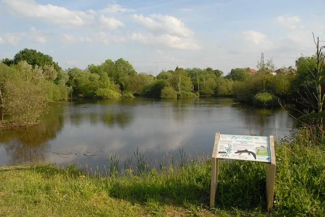
Rixton Clay Pits
Rixton Clay Pits — former clay extraction site in Rixton, England.
 📷 5
📷 5Forests & woodlands · West Midlands
Rixton Claypits Local Nature Reserve
Rixton Claypits Local Nature Reserve is a forest or woodland in the United Kingdom.
More places in this region
 📷 3
📷 3Canals · West Midlands
Anson Branch
Anson Branch — canal in West Midlands, England.
 📷 3
📷 3Canals · West Midlands
Ashton Canal
Ashton Canal — canal in north west England.
 📷 3
📷 3Canals · West Midlands
Aylesbury Canal Arm
Aylesbury Canal Arm — canal in the United Kingdom.
 📷 4
📷 4Canals · West Midlands
BCN Main Line
BCN Main Line — Canal in and around Birmingham , England.
Frequently asked questions
- Where is Manchester Ship Canal?
- Manchester Ship Canal is in the West Midlands, United Kingdom (postcode WA3 6HA), in the parish of Rixton-with-Glazebrook.
- When was Manchester Ship Canal built?
- Built or established in 1893.
- Who runs Manchester Ship Canal?
- Manchester Ship Canal is operated by Manchester Ship Canal Company.
- Is Manchester Ship Canal free to visit?
- Yes, Manchester Ship Canal is free to enter.
- How do I get to Manchester Ship Canal?
- The nearest railway station is Glazebrook, about 2.8 km away. Drivers can navigate to postcode WA3 6HA.