Mountains & hills · South East England
Man of War Bay
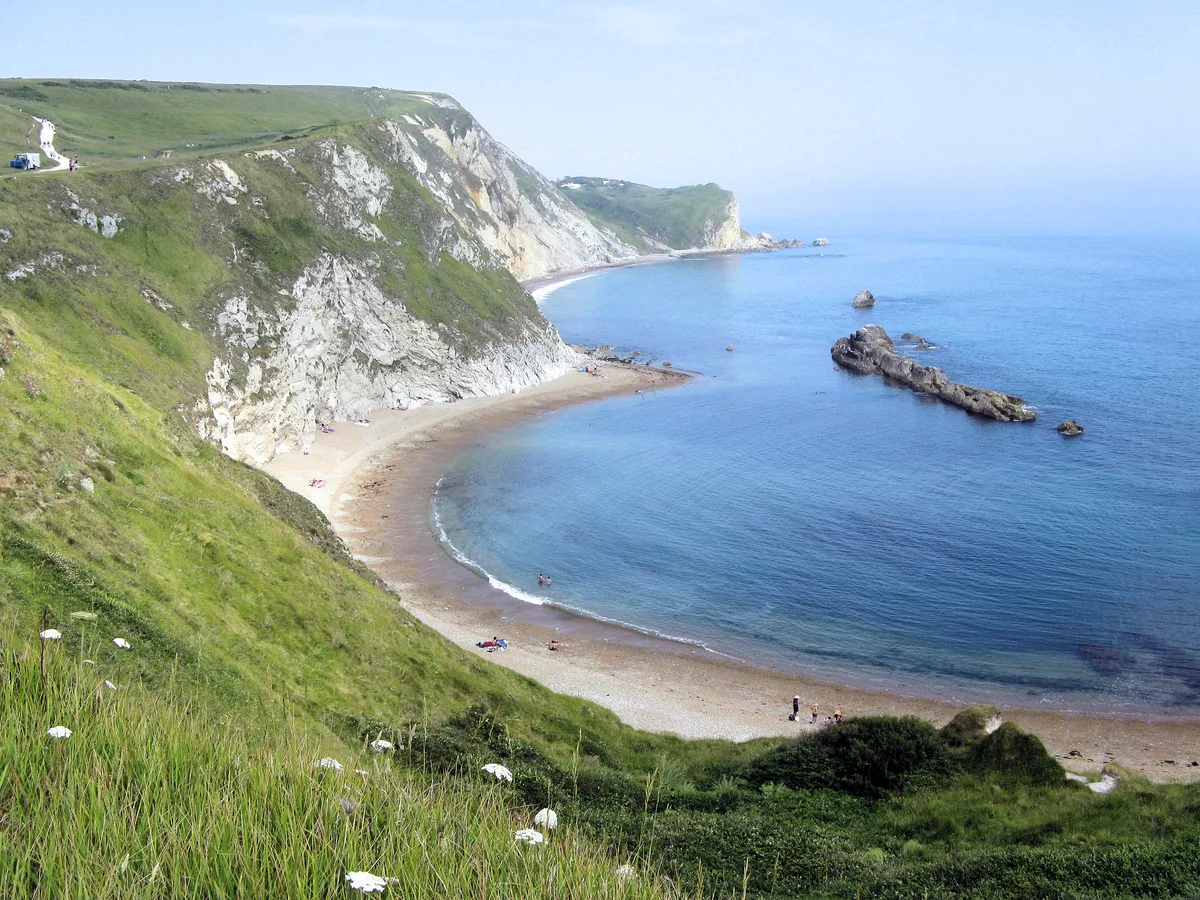
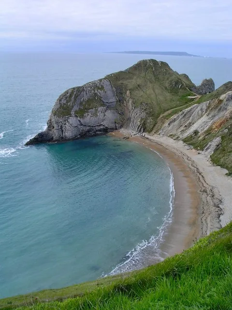
Man of War Bay — bay on the Dorset coast in southern England.

Wikimedia Commons contributors — see linked file page for photographer and licence licence
Plan your visit
- Typical visit
- 3 h–8 h
- Best time of year
- Late spring – early autumn (May–Oct)
- Nearest railway station
- Wool · 7.6 km
- Free entry
- Dog-friendly
About
Man of War Bay is a named summit in the United Kingdom. Part of English Channel. Wikidata describes it as: "bay on the Dorset coast in southern England". Coordinates: 50.6204°, -2.2703°.
Photo gallery
Protected designations
- Site of Special Scientific Interest: South Dorset Coast SSSI
- Area of Outstanding Natural Beauty: Dorset
Designations sourced from Natural England open data under OGL v3.
From the Wikipedia article
Man o' War Cove (or Man of War Bay and similar names) lies on the Dorset coast in southern England and is flanked by the rocky, steep and slightly projecting headlands of Durdle Door to the west and Man O War (or O' War) Head to the east. Its name is believed to be a corruption of the Brythonic 'Men-an-Vawr' (The Great Rock)
Excerpt from Wikipedia under CC BY-SA 4.0. See the source article linked in Sources below.
Background
Description
A line of pronounced rocks takes up the far side of the cove at the distance of the great Durdle Door headland to the east; these partially enclose the cove, and have few submerged components and feature mostly at the east end of the bay map-recorded as "The Man o' War". The line of exposed rocks continues, very intermittently about 100 metres (110 yards) from the shore as the Norman Rock, Pinion Rock and a cluster around the Ball Stone, along St Oswald's Bay. It is usually possible to walk along a thin strand of high tide, dry sand linking the cove to the rest of St Oswald's Bay an area almost entirely visible from the west side of the cove.
Visiting
There is a paid car park available 300 metres (330 yards) away from the cove. It is also connected to the South West Coast Path, so it is possible to park elsewhere along the trail and access the cove by foot.
Sourced from Wikipedia under CC BY-SA 4.0.
- Coordinates
- 50.6204, -2.2703
- District
- Dorset
- Parish
- West Lulworth
- Postcode
- BH20 5PU
- Parliamentary constituency
- South Dorset
- Nearest railway station
- Wool — 7.6 km
Sources
- wikidata: Q6746416 (CC0)
- wikipedia: Man o' War Cove (CC BY-SA 4.0)
- commons: Man O War Bay.JPG (CC BY-SA 4.0)
Other places nearby
Loading nearby places…
Nearby
 📷 5
📷 5Mountains & hills · South East England
St Oswald's Bay
St Oswald's Bay — bay in Dorset, United Kingdom.
 📷 5
📷 5Beaches · South East England
Man O'War Beach
Man O'War Beach — beach in the United Kingdom.
 📷 5
📷 5Beaches · South East England
Man O' War Cove
Man O' War Cove is a beach in the United Kingdom.
 📷 5
📷 5Mountains & hills · South East England
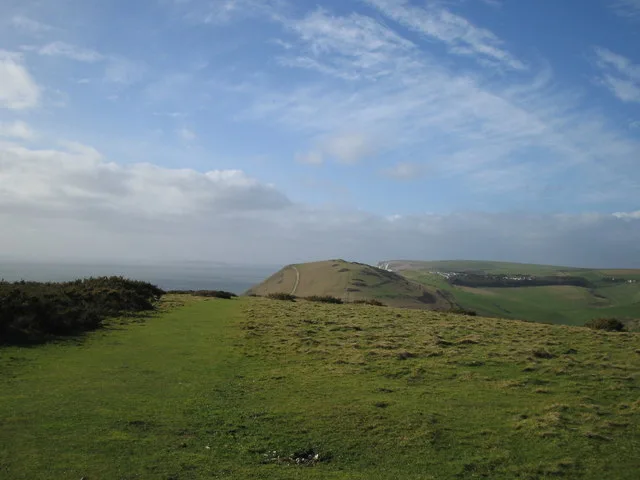
Hambury Tout
Hambury Tout — Named summit at 138 m.
Caravan parks · South East England
Durdle Door Holiday Park
Durdle Door Holiday Park — a caravan park in england south east.
 📷 5
📷 5Beaches · South East England
Durdle Door
Durdle Door — Beach (pebblestone).
More mountains in this region
 📷 5
📷 5Mountains & hills · South East England
Alum Bay
Alum Bay is a mountain or hill in the United Kingdom.
 📷 5
📷 5Mountains & hills · South East England
Arish Mell
Arish Mell — bay in Dorset, England.
 📷 5
📷 5Mountains & hills · South East England
Balaclava Bay
Balaclava Bay — bay in Dorset, England.
 📷 5
📷 5Mountains & hills · South East England
Balch Cave
Balch Cave — Cave in Somerset, England.
Frequently asked questions
- Where is Man of War Bay?
- Man of War Bay is in South-East England, United Kingdom (postcode BH20 5PU), in the parish of West Lulworth.
- Is Man of War Bay a protected site?
- Yes — Man of War Bay is part of the South Dorset Coast SSSI Site of Special Scientific Interest and the Dorset National Landscape (AONB).
- Is Man of War Bay free to visit?
- Yes, Man of War Bay is free to enter.
- How do I get to Man of War Bay?
- The nearest railway station is Wool, about 7.6 km away. Drivers can navigate to postcode BH20 5PU.