Archaeological sites · Scottish Lowlands
Maiden Way Roman road from B6318 to 450m SW of High House, Gillalees Beacon signal station and Beacon Pasture early post-medieval dispersed settlement
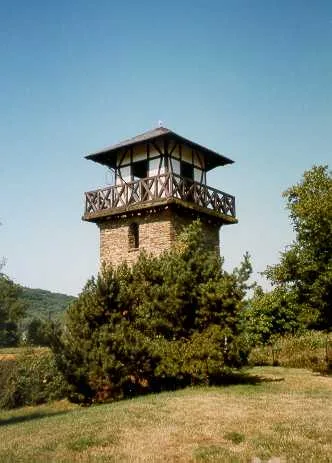
Maiden Way Roman road from B6318 to 450m SW of High House, Gillalees Beacon signal station and Beacon Pasture early post-medieval dispersed settlement — archaeological site in Kingwater, Carlisle, England, UK.

Karl and Ali — CC BY-SA 2.0 via Wikimedia Commons licence
Plan your visit
- Typical visit
- 45 min–1.5 h
- Free entry
- Dog-friendly
About
Maiden Way Roman road from B6318 to 450m SW of High House, Gillalees Beacon signal station and Beacon Pasture early post-medieval dispersed settlement is an archaeological site in the United Kingdom. It covers approximately 15 km². Heritage designation: scheduled monument. Part of borders of the Roman Empire. Wikidata describes it as: "archaeological site in Kingwater, Carlisle, England, UK". Coordinates: 55.0201°, -2.6382°.
Photo gallery
Protected designations
- Site of Special Scientific Interest: Kielder Mires SSSI
- Site of Special Scientific Interest: River Eden and Tributaries SSSI
Designations sourced from Natural England open data under OGL v3.
Place summary
Maiden Way is an archaeological site located in the Scottish Lowlands, within the parish of Kingwater. This scheduled monument features a Roman road extending from B6318 and includes the Gillalees Beacon signal station and an early post-medieval dispersed settlement at Beacon Pasture. It is part of the Kielder Mires and River Eden and Tributaries Sites of Special Scientific Interest (SSSI).
AI-generated from the structured facts on this page (operator, designation, listing, era). Not a substitute for visiting.
- Coordinates
- 55.0201, -2.6382
- District
- Cumberland
- Parish
- Kingwater
- Postcode
- CA8 2ES
- Parliamentary constituency
- Carlisle
Sources
- wikidata: Q17671722 (CC0)
Other places nearby
Loading nearby places…
Nearby
 📷 3
📷 3Archaeological sites · Scottish Lowlands
Blue Streak Rocket Engine Test Site
Blue Streak Rocket Engine Test Site — a archaeological in scotland-lowlands, United Kingdom.
 📷 5
📷 5Other places · North East England
RAF Spadeadam
RAF Spadeadam in England North East, United Kingdom.
 📷 4
📷 4Historic pubs · North East England
Kingwater
Kingwater in England North East, United Kingdom.
 📷 4
📷 4Castles · North East England
Triermain Castle
Triermain Castle in England North East, United Kingdom.
 📷 3
📷 3Historic houses · Scottish Lowlands
Slack House Organic Farm
Slack House Organic Farm — a other in scotland-lowlands, United Kingdom.
 Flagship📷 3
UNESCO World Heritage · Scottish Lowlands
borders of the Roman Empire
borders of the Roman Empire — world heritage site (limes in Germany and UK).
More archaeological sites in this region
 📷 3
📷 3Archaeological sites · Scottish Lowlands
Barcombe Hill Roman signal station
Barcombe Hill Roman signal station — archaeological site in Bardon Mill, Northumberland, England, UK.
 📷 3
📷 3Archaeological sites · Scottish Lowlands
Bibra Roman Fort
Bibra Roman Fort — archaeological site in Holme St Cuthbert, Cumberland, Cumbria , England, UK.
 📷 3
📷 3Archaeological sites · Scottish Lowlands
Birdoswald Roman fort and the section of Hadrian's Wall and vallum between the River Irthing and the field boundaries east of milecastle 50
Birdoswald Roman fort and the section of Hadrian's Wall and vallum between the River Irthing and the field boundaries east of milecastle 50 — archaeological site in Waterhead, Carlisle, England, UK.
 📷 3
📷 3Archaeological sites · Scottish Lowlands
Boomby Lane 1 and 2 Roman temporary camps
Boomby Lane 1 and 2 Roman temporary camps — archaeological site in Beaumont, Carlisle, England, UK.
Frequently asked questions
- Where is Maiden Way Roman road from B6318 to 450m SW of High House, Gillalees Beacon signal station and Beacon Pasture early post-medieval dispersed settlement?
- Maiden Way Roman road from B6318 to 450m SW of High House, Gillalees Beacon signal station and Beacon Pasture early post-medieval dispersed settlement is in the Scottish Lowlands, United Kingdom (postcode CA8 2ES), in the parish of Kingwater.
- Is Maiden Way Roman road from B6318 to 450m SW of High House, Gillalees Beacon signal station and Beacon Pasture early post-medieval dispersed settlement a listed building?
- Maiden Way Roman road from B6318 to 450m SW of High House, Gillalees Beacon signal station and Beacon Pasture early post-medieval dispersed settlement is officially recognised as scheduled monument listed.
- Is Maiden Way Roman road from B6318 to 450m SW of High House, Gillalees Beacon signal station and Beacon Pasture early post-medieval dispersed settlement a protected site?
- Yes — Maiden Way Roman road from B6318 to 450m SW of High House, Gillalees Beacon signal station and Beacon Pasture early post-medieval dispersed settlement is part of the Kielder Mires SSSI Site of Special Scientific Interest and the River Eden and Tributaries SSSI Site of Special Scientific Interest.
- How do I get to Maiden Way Roman road from B6318 to 450m SW of High House, Gillalees Beacon signal station and Beacon Pasture early post-medieval dispersed settlement?
- Drivers can navigate to postcode CA8 2ES. It sits within the Carlisle parliamentary constituency.