Hill forts · South West England
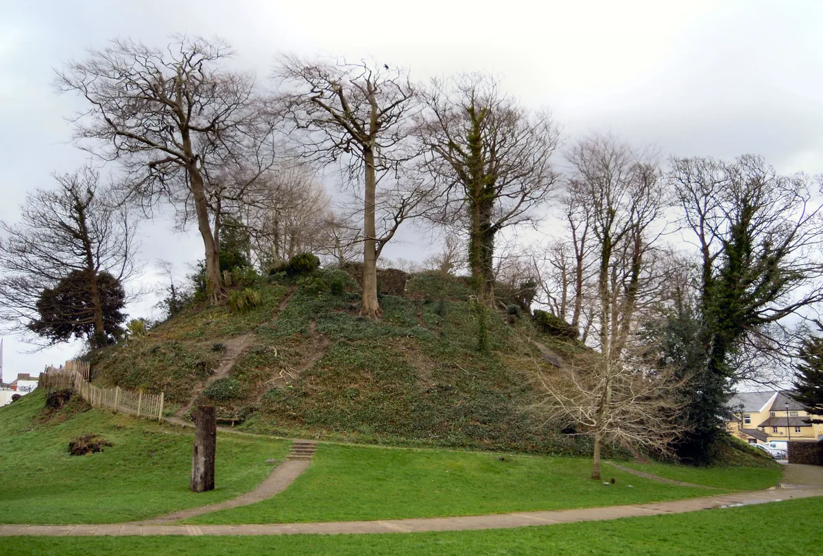
Maes Knoll Camp
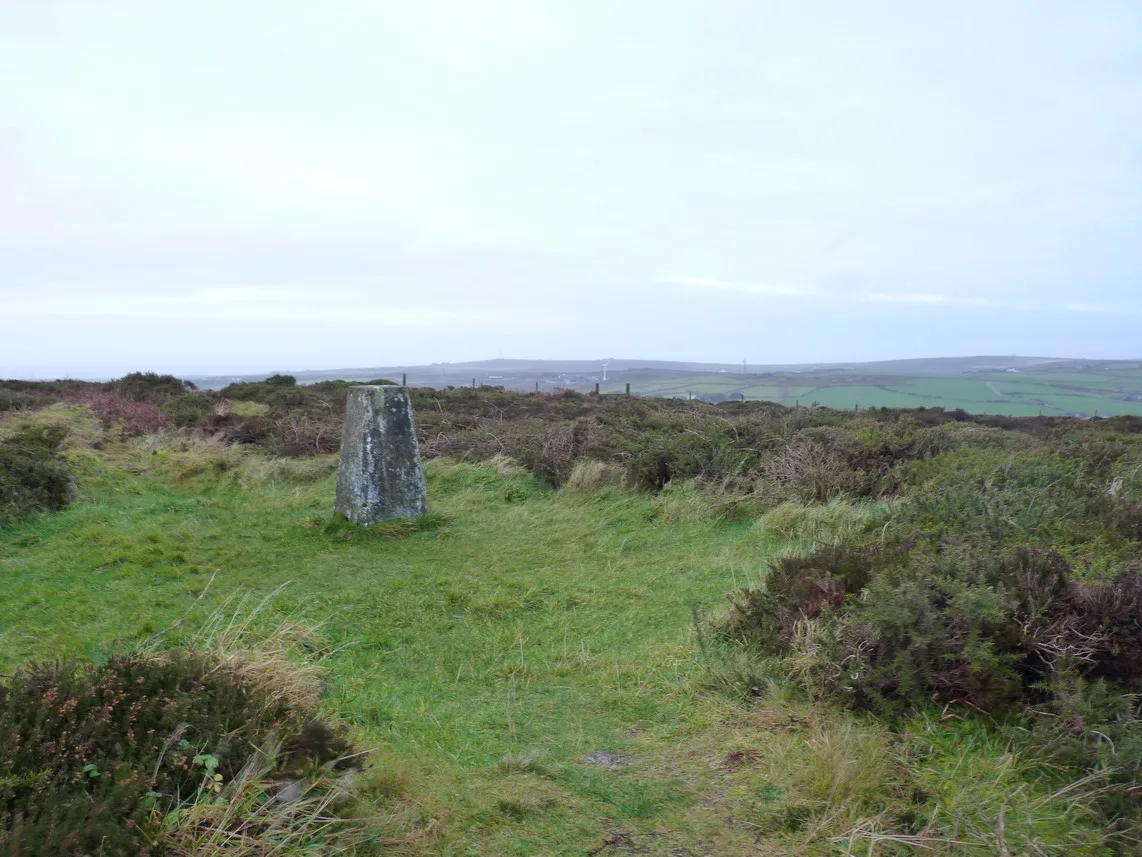
Maes Knoll Camp — hillfort in Bath and North East Somerset, England, UK.

Wikimedia Commons contributors — see linked file page for photographer and licence licence
Plan your visit
- Typical visit
- 1 h–2 h
- Nearest railway station
- Parson Street · 5.1 km
- Free entry
- Dog-friendly
About
Maes Knoll Camp is a hill fort in the United Kingdom. Heritage designation: scheduled monument. Wikidata describes it as: "hillfort in Bath and North East Somerset, England, UK". Coordinates: 51.3918°, -2.5762°.
Photo gallery
Protected designations
- Site of Special Scientific Interest: Severn Estuary SSSI
Designations sourced from Natural England open data under OGL v3.
From the Wikipedia article
Maes Knoll (sometimes Maes tump or Maes Knoll tump) is an Iron Age hill fort in Somerset, England, located at the eastern end of the Dundry Down ridge, south of the city of Bristol and north of the village of Norton Malreward near the eastern side of Dundry Hill. It is a Scheduled Ancient Monument.
Excerpt from Wikipedia under CC BY-SA 4.0. See the source article linked in Sources below.
Background
History
Hill forts developed in the Late Bronze and Early Iron Age, roughly the start of the first millennium BC. The reason for their emergence in Britain, and their purpose, has been a subject of debate. It has been argued that they could have been military sites constructed in response to invasion from continental Europe, sites built by invaders, or a military reaction to social tensions caused by an increasing population and consequent pressure on agriculture. The dominant view since the 1960s has been that the increasing use of iron led to social changes in Britain. Deposits of iron ore were distant from the tin and copper ore necessary to make bronze, so that trading patterns shifted and the…
Description
The hill fort, which is approximately 390 x, and 45 ft in height, covering 20 acre, consists of a fairly large flat open area, roughly triangular in shape, that has been fortified by ramparts and shaping of the steep-sided hilltop around the northern, eastern and southwestern sides of the hill. It rises to an altitude of 197 m above sea level, and provides views over the lands it would have once commanded. From here, there are clear views north to Bristol, east to Bath and the Cotswold Hills, and south over Stanton Drew stone circles to Chew Valley Lake and the Mendip Hills. The underlying rocks are Inferior Oolite of the Jurassic period.
Sourced from Wikipedia under CC BY-SA 4.0.
- Coordinates
- 51.3918, -2.5762
- District
- Bath and North East Somerset
- Parish
- Norton Malreward
- Postcode
- BS39 4EY
- Parliamentary constituency
- North East Somerset and Hanham
- Nearest railway station
- Parson Street — 5.1 km
- Official site
- en.wikipedia.org
Sources
- wikidata: Q6729282 (CC0)
- wikipedia: Maes Knoll (CC BY-SA 4.0)
- commons: Maes Knoll Tump.jpg (CC BY-SA 4.0)
Other places nearby
Loading nearby places…
Nearby
 📷 3
📷 3Archaeological sites · South West England
Maes Knoll
Maes Knoll — a archaeological in england-south-west, United Kingdom.
 📷 5
📷 5Historic churches · South West England
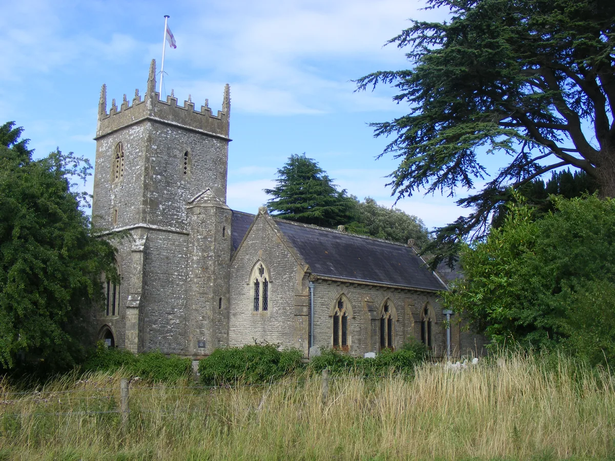
Holy Trinity Church, Norton Malreward
Holy Trinity Church, Norton Malreward — grade II listed church in Norton Malreward, Bath and North East Somerset, Somerset, England, UK.
 📷 3
📷 3Farms (open to visitors) · South West England
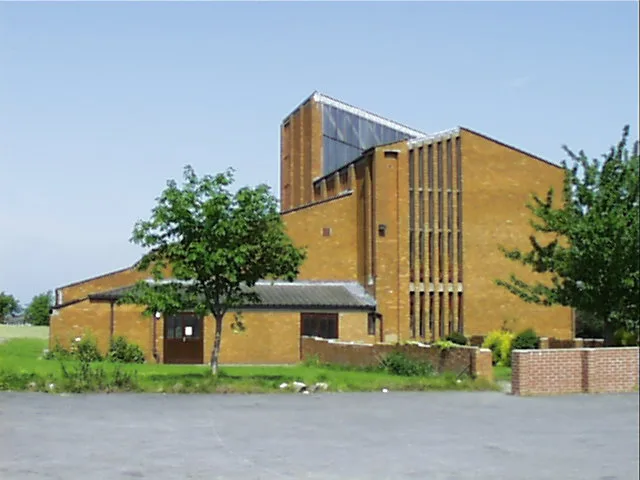
Hartcliffe City Farm
Hartcliffe City Farm — a other in england-south-west, United Kingdom.
 📷 3
📷 3Historic churches · South West England
St. Augustine's Church, Whitchurch, Bristol
St. Augustine's Church, Whitchurch, Bristol — church building in Bristol, United Kingdom.
 📷 3
📷 3Cemeteries · South West England
Whitchurch Cemetery
Whitchurch Cemetery is a cemetery in the United Kingdom.
 📷 5
📷 5Historic churches · South West England
Whitchurch, Bristol
Whitchurch, Bristol — a church in england-south-west, United Kingdom.
More places in this region
 📷 5
📷 5Hill forts · South West England
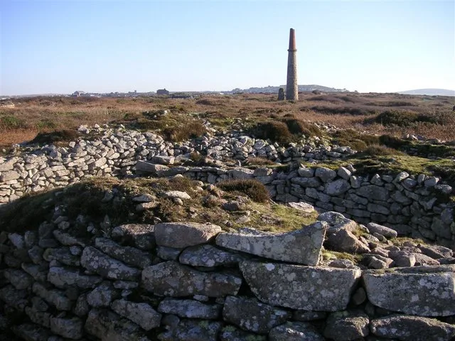
Ballowall Barrow
Ballowall Barrow — archaeological site in St Just, Cornwall, England, UK.
 📷 5
📷 5Hill forts · South West England
Barnstaple Castle
Barnstaple Castle — castle in Devon, England, UK.
 📷 5
📷 5Hill forts · South West England
Bartinney Castle
Bartinney Castle — Iron Age enclosure in Cornwall, England, UK.
 📷 5
📷 5Hill forts · South West England
Berry's Wood
Berry's Wood — iron Age hill fort in south Devon, England, UK.
Frequently asked questions
- Where is Maes Knoll Camp?
- Maes Knoll Camp is in South-West England, United Kingdom (postcode BS39 4EY), in the parish of Norton Malreward.
- Is Maes Knoll Camp a listed building?
- Maes Knoll Camp is officially recognised as scheduled monument listed.
- Is Maes Knoll Camp a protected site?
- Yes — Maes Knoll Camp is part of the Severn Estuary SSSI Site of Special Scientific Interest.
- Is Maes Knoll Camp free to visit?
- Yes, Maes Knoll Camp is free to enter.
- How do I get to Maes Knoll Camp?
- The nearest railway station is Parson Street, about 5.1 km away. Drivers can navigate to postcode BS39 4EY.