Islands · Scottish Highlands
Luing
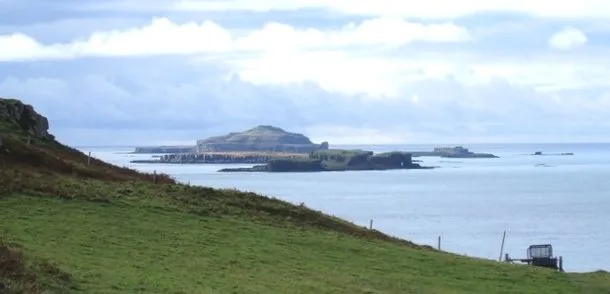
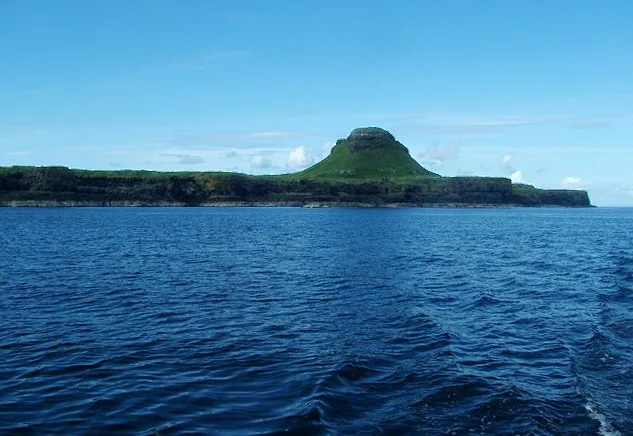
Luing — one of the Slate Islands, Firth of Lorn, in the west of Argyll in Scotland.

Wikimedia Commons contributors — see linked file page for photographer and licence licence
Plan your visit
- Typical visit
- 4 h–12 h
- Free entry
- Dog-friendly
About
Luing is a island in the United Kingdom. It covers approximately 1,400 km². Recent population estimates put it at around 195 people. Part of Slate Islands. Wikidata describes it as: "one of the Slate Islands, Firth of Lorn, in the west of Argyll in Scotland". Coordinates: 56.2292°, -5.6456°.
Photo gallery
From the Wikipedia article
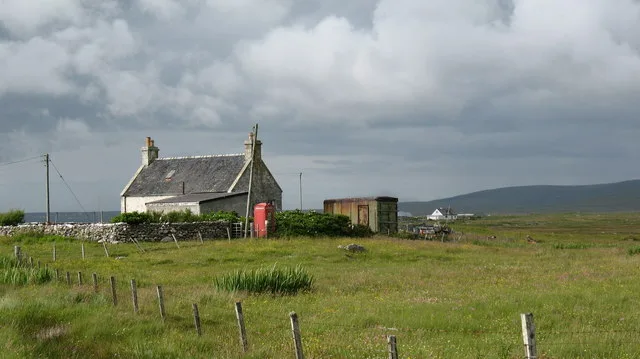
Luing ( LING; Scottish Gaelic: Luinn) is one of the Slate Islands, Firth of Lorn, in the west of Argyll in Scotland, about 16 miles (26 km) south of Oban. The island has an area of 1,430 hectares (3,500 acres) and is bounded by several small skerries and islets. It has a population of around 200 people, mostly living in Cullipool, Toberonochy (Tobar Dhonnchaidh), and Blackmillbay.
Excerpt from Wikipedia under CC BY-SA 4.0. See the source article linked in Sources below.
Background
History
In the early part of the Christian era Luing would have formed part of the Gaelic kingdom of Dalriada. From the 9th to 13th centuries almost all of the Hebrides came under the control of Norse settlers and formed part of the Kingdom of the Isles. However, when Edgar of Scotland signed a treaty with Magnus Barefoot in 1098, formally acknowledged the existing situation by giving up Scottish claims to the Hebrides and Kintyre, Luing and Lismore were retained by the Scots. The graveyard at the ruined church of Kilchattan documents the lives of past islanders, with quarriers, sailors and crofters side by side. Gravestones of note include those of Covenanter Alexander Campbell.
Sourced from Wikipedia under CC BY-SA 4.0.
- Coordinates
- 56.2292, -5.6456
- District
- Argyll and Bute
- Postcode
- PA34 4TY
- Parliamentary constituency
- Argyll, Bute and South Lochaber
- Population
- 195
Sources
- wikidata: Q1759502 (CC0)
- wikipedia: Luing (CC BY-SA 4.0)
- commons: Luing Ferry.jpg (CC BY-SA 4.0)
Other places nearby
Loading nearby places…
Nearby
 📷 5
📷 5Watermills · Scottish Highlands
Achafolla Mill, Luing
Achafolla Mill, Luing — category C listed building-listed watermill in scotland-highlands, United Kingdom.
 📷 3
📷 3Archaeological sites · Scottish Highlands
Dun Ablaich
Dun Ablaich — a archaeological in scotland-highlands, United Kingdom.
 📷 3
📷 3Memorials & monuments · Scottish Highlands
Luing War Memorial
Luing War Memorial — a memorial in scotland-highlands, United Kingdom.
 📷 3
📷 3Memorials & monuments · Scottish Highlands
SS Helena Faulbaums Memorial
SS Helena Faulbaums Memorial — a memorial in scotland-highlands, United Kingdom.
 📷 5
📷 5Historic churches · Scottish Highlands
Old Kilchattan Kirk Graveyard. Luing
Old Kilchattan Kirk Graveyard. Luing — category B listed building-listed church in scotland-highlands, United Kingdom.
 📷 5
📷 5Historic churches · Scottish Highlands
Luing,Old Parish Church of Kilchattan 800m NW of Toberonochy
Luing,Old Parish Church of Kilchattan 800m NW of Toberonochy — scheduled monument-listed church in scotland-highlands, United Kingdom.
More places in this region
 📷 5
📷 5Islands · Scottish Highlands
Bac Beag
Bac Beag — Scottish island, part of the Treshnish Isles in the Inner Hebrides.
 📷 5
📷 5Islands · Scottish Highlands
Bac Mòr
Bac Mòr — island in Argyll and Bute, Scotland, UK, one of the Treshnish Isles.
 Flagship📷 3
Islands · Scottish Highlands
Baleshare
Baleshare — flat tidal island in the Outer Hebrides, Scotland, UK.
 Flagship📷 5
Islands · Scottish Highlands
Barra
Barra — island in Outer Hebrides, Scotland, UK.
Frequently asked questions
- Where is Luing?
- Luing is in the Scottish Highlands, United Kingdom (postcode PA34 4TY).
- Is Luing free to visit?
- Yes, Luing is free to enter.
- How do I get to Luing?
- Drivers can navigate to postcode PA34 4TY. It sits within the Argyll, Bute and South Lochaber parliamentary constituency.