Mountains & hills · North East England
Low Rigg
Low Rigg — Named summit at 277 m.

Wikimedia Commons contributors — see linked file page for photographer and licence licence
Plan your visit
- Typical visit
- 3 h–8 h
- Best time of year
- Late spring – early autumn (May–Oct)
- Nearest railway station
- Threlkeld Quarry · 2.8 km
- Free entry
- Dog-friendly
About
Low Rigg is a named summit in the United Kingdom. Wikidata describes it as: "Named summit at 277 m.". Coordinates: 54.5951°, -3.0804°.
Photo gallery
Protected designations
- Site of Special Scientific Interest: River Derwent and Tributaries SSSI
Designations sourced from Natural England open data under OGL v3.
From the Wikipedia article
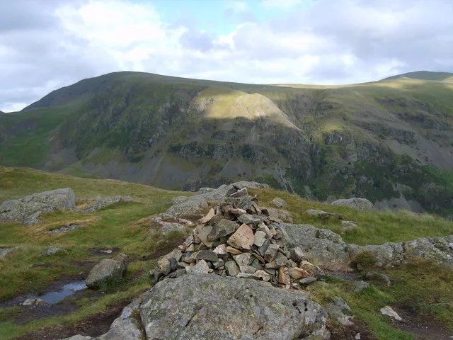
Low Rigg is a small hill in the English Lake District a few miles east of the town of Keswick and slightly north of its larger neighbour High Rigg. Geologically, Low Rigg is a lens-shaped laccolith consisting of an intrusion of a fine-grained granite.
Excerpt from Wikipedia under CC BY-SA 4.0. See the source article linked in Sources below.
- Coordinates
- 54.5951, -3.0804
- District
- Cumberland
- Parish
- St John's Castlerigg and Wythburn
- Postcode
- CA12 4UB
- Parliamentary constituency
- Penrith and Solway
- Nearest railway station
- Threlkeld Quarry — 2.8 km
Sources
- osm: n443621695 (ODbL)
- wikipedia: Low Rigg (CC BY-SA 4.0)
- commons: High Rigg.jpg (CC BY-SA 4.0)
Other places nearby
Loading nearby places…
Nearby
Hostels · North East England
St John's in the Vale Centre
St John's in the Vale Centre — a hostel in england north east.
Hostels · North East England
St John's in the Vale Centre
St John's in the Vale Centre — a hostel in england north east.
 📷 4
📷 4Historic churches · North East England
St John's Church, St John's in the Vale
St John's Church, St John's in the Vale — a Grade II*-listed church in england-north-east, United Kingdom.
 📷 3
📷 3Mountains & hills · North East England
High Rigg
High Rigg — Named summit at 355.7 m.
Caravan parks · North East England
Dalebottom Farm Camping Site and Caravan Park
Dalebottom Farm Camping Site and Caravan Park — a caravan park in england north east.
 📷 3
📷 3Farms (open to visitors) · Scottish Lowlands
Goosewell Farm Activities Centre
Goosewell Farm Activities Centre — a other in scotland-lowlands, United Kingdom.
More mountains in this region
 📷 3
📷 3Mountains & hills · North East England
Angletarn Pikes
Angletarn Pikes — Named summit at 566 m.
 📷 3
📷 3Mountains & hills · North East England
Angletarn Pikes South Top
Angletarn Pikes South Top — Named summit at 563.6 m.
 📷 3
📷 3Mountains & hills · North East England
Ard Crags
Ard Crags — Named summit at 581 m.
 📷 3
📷 3Mountains & hills · North East England
Arnison Crag
Arnison Crag — Named summit at 433 m.
Frequently asked questions
- Where is Low Rigg?
- Low Rigg is in North-East England, United Kingdom (postcode CA12 4UB), in the parish of St John's Castlerigg and Wythburn.
- Is Low Rigg a protected site?
- Yes — Low Rigg is part of the River Derwent and Tributaries SSSI Site of Special Scientific Interest.
- Is Low Rigg free to visit?
- Yes, Low Rigg is free to enter.
- How do I get to Low Rigg?
- The nearest railway station is Threlkeld Quarry, about 2.8 km away. Drivers can navigate to postcode CA12 4UB.