Mountains & hills · North West England
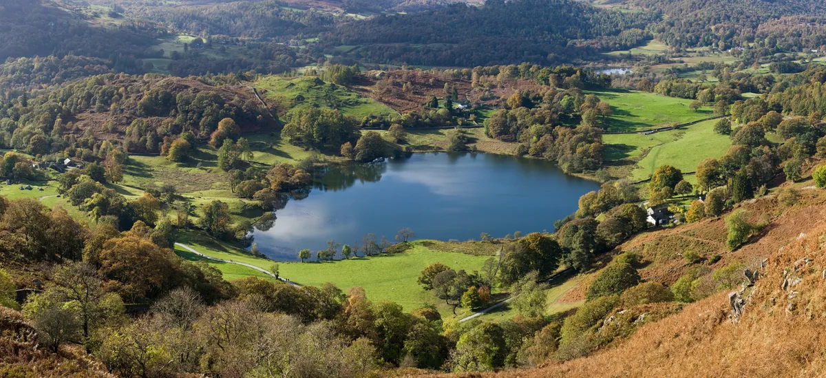
Loughrigg Fell
Loughrigg Fell — Named summit at 335.1 m.

Wikimedia Commons contributors — see linked file page for photographer and licence licence
Plan your visit
- Typical visit
- 3 h–8 h
- Best time of year
- Late spring – early autumn (May–Oct)
- Nearest railway station
- Windermere · 9.4 km
- Free entry
- Dog-friendly
About
Loughrigg Fell is a named summit in the United Kingdom. Wikidata describes it as: "Named summit at 335.1 m.". Coordinates: 54.4375°, -3.0084°.
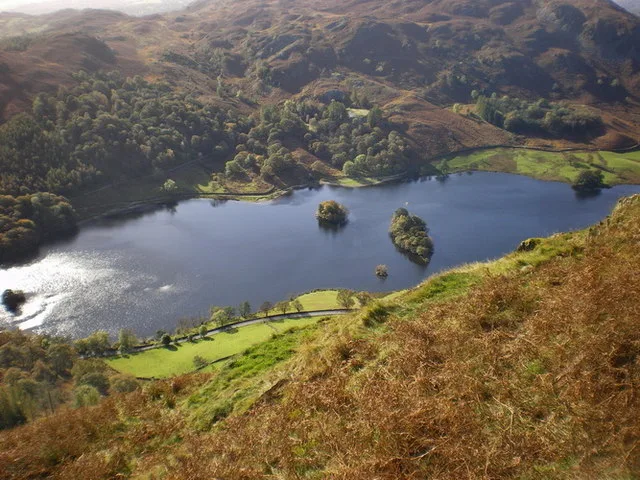
Photo gallery
Protected designations
- Site of Special Scientific Interest: River Eden and Tributaries SSSI
Designations sourced from Natural England open data under OGL v3.
From the Wikipedia article
Loughrigg Fell is a hill in the central part of the English Lake District. It stands on the end of the long ridge coming down from High Raise over Silver How towards Ambleside, and is separated from its neighbours by the depression of Red Bank.
Excerpt from Wikipedia under CC BY-SA 4.0. See the source article linked in Sources below.
- Coordinates
- 54.4375, -3.0084
- District
- Westmorland and Furness
- Parish
- Lakes
- Postcode
- LA22 9HQ
- Parliamentary constituency
- Westmorland and Lonsdale
- Nearest railway station
- Windermere — 9.4 km
Sources
- osm: n1779620834 (ODbL)
- wikipedia: Loughrigg Fell (CC BY-SA 4.0)
- commons: LoughriggSummit.jpg (CC BY-SA 4.0)
Other places nearby
Loading nearby places…
Nearby
 📷 3
📷 3Mountains & hills · North West England
Todd Crag
Todd Crag — a mountain in england-north-west, United Kingdom, 224 m.
 📷 3
📷 3Natural landmarks · North West England
Loughrigg Tarn
Loughrigg Tarn — lake in the Lake District, Cumbria, England.
Hostels · North West England
YHA Langdale
YHA Langdale — a hostel in england north west. Brand: Youth Hostels Association.
 📷 3
📷 3Caves · North West England
Rydal Cave
Rydal Cave — a cave in england-north-west, United Kingdom.
Campsites · North West England
Tarn Foot Farm Campsite
Tarn Foot Farm Campsite — a campsite in england north west.
 📷 4
📷 4Natural landmarks · North West England
Rydal Water
Rydal Water — lake in the United Kingdom.
More mountains in this region
 📷 3
📷 3Mountains & hills · North West England
Allen Crags
Allen Crags — Named summit at 785 m.
 📷 3
📷 3Mountains & hills · North West England
Alum Pot
Alum Pot — Open shaft pothole in North Yorkshire.
 📷 3
📷 3Mountains & hills · North West England
Arnside Knott
Arnside Knott — Named summit at 159 m.
 📷 3
📷 3Mountains & hills · North West England
Aye Gill Pike
Aye Gill Pike — Named summit at 556.3 m.
Frequently asked questions
- Where is Loughrigg Fell?
- Loughrigg Fell is in North-West England, United Kingdom (postcode LA22 9HQ), in the parish of Lakes.
- Is Loughrigg Fell a protected site?
- Yes — Loughrigg Fell is part of the River Eden and Tributaries SSSI Site of Special Scientific Interest.
- Is Loughrigg Fell free to visit?
- Yes, Loughrigg Fell is free to enter.
- How do I get to Loughrigg Fell?
- Drivers can navigate to postcode LA22 9HQ. It sits within the Westmorland and Lonsdale parliamentary constituency.