Caves · North West England
Long Kin East Cave
Long Kin East Cave is a cave in the United Kingdom.

Wikimedia Commons contributors — see linked file page for photographer and licence licence
Plan your visit
- Typical visit
- 45 min–1.5 h
- Nearest railway station
- Horton-in-Ribblesdale · 4.1 km
- Free entry
- Dog-friendly
About
Long Kin East Cave is a named cave entrance in the United Kingdom. Coordinates: 54.1530°, -2.3652°. This entry is part of The Great Britain Guide, a free, ad-free, open-data tourist directory.
Photo gallery
Protected designations
- Site of Special Scientific Interest: Ingleborough SSSI
- National Nature Reserve: INGLEBOROUGH
Designations sourced from Natural England open data under OGL v3.
From the Wikipedia article
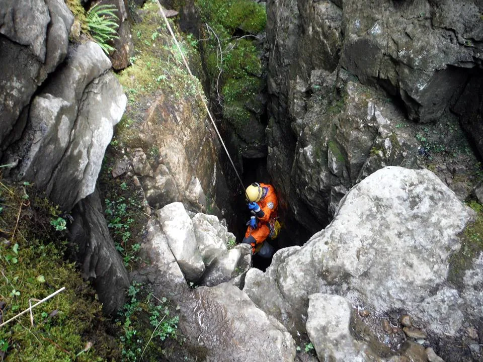
The Long Kin East Cave - Rift Pot system is a limestone cave system on the southern flanks of Ingleborough, North Yorkshire in England lying within the designated Ingleborough Site of Special Scientific Interest. Long Kin East Cave starts as a long meandering stream passage but then plummets down a 58-metre (190 ft) deep shaft when it meets a shattered fault into which Rift Pot also descends. At the bottom, the stream flows through some low canals and sumps, to eventually emerge at Austwick Beck Head in Crummackdale.
Excerpt from Wikipedia under CC BY-SA 4.0. See the source article linked in Sources below.
Background
History
There is a mention of Long Kin in an article published in The Gentleman's Magazine, by Pastor, know to be a pseudonym for John Hutton, in March 1761, but despite associating it with the near-by Jockey Hole the description matches neither Rift Pot nor Long East Cave: "There is, likewise, partly south-east, a small rivulet which falls into a place considerable deep, called Long-Kin;". It is clear that the first part of Long Kin East Cave had been explored as far as the skylight entrances by 1889, as a paper published in the Leeds Geological Association Transactions says: "these being three fissures connected by a subterranean passage, through which a small stream flows". A detailed…
Description
The main entrance to Long Kin East Cave () is where a small stream sinks into a deepening fissure in a small exposure of limestone rocks located in an extensive area of moorland. The fissure gains a roof and morphs into a walking-sized meandering stream passage, passing an alternative dry entrance at the first corner. After 216 m the passage passes below a walled-off pothole () where daylight enters. After a further 43 m an ascent up a slope of rocks leads to the bottom of the Long Kin East Pot entrance - a 4 m deep shaft (). Upstream from the junction, a wet crawl reaches some gour pools in a walking-sized passage, before continuing as a crawl which chokes just to the east of Jockey Hole.…
Sourced from Wikipedia under CC BY-SA 4.0.
- Coordinates
- 54.1530, -2.3652
- Address
- Ingleborough, North Yorkshire, England
- Nearest railway station
- Horton-in-Ribblesdale — 4.1 km
Sources
- osm: n513816062 (ODbL)
- wikipedia: Long Kin East Cave - Rift Pot System (CC BY-SA 4.0)
- commons: Rift-pot-entrance-on-ingleborough.jpg (CC BY-SA 4.0)
Other places nearby
Loading nearby places…
Nearby
 📷 3
📷 3Mountains & hills · North West England
Long Kin East Cave - Rift Pot System
Long Kin East Cave - Rift Pot System — cave system in North Yorkshire, England.
 📷 5
📷 5Caves · North West England
Long Kin East Pot
Long Kin East Pot — a cave broad in england-north-west, United Kingdom.
📷 5Caves · North West England
Jockey Hole
Jockey Hole — a cave broad in england-north-west, United Kingdom.
📷 3Caves · North West England
Rift Pot
Rift Pot is a cave in the United Kingdom.
📷 5Caves · North West England
Marble Sink
Marble Sink — a cave broad in england-north-west, United Kingdom.
📷 5Caves · North West England
Marble Pot
Marble Pot — a cave broad in england-north-west, United Kingdom.
More caves in this region
 📷 3
📷 3Caves · North West England
Alum Pot
Alum Pot is a cave in the United Kingdom.
 📷 3
📷 3Caves · North West England
Antler Hole
Antler Hole is a cave in the United Kingdom.
 📷 3
📷 3Caves · North West England
Aquamole Pot
Aquamole Pot is a cave in the United Kingdom.
 📷 3
📷 3Caves · North West England
Austwick Beck Head
Austwick Beck Head is a cave in the United Kingdom.
Frequently asked questions
- Where is Long Kin East Cave?
- Long Kin East Cave is in North-West England, United Kingdom.
- Is Long Kin East Cave a protected site?
- Yes — Long Kin East Cave is part of the Ingleborough SSSI Site of Special Scientific Interest and the INGLEBOROUGH National Nature Reserve.
- Is Long Kin East Cave free to visit?
- Yes, Long Kin East Cave is free to enter.
- How do I get to Long Kin East Cave?
- The nearest railway station is Horton-in-Ribblesdale, about 4.1 km away.