Mountains & hills · North West England
Loft Crag
Loft Crag — Named summit at 681.7 m.

Wikimedia Commons contributors — see linked file page for photographer and licence licence
Plan your visit
- Typical visit
- 3 h–8 h
- Best time of year
- Late spring – early autumn (May–Oct)
- Free entry
- Dog-friendly
About
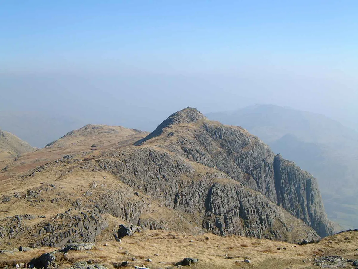
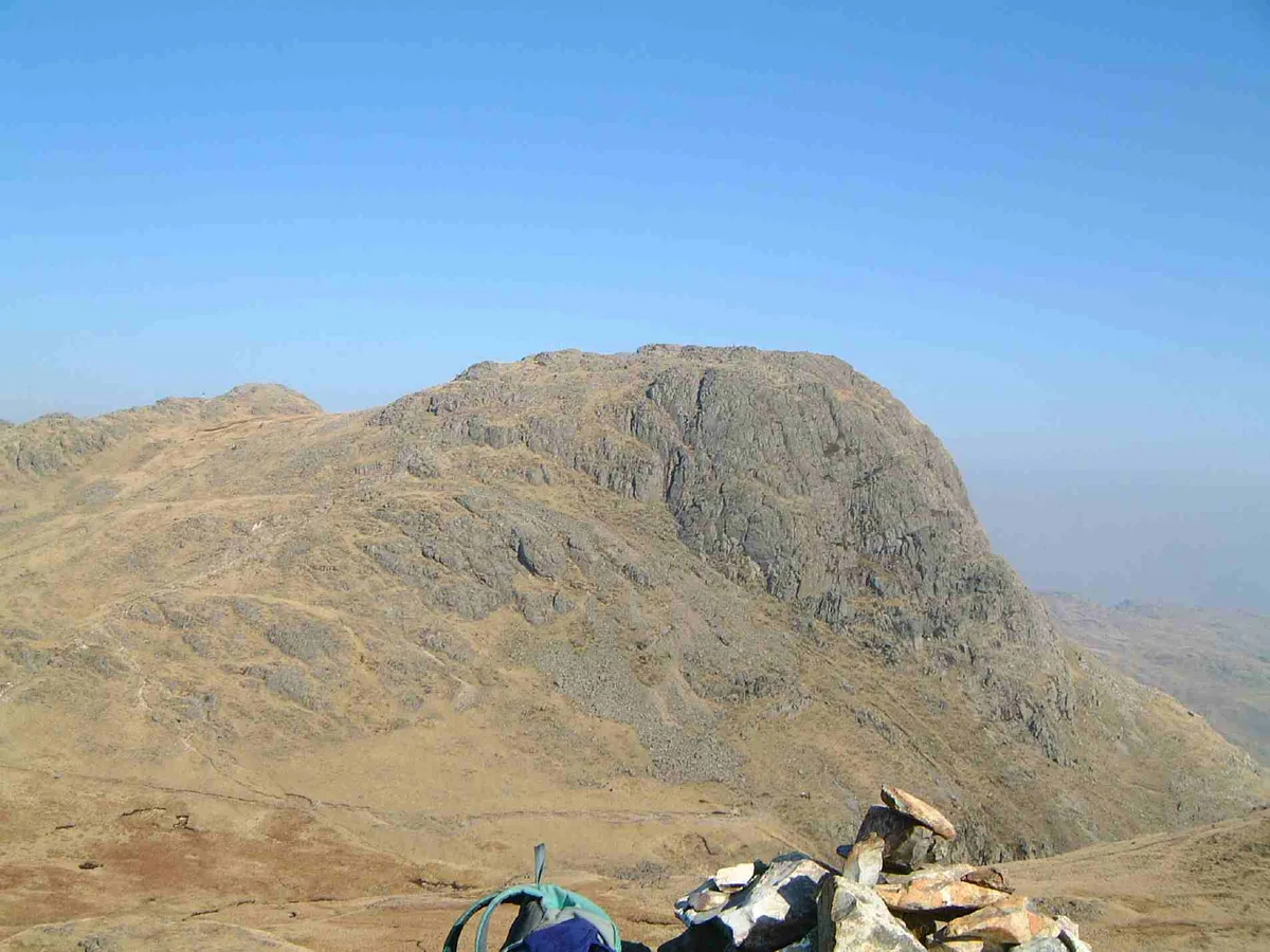
Loft Crag is a named summit in the United Kingdom. Wikidata describes it as: "Named summit at 681.7 m.". Coordinates: 54.4545°, -3.1159°.
Photo gallery
Protected designations
- Site of Special Scientific Interest: Langdale Pikes SSSI
Designations sourced from Natural England open data under OGL v3.
From the Wikipedia article
Loft Crag is a fell in the English Lake District, situated nine kilometres (5+1⁄2 miles) west of Ambleside in the valley of Great Langdale. Along with the neighbouring fells of Harrison Stickle and Pike of Stickle it forms the picturesque Langdale Pikes, which when viewed from the area around Elterwater village gives one of the best-known views in the National Park.
Excerpt from Wikipedia under CC BY-SA 4.0. See the source article linked in Sources below.
- Coordinates
- 54.4545, -3.1159
- District
- Westmorland and Furness
- Parish
- Lakes
- Postcode
- LA22 9JY
- Parliamentary constituency
- Westmorland and Lonsdale
Sources
- osm: n29766674 (ODbL)
- wikipedia: Loft Crag (CC BY-SA 4.0)
- commons: Loft Crag from Pike of Stickle.jpg (CC BY-SA 4.0)
Other places nearby
Loading nearby places…
Nearby
 📷 3
📷 3Natural landmarks · North West England
Loft Crag
Loft Crag — mountain in United Kingdom.
 📷 3
📷 3Archaeological sites · North West England
Langdale Axe Stone Quarry
Langdale Axe Stone Quarry — a archaeological in england-north-west, United Kingdom.
 📷 4
📷 4Mountains & hills · North West England
Pike of Stickle
Pike of Stickle — Named summit at 708.4 m.
 📷 3
📷 3Natural landmarks · North West England
Harrison Stickle
Harrison Stickle — mountain in United Kingdom.
 📷 4
📷 4Natural landmarks · North West England
Pike of Stickle
Pike of Stickle is a natural landmark in the United Kingdom.
 📷 3
📷 3Mountains & hills · North West England
Harrison Stickle
Harrison Stickle — Named summit at 735.3 m.
More mountains in this region
 📷 3
📷 3Mountains & hills · North West England
Allen Crags
Allen Crags — Named summit at 785 m.
 📷 3
📷 3Mountains & hills · North West England
Alum Pot
Alum Pot — Open shaft pothole in North Yorkshire.
 📷 3
📷 3Mountains & hills · North West England
Arnside Knott
Arnside Knott — Named summit at 159 m.
 📷 3
📷 3Mountains & hills · North West England
Aye Gill Pike
Aye Gill Pike — Named summit at 556.3 m.
Frequently asked questions
- Where is Loft Crag?
- Loft Crag is in North-West England, United Kingdom (postcode LA22 9JY), in the parish of Lakes.
- Is Loft Crag a protected site?
- Yes — Loft Crag is part of the Langdale Pikes SSSI Site of Special Scientific Interest.
- Is Loft Crag free to visit?
- Yes, Loft Crag is free to enter.
- How do I get to Loft Crag?
- Drivers can navigate to postcode LA22 9JY. It sits within the Westmorland and Lonsdale parliamentary constituency.