Natural landmarks · North West England
Stickle Tarn
Stickle Tarn — lake near Harrison Stickle, Langdale, Cumbria, United Kingdom.

Wikimedia Commons contributors — see linked file page for photographer and licence licence
Plan your visit
- Typical visit
- 1 h–2 h
- Free entry
- Dog-friendly
About
Stickle Tarn is a named natural landmark in the United Kingdom. Wikidata describes it as: "lake near Harrison Stickle, Langdale, Cumbria, United Kingdom". Coordinates: 54.4586°, -3.1025°.
Photo gallery
Protected designations
- Site of Special Scientific Interest: Langdale Pikes SSSI
Designations sourced from Natural England open data under OGL v3.
From the Wikipedia article
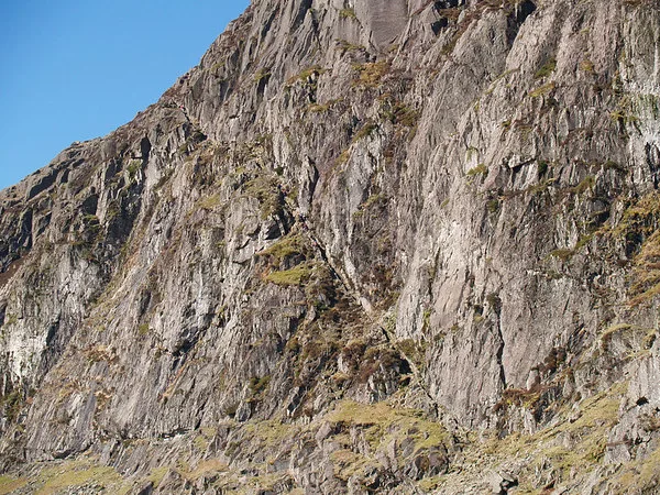
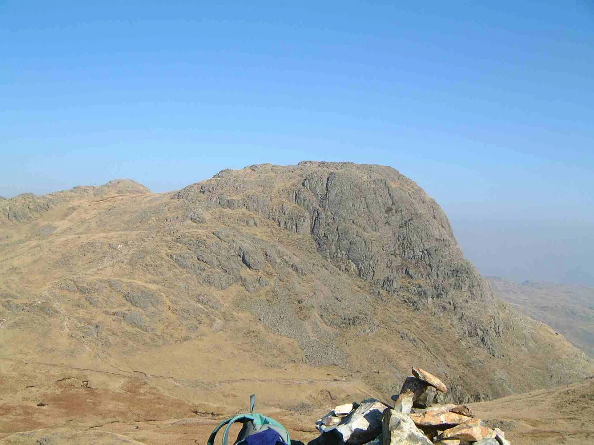
Stickle Tarn is a small tarn near Harrison Stickle in Lake District, England. The tarn was enlarged by the building of a stone dam in 1838 and is used to supply water for the inhabitants of Langdale. The tarn is situated in a corrie, flanked on the west side by Harrison Stickle, and on the north by the massive imposing bulk of Pavey Ark's south face. The tarn is frequently visited by fellwalkers ascending to Pavey Ark's summit, or en route to High Raise from Great Langdale. In February 2015 it was put up for sale by the Lake District National Park Authority, which was seeking to reduce its landholdings in the national park. The walk from Langdale to Stickle Tarn is one of the most popular in the Lake District, and short enough to be a relatively easy outing for families.
Excerpt from Wikipedia under CC BY-SA 4.0. See the source article linked in Sources below.
- Coordinates
- 54.4586, -3.1025
- District
- Westmorland and Furness
- Parish
- Lakes
- Postcode
- LA22 9JX
- Parliamentary constituency
- Westmorland and Lonsdale
Sources
- wikidata: Q7363091 (CC0)
- wikipedia: Stickle Tarn, Langdale (CC BY-SA 4.0)
- commons: Stickle Tarn - geograph.org.uk - 241395.jpg (CC BY-SA 4.0)
Other places nearby
Loading nearby places…
Nearby
 📷 3
📷 3Natural landmarks · North West England
Pavey Ark
Pavey Ark — mountain in United Kingdom.
 📷 3
📷 3Mountains & hills · North West England
Pavey Ark
Pavey Ark — Named summit at 701.6 m.
 📷 3
📷 3Archaeological sites · North West England
Axe Workings
Axe Workings — a archaeological in england-north-west, United Kingdom.
 📷 3
📷 3Mountains & hills · North West England
Harrison Stickle
Harrison Stickle — Named summit at 735.3 m.
 📷 3
📷 3Natural landmarks · North West England
Harrison Stickle
Harrison Stickle — mountain in United Kingdom.
 📷 3
📷 3Mountains & hills · North West England
Thunacar Knott (summit)
Thunacar Knott (summit) — Named summit at 723 m.
More natural landmarks in this region
 ★ Iconic📷 4
Natural landmarks · North West England
Coniston Water
Lake District lake — Swallows and Amazons setting and Donald Campbell water-speed history.
 📷 3
📷 3Natural landmarks · North West England
Elter Water
Elter Water — lake in the United Kingdom.
 📷 3
📷 3Natural landmarks · North West England
Esthwaite Water
Esthwaite Water — lake in the United Kingdom.
 Flagship📷 5
Natural landmarks · North West England
Semerwater
Semerwater — lake in North Yorkshire, England, UK.
Frequently asked questions
- Where is Stickle Tarn?
- Stickle Tarn is in North-West England, United Kingdom (postcode LA22 9JX), in the parish of Lakes.
- Is Stickle Tarn a protected site?
- Yes — Stickle Tarn is part of the Langdale Pikes SSSI Site of Special Scientific Interest.
- Is Stickle Tarn free to visit?
- Yes, Stickle Tarn is free to enter.
- How do I get to Stickle Tarn?
- Drivers can navigate to postcode LA22 9JX. It sits within the Westmorland and Lonsdale parliamentary constituency.