Other places · Mid Wales
Llandrindod Wells
Also known as: Llandrindod
Llandrindod Wells in Wales Mid, United Kingdom.

Jaggery — CC BY-SA 2.0 via Wikimedia Commons licence
Plan your visit
- Typical visit
- 1 h–2 h
About
Llandrindod Wells is a place of interest in Wales Mid, United Kingdom — drawn from open-data sources for visitor reference. See the linked Wikipedia article for the full description.
Photo gallery
From the Wikipedia article
Llandrindod Wells (; locally /ɬænˌdrɪndɒd-/; Welsh: Llandrindod [ɬanˈdɾindɔd] ; lit. 'trinity parish') is a town and community in Powys, Wales. It serves as the seat of Powys County Council, and is therefore the administrative centre of Powys. The town was historically in Radnorshire. Llandrindod Wells developed as a spa town in the 19th century, with a boom in the late 20th century as a centre of local government. Before the 1860s the site of the town was common land in Llanfihangel Cefnllys parish. Llandrindod Wells is the fifth largest town in Powys. The population as of the 2021 UK census was 5,602, an increase on the previous census.
Excerpt from Wikipedia under CC BY-SA 4.0. See the source article linked in Sources below.
Background
History
During the mid-18th century, the 'healing qualities' of the local spring waters attracted visitors to the area resulting in an economic boom with the building of a 'splendid' hotel at Llandrindod Hall. The medicinal qualities of the springs was first described in detail by the self-proclaimed physician Diederich Wessel Linden. The most famous of the springs was Cwmygof Well, in the rocky valley of Dolysgallog Farm. The farm became a boarding house in the 1820s to accommodate the growing numbers of visitors. Later, the area of land which was to become 'Rock Park' was set aside for exercise and recreation. A period of relative decline during the late 18th and early 19th centuries was reversed…
Sourced from Wikipedia under CC BY-SA 4.0.
- Coordinates
- 52.2435, -3.3855
- District
- Powys
- Parish
- Llandrindod Wells
- Postcode
- LD1 6AW
- Parliamentary constituency
- Brecon, Radnor and Cwm Tawe
Sources
- wikidata: Q1024885 (CC0)
- wikipedia: Llandrindod Wells (CC BY-SA 4.0)
Other places nearby
Loading nearby places…
Nearby
 📷 4
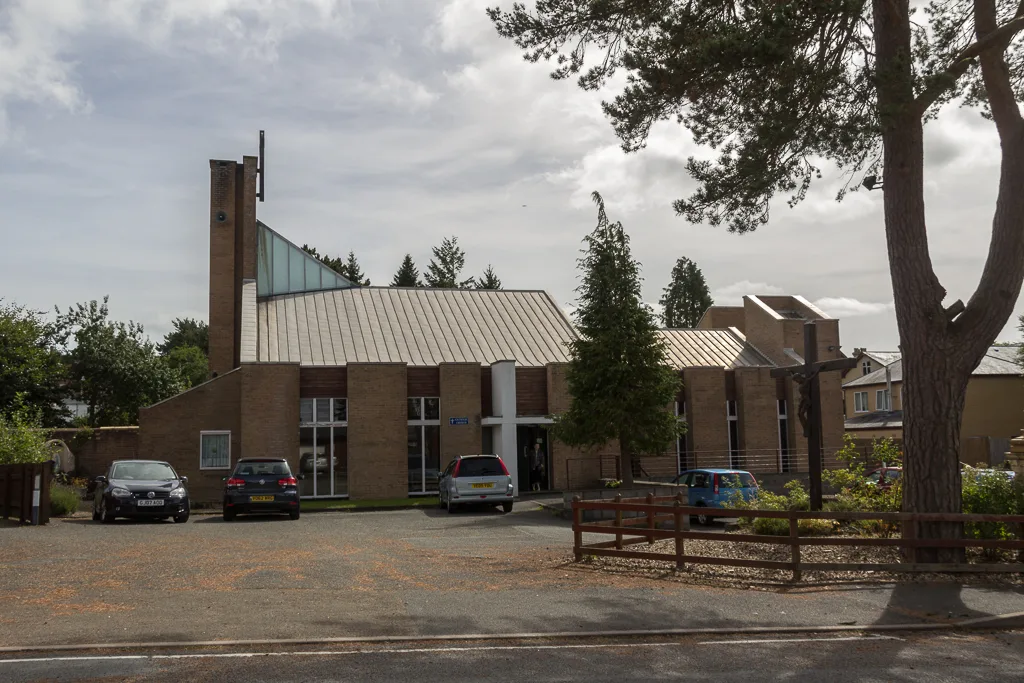
📷 4Historic churches · Mid Wales
Our Lady of Ransom and the Holy Souls Church
Our Lady of Ransom and the Holy Souls Church — church in Llandrindod Wells, Powys, Wales.
 📷 3
📷 3Other places · Mid Wales
Llandrindod East/Llandrindod West
Llandrindod East/Llandrindod West in Wales Mid, United Kingdom.
 📷 3
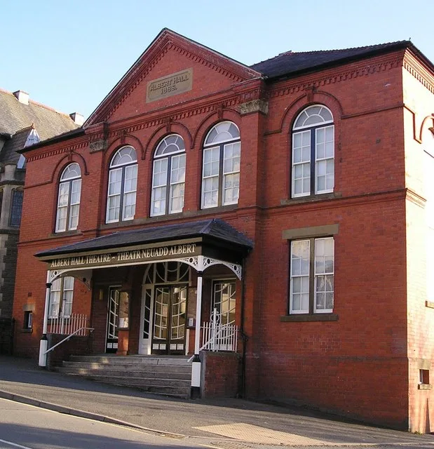
📷 3Theatres · Mid Wales
The Albert Hall
The Albert Hall is a theatre in the United Kingdom.
 📷 3
📷 3Chapels · Mid Wales
The Albert Hall
The Albert Hall — Theatre, and Arts Venue in Llandrindod Wells.
 📷 3
📷 3Museums · Mid Wales
Signal Box Museum
Signal Box Museum — a museum in wales-mid, United Kingdom.
 📷 4
📷 4Heritage railway stations · Mid Wales
Llandrindod railway station
Llandrindod railway station in Wales Mid, United Kingdom.
More places in this region
 📷 3
📷 3Other places · Mid Wales
Chain Links
Chain Links — Public artwork (sculpture) by Joss Smith.
 📷 3
📷 3Other places · Mid Wales
David Davies
David Davies — Public artwork (statue).
 📷 3
📷 3Other places · Mid Wales
Dwrgi Aberteifi / Teifi Otter
Dwrgi Aberteifi / Teifi Otter — Public artwork (statue) by Geoffrey Powell and Fiorini Foundry.
 📷 3
📷 3Other places · Mid Wales
Ffenestr Ffug
Ffenestr Ffug — Public artwork (mural).
Frequently asked questions
- Where is Llandrindod Wells?
- Llandrindod Wells is in Mid Wales, in the United Kingdom — coordinates 52.2435°, -3.3855°.