Forests & woodlands · East of England
Knettishall Heath
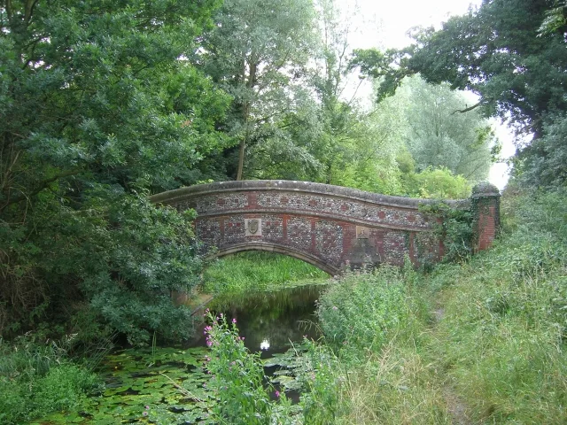
Knettishall Heath is a forest or woodland in the United Kingdom.

Wikimedia Commons contributors — see linked file page for photographer and licence licence
Plan your visit
- Typical visit
- 1 h–3 h
- Nearest railway station
- Harling Road · 7.9 km
- Free entry
- Family-friendly
- Dog-friendly
About
Knettishall Heath is a named forest, woodland or nature reserve in the United Kingdom. Coordinates: 52.3873°, 0.8683°. This entry is part of The Great Britain Guide, a free, ad-free, open-data tourist directory.
Photo gallery
Protected designations
- Site of Special Scientific Interest: Knettishall Heath SSSI
- Site of Special Scientific Interest: Breckland Forest SSSI
Designations sourced from Natural England open data under OGL v3.
From the Wikipedia article
Knettishall Heath is a 91.7-hectare (227-acre) biological Site of Special Scientific Interest west of Knettishall in Suffolk, England. A larger area of 176 hectares is the Knettishall Heath Nature Reserve, which is managed by the Suffolk Wildlife Trust. Despite its name, Knettishall Heath is in fact a diverse mosaic of habitats with woodland and riverside meadows, as well as large areas of heath.
Excerpt from Wikipedia under CC BY-SA 4.0. See the source article linked in Sources below.
Background
Visiting
There are several access points to the heathland, most found off the road between Knettishall and Rushford villages. The main car park for the area can be found on an unnamed road (informally known as Heath Road) off Spalding's Chair Hill. The A1066 passes within a mile or two of the heathland, where it runs from Thetford to Garboldisham.
Sourced from Wikipedia under CC BY-SA 4.0.
- Coordinates
- 52.3873, 0.8683
- County
- Norfolk
- District
- Breckland
- Parish
- Riddlesworth
- Postcode
- IP22 2TE
- Parliamentary constituency
- South West Norfolk
- Nearest railway station
- Harling Road — 7.9 km
- Official site
- www.suffolkwildlifetrust.org
Sources
- osm: w436483371 (ODbL)
- wikipedia: Knettishall Heath (CC BY-SA 4.0)
- commons: Knettishall Heath Country Park - geograph.org.uk - 32235.jpg (CC BY-SA 4.0)
Other places nearby
Loading nearby places…
Nearby
 📷 5
📷 5Wildlife reserves · East of England
Knettishall Heath
Knettishall Heath — nature reserve in Suffolk, England, UK.
 📷 3
📷 3Archaeological sites · East of England
Hut Hill
Hut Hill — a archaeological in england-east, United Kingdom.
 📷 5
📷 5Historic houses · East of England
Riddlesworth Hall School
Riddlesworth Hall School — a school heritage in england-east, United Kingdom.
 📷 3
📷 3Public art & sculpture · East of England
Coney Weston Village Sign
Coney Weston Village Sign — a public art in england-east, United Kingdom.
 📷 3
📷 3Memorials & monuments · East of England
Coney Weston War Memorial
Coney Weston War Memorial — Grade II listed building-listed memorial in england-east, United Kingdom.
 📷 3
📷 3Historic churches · East of England
Church of St Mary
Church of St Mary — church in Coney Weston, Suffolk, England, UK.
More forests in this region
 📷 3
📷 3Forests & woodlands · East of England
Betty's Fen
Betty's Fen is a forest or woodland in the United Kingdom.
 📷 3
📷 3Forests & woodlands · East of England
Bowthorpe Marsh
Bowthorpe Marsh is a forest or woodland in the United Kingdom.
 📷 4
📷 4Forests & woodlands · East of England
Bradfield Woods National Nature Reserve
Bradfield Woods National Nature Reserve is a forest or woodland in the United Kingdom.
 📷 5
📷 5Forests & woodlands · East of England
Captain's Wood Nature Reserve
Captain's Wood Nature Reserve is a forest or woodland in the United Kingdom.
Frequently asked questions
- Where is Knettishall Heath?
- Knettishall Heath is in Norfolk, East of England, United Kingdom (postcode IP22 2TE), in the parish of Riddlesworth.
- Is Knettishall Heath a protected site?
- Yes — Knettishall Heath is part of the Knettishall Heath SSSI Site of Special Scientific Interest and the Breckland Forest SSSI Site of Special Scientific Interest.
- Is Knettishall Heath free to visit?
- Yes, Knettishall Heath is free to enter.
- How do I get to Knettishall Heath?
- The nearest railway station is Harling Road, about 7.9 km away. Drivers can navigate to postcode IP22 2TE.