Archaeological sites · Scottish Highlands
Kirkhill Forest
Kirkhill Forest is a archaeological site in the United Kingdom.

Wikimedia Commons contributors — see linked file page for photographer and licence licence
Plan your visit
- Typical visit
- 45 min–1.5 h
- Nearest railway station
- Dyce · 3.2 km
- Free entry
- Dog-friendly
About
Kirkhill Forest is an archaeological site in the United Kingdom. Coordinates: 57.1943°, -2.2416°. This entry is part of The Great Britain Guide, a free, ad-free, open-data tourist directory.
Photo gallery
From the Wikipedia article
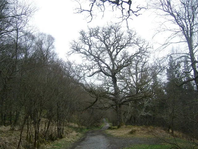
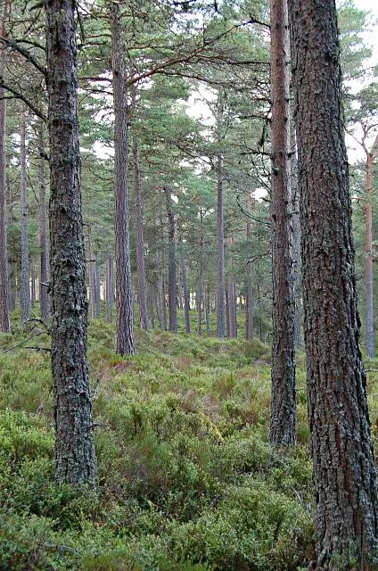
Kirkhill Forest is a forest in Aberdeenshire, Scotland, situated to the north-west of Aberdeen, on the north side of the A96 between the villages of Dyce and Blackburn. Kirkhill is a working forest with a network of paths for walking, a permanent orienteering trail, and a mountain bike fun park. The forest includes the Tappie Tower, a 19th-century folly offering panoramic views across the surrounding area.
Excerpt from Wikipedia under CC BY-SA 4.0. See the source article linked in Sources below.
- Coordinates
- 57.1943, -2.2416
- District
- Aberdeen City
- Postcode
- AB21 0TU
- Parliamentary constituency
- Aberdeen North
- Nearest railway station
- Dyce — 3.2 km
Sources
- wikidata: Q19585850 (CC0)
- wikipedia: Kirkhill Forest (CC BY-SA 4.0)
- commons: Looking Towards Kirkhill Forest - geograph.org.uk - 975302.jpg (CC BY-SA 4.0)
Other places nearby
Loading nearby places…
Nearby
 📷 3
📷 3Archaeological sites · Scottish Highlands
34 ABD
34 ABD — a archaeological in scotland-highlands, United Kingdom.
📷 3Archaeological sites · Scottish Highlands
35 ABD
35 ABD — a archaeological in scotland-highlands, United Kingdom.
 📷 3
📷 3Archaeological sites · Scottish Highlands
36 ABD
36 ABD — a archaeological in scotland-highlands, United Kingdom.
 📷 3
📷 3Battlefields & battle sites · Scottish Highlands
Gueval Wood
Gueval Wood in Scotland Highlands, United Kingdom.
 📷 3
📷 3Natural landmarks · Scottish Highlands
Elrick Hill
Elrick Hill — a other in scotland-highlands, United Kingdom.
📷 3Archaeological sites · Scottish Highlands
33 ABD
33 ABD — a archaeological in scotland-highlands, United Kingdom.
More archaeological sites in this region
 📷 5
📷 5Archaeological sites · Scottish Highlands
Ariundle Oakwood National Nature Reserve
Ariundle Oakwood National Nature Reserve — forested nature reserve in Highland, Scotland, UK.
 📷 3
📷 3Archaeological sites · Scottish Highlands
Abernethy Forest
Abernethy Forest — forest in Highland, Scotland, UK.
 📷 3
📷 3Archaeological sites · Scottish Highlands
Abriachan Forest
Abriachan Forest — Forest near Abriachan village in Scotland.
 📷 3
📷 3Archaeological sites · Scottish Highlands
Achnashellach Forest
Achnashellach Forest is a archaeological site in the United Kingdom.
Frequently asked questions
- Where is Kirkhill Forest?
- Kirkhill Forest is in Scottish Highlands, in the United Kingdom — coordinates 57.1943°, -2.2416°. The nearest railway station is Dyce, around 3.2 km away.
- Is Kirkhill Forest free to visit?
- Yes — admission to Kirkhill Forest is free.