Towns & cities · West Midlands
Ivinghoe
Ivinghoe — village and civil parish in Buckinghamshire, England.

Wikimedia Commons contributors — see linked file page for photographer and licence licence
Plan your visit
- Typical visit
- 3 h–6 h
- Nearest railway station
- Cheddington · 3.5 km
- Free entry
- Family-friendly
- Dog-friendly
About
Ivinghoe is a town, city, village or settlement in the United Kingdom. Recent population estimates put it at around 965 people. Address: LU7. Wikidata describes it as: "village and civil parish in Buckinghamshire, England". Coordinates: 51.8364°, -0.6261°.
Photo gallery
Protected designations
- Area of Outstanding Natural Beauty: Chilterns
Designations sourced from Natural England open data under OGL v3.
From the Wikipedia article
Ivinghoe is a town and civil parish in east Buckinghamshire, England, close to the borders with Hertfordshire and Bedfordshire. It is 33 miles (53 kilometres) northwest of London, 4 mi (6 km) north of Tring and 6 mi (10 km) south of Leighton Buzzard, close to the village of Pitstone.
Excerpt from Wikipedia under CC BY-SA 4.0. See the source article linked in Sources below.
Background
Architecture
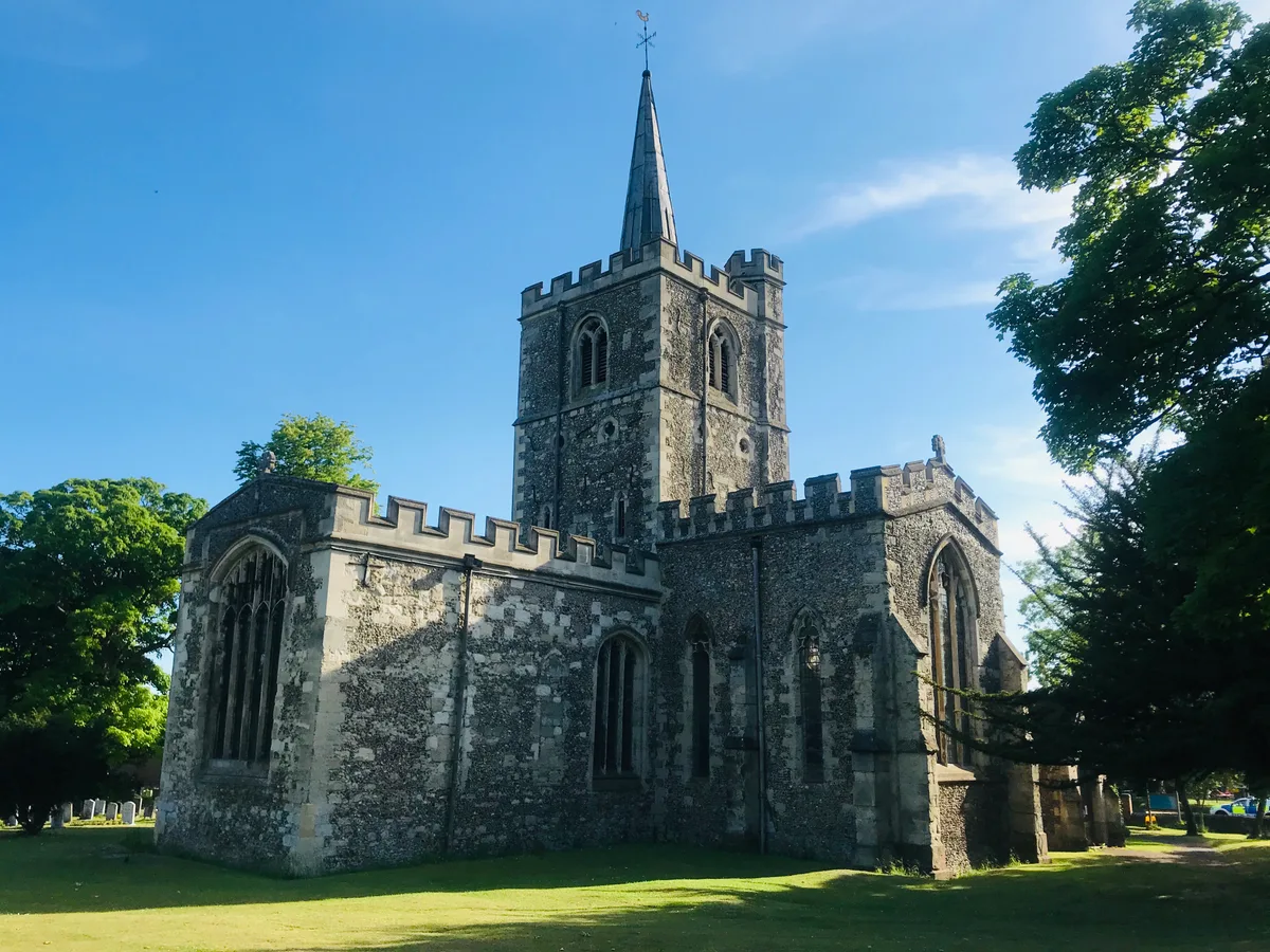
The Church of St Mary the Virgin, Ivinghoe dates from 1220 but was set on fire in 1234 in an act of spite against the local Bishop. The church was rebuilt in 1241. The town has some fine examples of Tudor architecture, particularly around the village green, with 28 buildings marked as listed or significant. The population of Ivinghoe in 1841 was 740.
Sourced from Wikipedia under CC BY-SA 4.0.
- Coordinates
- 51.8364, -0.6261
- District
- Buckinghamshire
- Parish
- Ivinghoe
- Postcode
- LU7
- Parliamentary constituency
- Aylesbury
- Population
- 965
- Nearest railway station
- Cheddington — 3.5 km
- Official site
- ivinghoe.co.uk
Sources
- wikidata: Q671595 (CC0)
- wikipedia: Ivinghoe (CC BY-SA 4.0)
- commons: Ivinghoe - geograph.org.uk - 787578.jpg (CC BY-SA 4.0)
Other places nearby
Loading nearby places…
Nearby
 📷 5
📷 5Historic churches · West Midlands
Church of St Mary
Church of St Mary — church in Ivinghoe, Buckinghamshire, England, UK.
Campsites · West Midlands
Town Farm
Town Farm — a campsite in england west midlands.
 📷 3
📷 3Windmills · West Midlands
Pitstone Windmill
Pitstone Windmill is a windmill in the United Kingdom.
 📷 3
📷 3Watermills · West Midlands
Watermill at Ford End Farm
Watermill at Ford End Farm — Grade II listed building-listed watermill in england-west-midlands, United Kingdom.
 📷 3
📷 3Museums · West Midlands
Pitstone Green Museum
Pitstone Green Museum — a museum in england-west-midlands, United Kingdom.
 📷 5
📷 5Museums · West Midlands
Pitstone
Pitstone (formerly Pightelsthorn, with possible variation Pychelesthorn in 1399) is a village and civil parish in east Buckinghamshire, England. It is at the foot of the central range of the Chiltern
More towns in this region
 Flagship📷 3
Towns & cities · West Midlands
Adderbury
Adderbury — village and civil parish in Cherwell district, Oxfordshire, England.
 Flagship📷 3
Towns & cities · West Midlands
Admington
Admington — village in Warwickshire, England, UK.
 Flagship📷 3
Towns & cities · West Midlands
Aldington
Aldington — village in Worcestershire, United Kingdom.
 Flagship📷 5
Towns & cities · West Midlands
Anstey
Anstey — large village in Leicestershire, England.
Frequently asked questions
- Where is Ivinghoe?
- Ivinghoe is in the West Midlands, United Kingdom (postcode LU7), in the parish of Ivinghoe.
- Is Ivinghoe a protected site?
- Yes — Ivinghoe is part of the Chilterns National Landscape (AONB).
- Is Ivinghoe free to visit?
- Yes, Ivinghoe is free to enter.
- How do I get to Ivinghoe?
- The nearest railway station is Cheddington, about 3.5 km away. Drivers can navigate to postcode LU7.