Archaeological sites · North East England
Hunnum
Hunnum in England North East, United Kingdom.

Tim Fish — CC BY-SA 2.0 via Wikimedia Commons licence
Plan your visit
- Typical visit
- 45 min–1.5 h
- Free entry
- Dog-friendly
About
Hunnum is a place of interest in England North East, United Kingdom — drawn from open-data sources for visitor reference. See the linked Wikipedia article for the full description.
Photo gallery
From the Wikipedia article
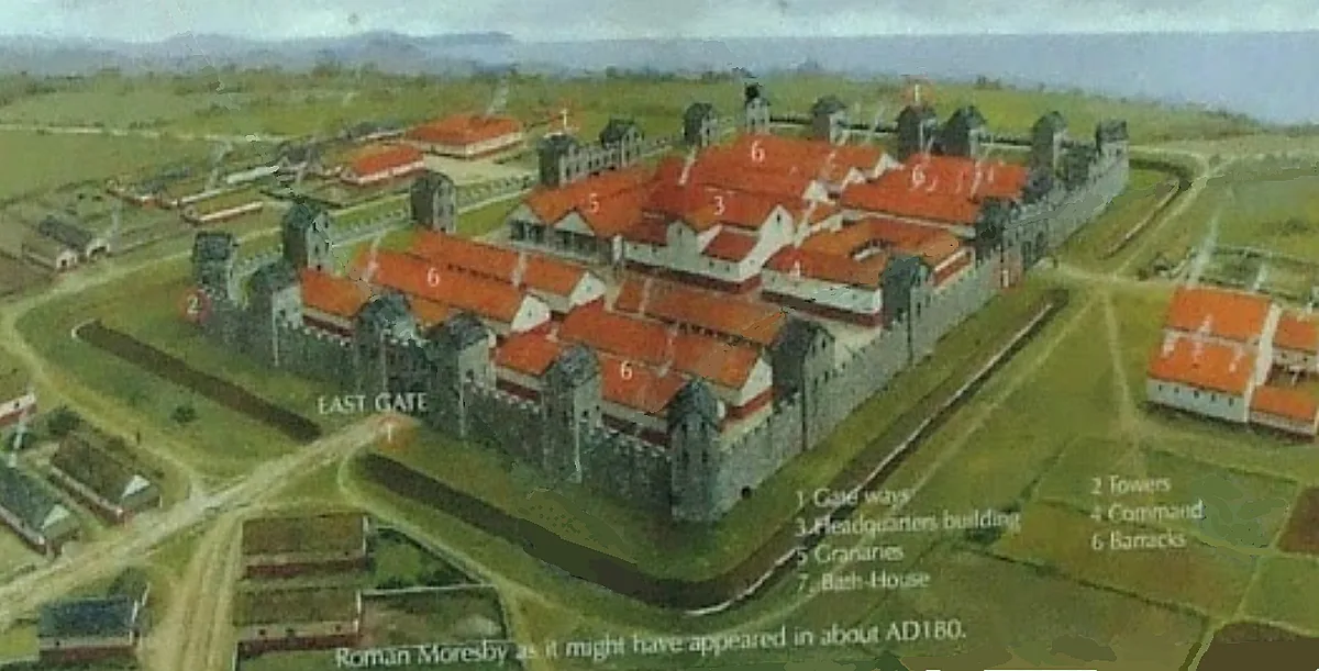
Hunnum (also known as Onnum, and with the modern name of Halton Chesters) was a Roman fort on Hadrian's Wall located north of the modern-day village of Halton, Northumberland in North East England. It was the fifth fort on Hadrian's Wall and is situated about 7.5 miles west of Vindobala fort, 5.9 miles east of Chesters fort and 2.5 miles north of the Stanegate fort of Coria (Corbridge). The site of the fort is bisected by the B6318 Military Road, which runs along the route of the wall at that point. The fort may also have guarded Dere Street which crosses the Roman Wall through the valley immediately to the west, but its distance from Dere Street and that Milecastle 22 was also displaced from Dere Street implies that this was not a priority and may have been expected to be disused north of the Wall after Hadrian's Wall was built. The Latinised Brittonic name “Onnum” may mean "Stream/Water", "Ash tree", or “Rock”; if it means "Stream", it may be a reference to the Fence Burn, where a stream touches the line of Hadrian's Wall, but if it means "Rock", it may refer to Down Hill situated to the east of it.
Excerpt from Wikipedia under CC BY-SA 4.0. See the source article linked in Sources below.
Background
Description
The original fort was built between 122 and 126 AD with a rectangular plan measuring 460 ft north to south by 410 ft east to west. It projected partly north of the wall as did other cavalry wall forts to allow rapid access to the north. There were four main gates, at the main points of the compass, with double portals with guard chambers. At various times some of the portals have been blocked up and both portals of the west gate were blocked almost at once. There were towers at each corner of the fort, and also on either side of the main gates. The Vallum passed some short distance south of the fort, and was crossed by a road leading from the south gate to the vicus just south of the…
Sourced from Wikipedia under CC BY-SA 4.0.
- Coordinates
- 55.0100, -2.0060
- District
- Northumberland
- Parish
- Whittington
- Postcode
- NE45 5QA
- Parliamentary constituency
- Hexham
Sources
Other places nearby
Loading nearby places…
Nearby
 📷 3
📷 3Archaeological sites · Scottish Lowlands
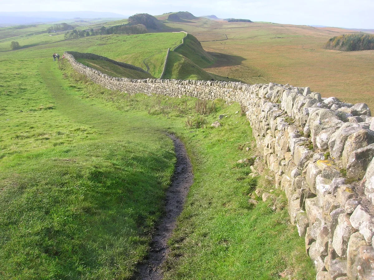
Haltonchesters Roman fort, settlement and Hadrian's Wall and vallum between the field boundary east of Haltonchesters fort and the Fence Burn in wall mile 2
Haltonchesters Roman fort, settlement and Hadrian's Wall and vallum between the field boundary east of Haltonchesters fort and the Fence Burn in wall mile 2 — archaeological site in Whittington, Northumberland, England, UK.
 📷 5
📷 5Castles · Scottish Lowlands
Halton Castle, Northumberland
Halton Castle, Northumberland — a castle in scotland-lowlands, United Kingdom.
 📷 3
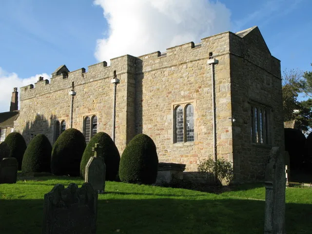
📷 3Historic churches · Scottish Lowlands
Halton Church
Halton Church — Grade I listed church in Halton, Northumberland, England, UK.
 📷 4
📷 4Archaeological sites · North East England
Milecastle 21
Milecastle 21 in England North East, United Kingdom.
 📷 3
📷 3Other places · North East England
Milecastle 22
Milecastle 22 in England North East, United Kingdom.
📷 3Archaeological sites · Scottish Lowlands
Milecastle 22 (Portgate)
Milecastle 22 (Portgate) — a archaeological in scotland-lowlands, United Kingdom.
More archaeological sites in this region
 ★ Iconic📷 4
Archaeological sites · North East England
Hadrian's Wall
73-mile UNESCO World Heritage Roman frontier wall — Britain's most extensive Roman monument.
 📷 3
📷 3Archaeological sites · North East England
Force Crag mines and barytes mill and a prehistoric cairnfield
Force Crag mines and barytes mill and a prehistoric cairnfield — archaeological site in Above Derwent, Allerdale, England, UK.
 📷 3
📷 3Archaeological sites · North East England
Gabrosentum Roman Fort
Gabrosentum Roman Fort — Roman fort in Parton, Copeland, England, UK.
 📷 3
📷 3Archaeological sites · North East England
Gisborough Priory Augustinian monastery: late Saxon settlement, cemetery, monastic precinct and dovecote
Gisborough Priory Augustinian monastery: late Saxon settlement, cemetery, monastic precinct and dovecote — archaeological site in Guisborough, Redcar and Cleveland, England, UK.
Frequently asked questions
- Where is Hunnum?
- Hunnum is in North East England, in the United Kingdom — coordinates 55.0100°, -2.0060°.
- Is Hunnum free to visit?
- Yes — admission to Hunnum is free.