Islands · North Wales
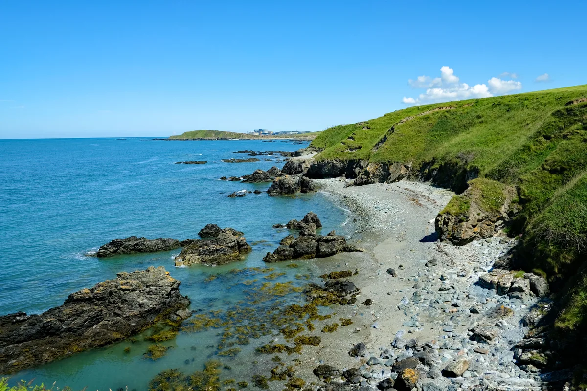
Holy Island
Holy Island — island next to the island of Anglesey, Wales.

Wikimedia Commons contributors — see linked file page for photographer and licence licence
Plan your visit
- Typical visit
- 4 h–12 h
- Nearest railway station
- Holyhead · 2.8 km
- Free entry
- Dog-friendly
About
Holy Island is a island in the United Kingdom. It covers approximately 39 km². Recent population estimates put it at around 13,659 people. Part of British Isles. Wikidata describes it as: "island next to the island of Anglesey, Wales". Coordinates: 53.2833°, -4.6167°.
Photo gallery
From the Wikipedia article
Holy Island (Welsh: Ynys Gybi, 'the island of (Saint) Cybi') is an island on the western side of the larger Isle of Anglesey, Wales, from which it is separated by the Cymyran Strait. It is called "Holy" because of the high concentration of standing stones, burial chambers and other religious sites on the small island. The alternative English name of the island is Holyhead Island. According to the 2011 UK Census, the population was 13,659, of whom 11,431 (84%) lived in the largest town, Holyhead.
Excerpt from Wikipedia under CC BY-SA 4.0. See the source article linked in Sources below.
- Coordinates
- 53.2833, -4.6167
- District
- Isle of Anglesey
- Parish
- Trearddur
- Postcode
- LL65 2UB
- Parliamentary constituency
- Ynys Môn
- Population
- 13,659
- Nearest railway station
- Holyhead — 2.8 km
- Official site
- www.geograph.org.uk
Sources
- wikidata: Q1831562 (CC0)
- wikipedia: Holy Island, Anglesey (CC BY-SA 4.0)
- commons: Cyclist on the road leading to the Breakwater Country Park - geograph.org.uk - 1415832.jpg (CC BY-SA 4.0)
Other places nearby
Loading nearby places…
Nearby
.jpg?width=1200) 📷 5
📷 5Towns & cities · North Wales
Trearddur
Trearddur — village and community on Holy Island, in Anglesey, Wales, UK.
 📷 3
📷 3Chapels · North Wales
Towyn y Capel
Towyn y Capel — vanished chapel in Trearddur Bay, Anglesey, Wales.
 📷 3
📷 3Forts · North Wales
World War II Pillbox
World War II Pillbox is a fort in the United Kingdom.
Hotels · North Wales
Trearddur Bay Hotel
Trearddur Bay Hotel — a hotel in wales north.
Caravan parks · North Wales
Trearddur Bay Country Park
Trearddur Bay Country Park — a caravan park in wales north.
Campsites · North Wales
Tyn Towyn Campsite
Tyn Towyn Campsite — a campsite in wales north.
More places in this region
 📷 5
📷 5Islands · North Wales
Anglesey
Anglesey — island in north-west Wales, UK.
 📷 5
📷 5Islands · North Wales
Bardsey Island
Bardsey Island — island off the coast of North Wales.
 Flagship📷 5
Islands · North Wales
Church Island
Church Island — island in Anglesey, Wales.
 Flagship📷 3
Islands · North Wales
Ireland
Ireland — island in the North Atlantic Ocean.
Frequently asked questions
- Where is Holy Island?
- Holy Island is in North Wales, United Kingdom (postcode LL65 2UB), in the parish of Trearddur.
- Is Holy Island free to visit?
- Yes, Holy Island is free to enter.
- How do I get to Holy Island?
- The nearest railway station is Holyhead, about 2.8 km away. Drivers can navigate to postcode LL65 2UB.