Towns & cities · North East England
Hinderwell
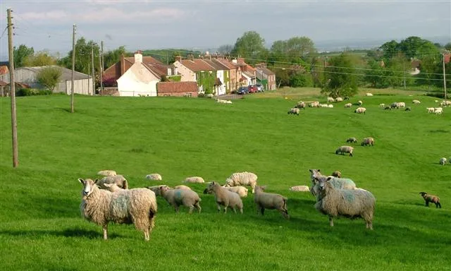
Hinderwell — village and civil parish in North Yorkshire, England.

Wikimedia Commons licence
Plan your visit
- Typical visit
- 3 h–6 h
- Nearest railway station
- Lealholm · 9.4 km
- Free entry
- Family-friendly
- Dog-friendly
About
Hinderwell is a town, city, village or settlement in the United Kingdom. Recent population estimates put it at around 1,775 people. Address: TS13. Wikidata describes it as: "village and civil parish in North Yorkshire, England". Coordinates: 54.5398°, -0.7766°.
Photo gallery
From the Wikipedia article
Hinderwell is a village and civil parish in North Yorkshire, England which lies within the North York Moors National Park, about a mile from the coast on the A174 road between the towns of Loftus and Whitby. The 2011 UK census states Hinderwell parish had a population of 1,875, a decrease on the 2001 UK census figure of 2,013. Hinderwell was the most northerly parish in the Scarborough Borough Council area until its abolition in 2023. Hinderwell is mentioned in the Domesday Book of 1086 as Hildrewell, which is said to derive from the well of Saint Hilda of Whitby, the Abbess of Whitby Abbey. St Hilda's Church, Hinderwell is named for her, as it St Hilda's Well in the churchyard. Hinderwell Methodist Church was built in 1873. The civil parish of Hinderwell encompasses: the village of Staithes, the hamlet of Port Mulgrave (NZ794174), the hamlet of Runswick Bay (NZ806161), a popular beach resort with a lifeboat service operated independently since 1982, the hamlet of Dalehouse (NZ777180), which contains the Fox and Hounds pub. From 1974 to 2023 it was part of the Borough of Scarborough, it is now administered by the unitary North Yorkshire Council.
Excerpt from Wikipedia under CC BY-SA 4.0. See the source article linked in Sources below.
- Coordinates
- 54.5398, -0.7766
- District
- North Yorkshire
- Parish
- Hinderwell
- Postcode
- TS13
- Parliamentary constituency
- Scarborough and Whitby
- Population
- 1,775
- Nearest railway station
- Lealholm — 9.4 km
Sources
- wikidata: Q2035320 (CC0)
- wikipedia: Hinderwell (CC BY-SA 4.0)
Other places nearby
Loading nearby places…
Nearby
Caravan parks · North East England
Serenity
Serenity — a caravan park in england north east.
Caravan parks · North East England
Gatehouse
Gatehouse — a caravan park in england north east.
 📷 3
📷 3Memorials & monuments · North East England
Hinderwell, Port Mulgrave and Runswick War Memorial Clock Tower
Hinderwell, Port Mulgrave and Runswick War Memorial Clock Tower — Grade II listed building-listed memorial in england-north-east, United Kingdom.
 📷 3
📷 3Archaeological sites · North East England
Hinderwell Spring
Hinderwell Spring — a archaeological in england-north-east, United Kingdom.
 📷 3
📷 3Gardens · North East England
Silkstone Hall, Formerly The Croft, Including Gateways
Silkstone Hall, Formerly The Croft, Including Gateways — a garden in england-north-east, United Kingdom.
 📷 3
📷 3Archaeological sites · North East England
Lingrow Howe
Lingrow Howe — a archaeological in england-north-east, United Kingdom.
More towns in this region
 Flagship📷 3
Towns & cities · North East England
Newby
Newby — village and civil parish in Hambleton, North Yorkshire, England, UK.
 📷 5
📷 5Towns & cities · North East England
Archdeacon Newton
Archdeacon Newton — village and civil parish in County Durham, England, UK.
 📷 3
📷 3Towns & cities · North East England
Bampton
Bampton — village and civil parish in Eden, Cumbria, England.
 📷 3
📷 3Towns & cities · North East England
Bomby
Bomby — village in Cumbria, UK.
Frequently asked questions
- Where is Hinderwell?
- Hinderwell is in North-East England, United Kingdom (postcode TS13), in the parish of Hinderwell.
- Is Hinderwell free to visit?
- Yes, Hinderwell is free to enter.
- How do I get to Hinderwell?
- Drivers can navigate to postcode TS13. It sits within the Scarborough and Whitby parliamentary constituency.