Viewpoints · West Midlands
Highest Point
Highest Point is a viewpoint in the United Kingdom.

A J Paxton — CC BY-SA 2.0 via Wikimedia Commons licence
Plan your visit
- Typical visit
- 20 min–45 min
- Best time of year
- Clear days year-round
- Nearest railway station
- Copsewood Miniature Railway · 2.7 km
- Free entry
- Dog-friendly
About
Highest Point is a named viewpoint in the West Midlands, marked on Ordnance Survey maps for its outlook. It sits within the Coventry East parliamentary constituency. The nearest railway station is Copsewood Miniature Railway, about 2.7 km away. Postcode area CV2.
Photo gallery
From the Wikipedia article
Ben Nevis ( NEV-iss; Scottish Gaelic: Beinn Nibheis, Scottish Gaelic pronunciation: [pe(ɲ) ˈɲivɪʃ]) is the highest mountain in Scotland, the United Kingdom, and the British Isles. Ben Nevis stands at the western end of the Grampian Mountains in the Highland region of Lochaber, close to the town of Fort William. The mountain is a popular destination, attracting an estimated 150,000 visitors a year, around three-quarters of whom use the Mountain Track from Glen Nevis. The mountain has hosted a foot race since 1898. The 700-metre (2,300 ft) cliffs of the north face are among the highest in Scotland, providing classic scrambles and rock climbs of all difficulties for climbers and mountaineers. They are also the principal locations in Scotland for ice climbing. The cliffs of the north face can be viewed from the Charles Inglis Clark Memorial Hut, a private alpine hut. The summit is 1,345 metres (4,413 ft) above sea level and is the highest land in any direction for 739 kilometres (459 miles). The summit is a stony plateau (a felsenmeer). It features a number of monuments and the ruins of an observatory which was continuously staffed between 1883 and 1904. The meteorological data collected during this period is still important for understanding Scottish mountain weather. C. T. R. Wilson was inspired to invent the cloud chamber after a period spent working at the observatory. The mountain gives its name to the Ben Nevis Distillery at its base, a packet ship, Ben Nevis mountain in Svalbard, a mountain more commonly known as Hung Fa Chai in Hong Kong, and the cartoon character Wee Ben Nevis.
Excerpt from Wikipedia under CC BY-SA 4.0. See the source article linked in Sources below.
- Coordinates
- 52.4239, -1.4572
- District
- Coventry
- Parish
- Coventry, unparished area
- Postcode
- CV2 1JA
- Parliamentary constituency
- Coventry East
- Nearest railway station
- Copsewood Miniature Railway — 2.7 km
Sources
- osm: n1994195090 (ODbL)
- wikipedia: Highest point in Scotland (CC BY-SA 4.0)
Other places nearby
Loading nearby places…
Nearby
 📷 5
📷 5Historic churches · West Midlands
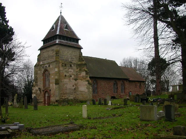
St Mary Magdalene's Church, Wyken
St Mary Magdalene's Church, Wyken — Grade I listed church in Wyken, Coventry, West Midlands, England, UK.
 📷 5
📷 5Castles · West Midlands
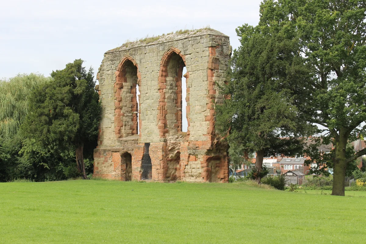
Caludon Castle
Caludon Castle — Grade I listed castle in Coventry, West Midlands, England, UK.
 📷 5
📷 5Historic churches · West Midlands
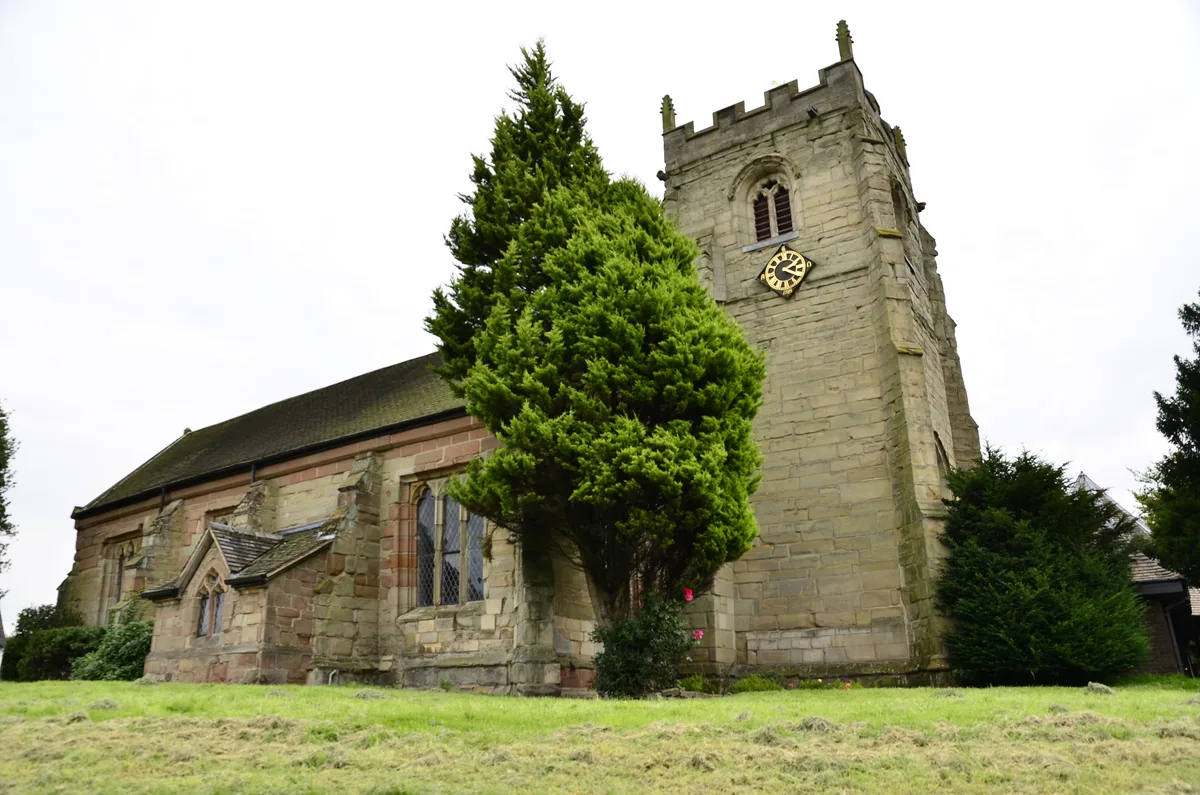
St Mary's Church, Walsgrave
St Mary's Church, Walsgrave — church in Coventry, West Midlands, England, UK.
 📷 5
📷 5Natural landmarks · West Midlands
Coventry Hospital School and Home Tuition Service
Coventry Hospital School and Home Tuition Service — a school heritage in england-west-midlands, United Kingdom.
Hostels · West Midlands
Axholme House
Axholme House — a hostel in england west midlands.
 📷 5
📷 5Natural landmarks · West Midlands
Henley College, Coventry
Henley College, Coventry — a school heritage in england-west-midlands, United Kingdom.
More viewpoints in this region
 📷 4
📷 4Viewpoints · West Midlands
Ambion Hill
Ambion Hill is a viewpoint in the United Kingdom.
 📷 3
📷 3Viewpoints · West Midlands
Apedale Winding Wheel
Apedale Winding Wheel is a viewpoint in the United Kingdom.
 📷 3
📷 3Viewpoints · West Midlands
Baggeridge Toposcope
Baggeridge Toposcope is a viewpoint in the United Kingdom.
 📷 3
📷 3Viewpoints · West Midlands
Barrett Bridge
Barrett Bridge is a viewpoint in the United Kingdom.
Frequently asked questions
- Where is Highest Point?
- Highest Point is in the West Midlands, United Kingdom (postcode CV2 1JA), in the parish of Coventry, unparished area.
- Is Highest Point free to visit?
- Yes, Highest Point is free to enter.
- How do I get to Highest Point?
- The nearest railway station is Copsewood Miniature Railway, about 2.7 km away. Drivers can navigate to postcode CV2 1JA.