Museums · North Wales
Heswall
Heswall — a museum in wales-north, United Kingdom.

John S Turner — CC BY-SA 2.0 via Wikimedia Commons licence
Plan your visit
- Typical visit
- 1.5 h–3 h
- Best time of year
- Year-round
- Family-friendly
- Limited wheelchair access
About
Heswall is a museum in wales-north, United Kingdom, listed in the Wikipedia register of British heritage and tourism sites. See the linked Wikipedia article for full details.
Photo gallery
Place summary
Heswall is a museum located in North Wales. It showcases the local history and culture of the area. The museum features a range of exhibits that reflect the heritage of the community.
AI-generated from the structured facts on this page (operator, designation, listing, era). Not a substitute for visiting.
Background
History
Before the Norman Conquest, Heswall has been cited as a possible location for Dingesmere, mentioned with regard to the Battle of Brunanburh, in Egil's Saga. Heswall was recorded in the Domesday Book of 1086 as Eswelle, owned by Robert de Rodelent, who also owned much of the land on the eastern side of the River Dee. In 1277, it became the property of Patrick de Haselwall, who was Sheriff of Cheshire.
Architecture
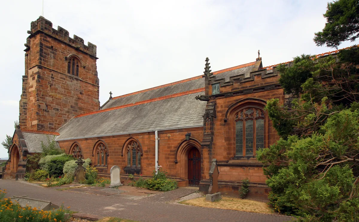
The oldest structure is the tower of St Peter's Parish Church, which is about 500 years old. The present church was built in 1879, and is the third to have been built on the site. The previous church was destroyed by a violent thunderstorm on 19 September 1875; the organist and the boy who pumped the bellows for the organ were both killed. The remains of Gayton's windmill, which stopped operating in 1860 and is now converted into a house, can be seen close to the Devon Doorway pub-restaurant on Gayton Roundabout, a short distance back up Telegraph Road towards Heswall. The Royal Liverpool Children's Hospital originally opened in Heswall as Liverpool Country Hospital for Children in 1909.…
Visiting
There are several areas of open space. The largest is the Dales, an area of dry, sandy heathland overlooking the River Dee. It has the status of both Site of Special Scientific Interest (SSSI) and Local Nature Reserve (LNR). Within this SSSI lies 'the Dungeon', a small river valley cut into the hillside. A path connects the Dales to the Wirral Way and the coast. Other open areas also overlooking the Dee are the Beacons, and Poll Hill, which is the highest point on the Wirral Peninsula. Whitfield Common, off Whitfield Lane, contains open land as well as playing fields and tennis courts.
Sourced from Wikipedia under CC BY-SA 4.0.
- Coordinates
- 53.3280, -3.0990
- District
- Wirral
- Parish
- Wirral, unparished area
- Postcode
- CH60 0AN
- Parliamentary constituency
- Wirral West
Sources
- wikipedia: Heswall (CC BY-SA 4.0)
Other places nearby
Loading nearby places…
Nearby
 📷 3
📷 3Memorials & monuments · North Wales
Hill House Garden Memorial
Hill House Garden Memorial — a memorial in wales-north, United Kingdom.
📷 3Memorials & monuments · North Wales
Heswall War Memorial
Heswall War Memorial — Grade II listed building-listed memorial in wales-north, United Kingdom.
 📷 3
📷 3Historic churches · North Wales
St Peter's Church, Heswall
St Peter's Church, Heswall — Grade II* listed church in Wirral, UK.
 📷 5
📷 5Parks · North Wales
Heswall Dales
Heswall Dales is an area of some 72 acres (290,000 m2) of lowland heath situated close to Heswall on the Wirral Peninsula, England. It is a Site of Special Scientific Interest and a Local Nature Reser
 📷 3
📷 3Parks · North Wales
Cleaver Heath Nature Reserve
Cleaver Heath Nature Reserve — nature reserve and Site of Special Scientific Interest in Wirral, England.
 📷 3
📷 3Historic houses · North Wales
Gayton Hall
Gayton Hall — house in Gayton, Wirral, Merseyside, England, UK.
More museums in this region
 📷 4
📷 4Museums · North Wales
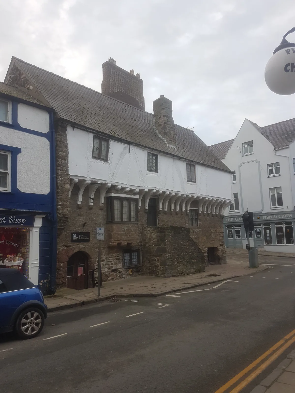
Aberconwy House Museum
Aberconwy House Museum — museum in Betws y Coed.
 📷 3
📷 3Museums · North Wales
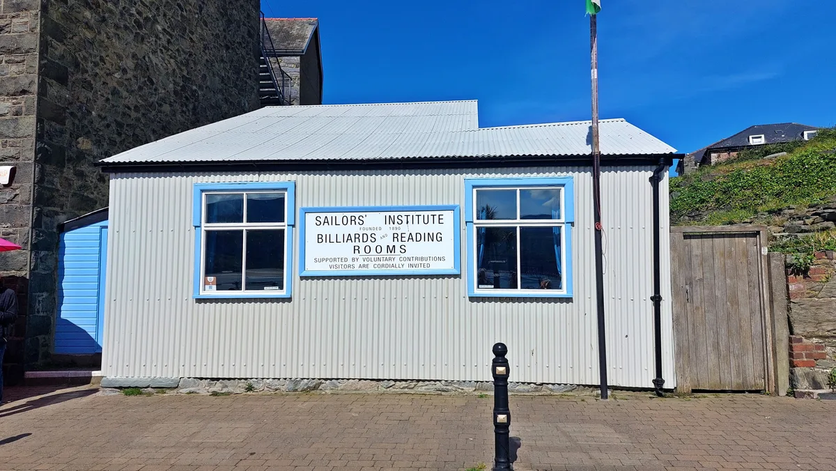
Barmouth Sailors' Institute
Barmouth Sailors' Institute — Community centre, heritage organisation and museum in the Barmouth, Wales, UK.
 📷 3
📷 3Museums · North Wales
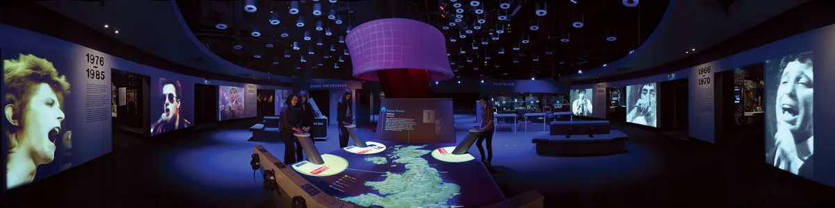
British Music Experience
British Music Experience is a museum in the United Kingdom.
 📷 3
📷 3Museums · North Wales
Caernarfon Castle and Town Walls
Caernarfon Castle and Town Walls — part of a World Heritage site in the United Kingdom.
Frequently asked questions
- Where is Heswall?
- Heswall is in North Wales, in the United Kingdom — coordinates 53.3280°, -3.0990°.
- Is Heswall wheelchair accessible?
- Partially — OpenStreetMap notes limited wheelchair access at Heswall. Check ahead for specific facilities.