Natural landmarks · Scottish Lowlands
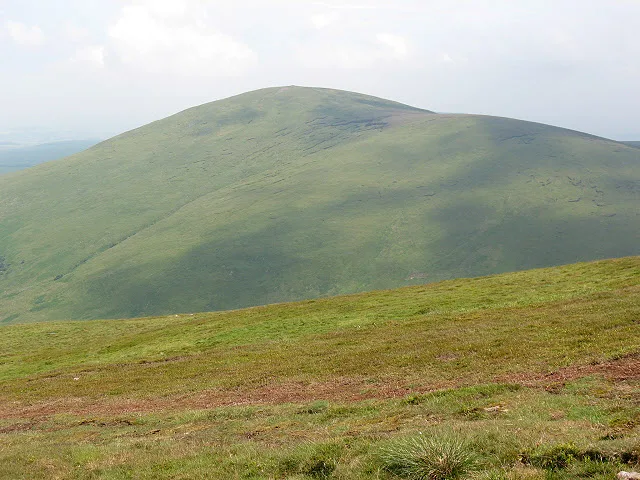
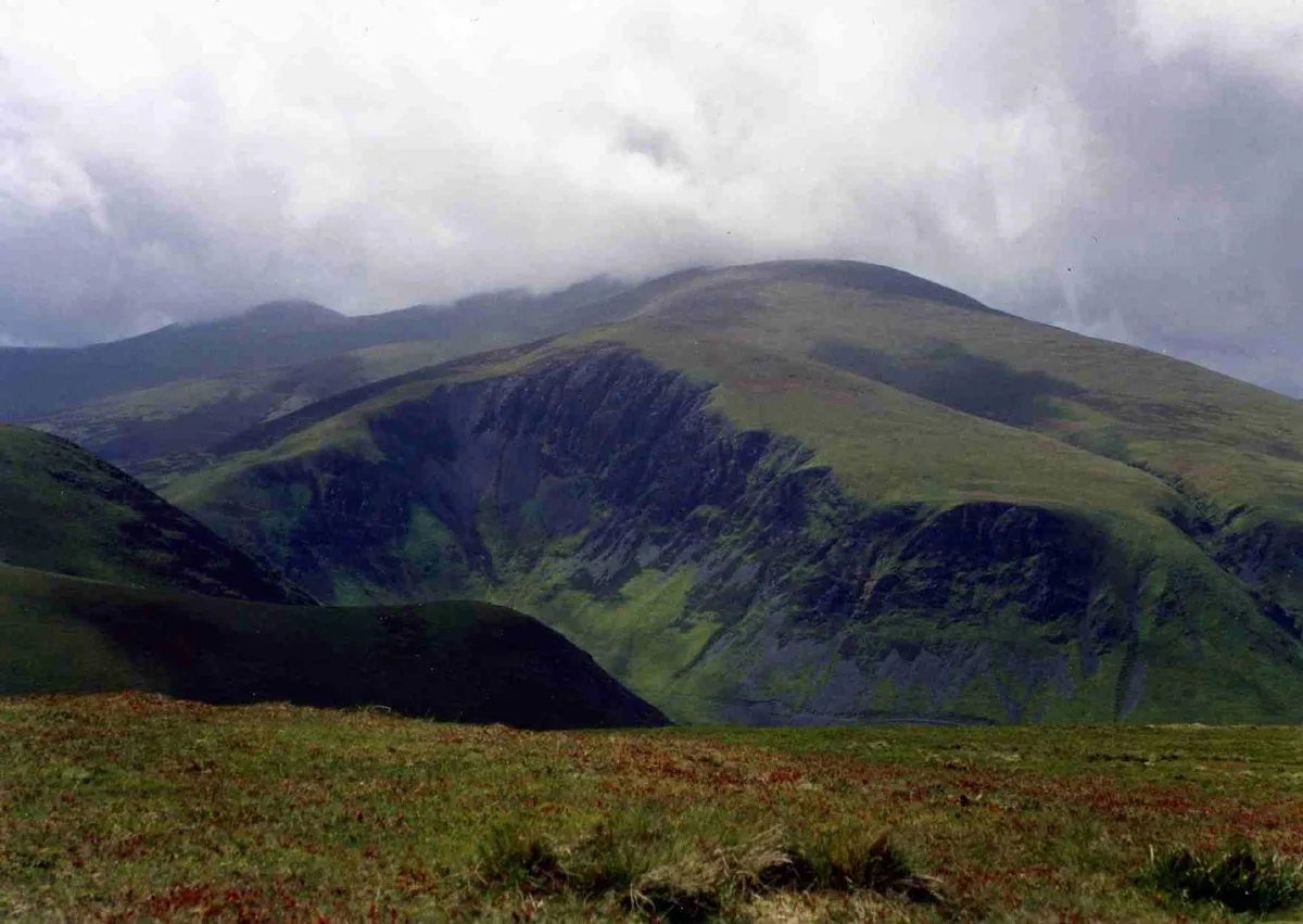
Hedgehope Hill
Hedgehope Hill — mountain in United Kingdom.

Wikimedia Commons contributors — see linked file page for photographer and licence licence
Plan your visit
- Typical visit
- 1 h–2 h
- Free entry
- Dog-friendly
About
Hedgehope Hill is a named natural landmark in the United Kingdom. Wikidata describes it as: "mountain in United Kingdom". Coordinates: 55.4719°, -2.0904°.
Photo gallery
Protected designations
- Site of Special Scientific Interest: The Cheviot SSSI
- Site of Special Scientific Interest: Tweed Catchment Rivers - England: Till Catchment SSSI
Designations sourced from Natural England open data under OGL v3.
From the Wikipedia article
Hedgehope Hill is a mountain in the Cheviot Hills of north Northumberland in northeast England, and categorised as a Hewitt. It is the second-highest mountain in the area after The Cheviot itself. At a height of 714 metres (2,343 ft) and a distance of about 3 miles (4.8 km) from the Scottish border, it is best climbed from Langleeford in the Harthope Valley, over which it looms. The Harthope valley is accessible by a minor road from near Wooler to the northeast. A slightly gentler climb, though a longer distance, is from Linhope in the Breamish valley, approaching from the south east. An alternative route to the summit could involve a long day's climb of both the Cheviot and Hedgehope Hill, starting and finishing at Langleeford. It is a steep climb from any approach, best reserved for fitter walkers though the steepest inclines are not long in distance. Hedgehope has steeper sides than the taller but flatter-topped Cheviot and affords excellent views on all sides. On a clear day, views stretch to Blyth down the coastline up to 40 miles (60 km) away. Conversely, the mountain can be viewed on a clear day from most areas of Northumberland and even as far south as central County Durham.
Excerpt from Wikipedia under CC BY-SA 4.0. See the source article linked in Sources below.
- Coordinates
- 55.4719, -2.0904
- Address
- Cheviot Hills, Northumberland
Sources
- wikidata: Q5697321 (CC0)
- wikipedia: Hedgehope Hill (CC BY-SA 4.0)
- commons: Hedgehope Hill from Scald Hill - geograph.org.uk - 1421255.jpg (CC BY-SA 4.0)
Other places nearby
Loading nearby places…
Nearby
 📷 3
📷 3Mountains & hills · Scottish Lowlands
Hedgehope Hill
Hedgehope Hill — Named summit at 714 m.
 📷 4
📷 4Memorials & monuments · North East England
Stone circle and stone alignment 370m west of Threestoneburn House
Stone circle and stone alignment 370m west of Threestoneburn House in England North East, United Kingdom.
 📷 3
📷 3Stone circles · Scottish Lowlands
Threestoneburn Stone Circle
Threestoneburn Stone Circle — a stone circle in scotland-lowlands, United Kingdom.
 📷 3
📷 3Mountains & hills · Scottish Lowlands
The Cheviot
The Cheviot — Named summit at 815 m.
 📷 3
📷 3Memorials & monuments · Central Scotland
SH / II
SH / II — a memorial in scotland-central, United Kingdom.
 📷 4
📷 4National parks · North East England
The Cheviot Hills
The Cheviot Hills in England North East, United Kingdom.
More natural landmarks in this region
 Flagship📷 3
Natural landmarks · Scottish Lowlands
Bassenthwaite Lake
Bassenthwaite Lake — lake in Cumbria, England, UK.
 Flagship📷 3
Natural landmarks · Scottish Lowlands
Loch Enoch
Loch Enoch — lake in Dumfries and Galloway, Scotland, UK.
 📷 5
📷 5Natural landmarks · Scottish Lowlands
Annandale Water
Annandale Water — lake in Dumfries and Galloway, Scotland, UK.
 📷 3
📷 3Natural landmarks · Scottish Lowlands
Bakestall
Bakestall — mountain in United Kingdom.
Frequently asked questions
- Where is Hedgehope Hill?
- Hedgehope Hill is in the Scottish Lowlands, United Kingdom.
- Is Hedgehope Hill a protected site?
- Yes — Hedgehope Hill is part of the The Cheviot SSSI Site of Special Scientific Interest and the Tweed Catchment Rivers - England: Till Catchment SSSI Site of Special Scientific Interest.
- Is Hedgehope Hill free to visit?
- Yes, Hedgehope Hill is free to enter.