Towns & cities · West Midlands
Hartford
Also known as: Hartford, Swydd Gaer
Hartford — village and civil parish in Cheshire, England.

Wikimedia Commons contributors — see linked file page for photographer and licence licence
Plan your visit
- Typical visit
- 3 h–6 h
- Nearest railway station
- Hartford · 0.5 km
- Free entry
- Family-friendly
- Dog-friendly
About
Hartford is a town, city, village or settlement in the United Kingdom. Recent population estimates put it at around 5,515 people. Address: CW8. Wikidata describes it as: "village and civil parish in Cheshire, England". Coordinates: 53.2450°, -2.5490°.
Photo gallery
From the Wikipedia article
Hartford is a village and civil parish in the unitary authority of Cheshire West and Chester and the ceremonial county of Cheshire, England. It lies in the Cheshire Plain, to the south-west of the town of Northwich, at the intersection of the A559 road and the West Coast Main Line. It is surrounded by the parishes of Weaverham to the north, Kingsmead and Davenham to the east, Whitegate and Marton to the south and Cuddington to the west. The village forms part of the Mid-Cheshire parliamentary constituency. In the 2011 Census, the population of the parish was 5,558.
Excerpt from Wikipedia under CC BY-SA 4.0. See the source article linked in Sources below.
Background
History
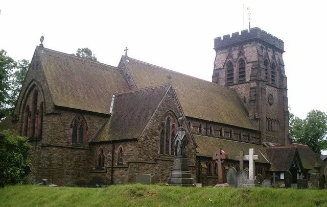
Hartford was recorded in the Domesday Book of 1086, when the Manor was held by Gilbert de Venables as part of the Barony of Kinderton. Prior to the reign of Edward III, it was held by a family who assumed the local name, from which it passed to the Horton, Massey, Holcroft, Marbury and Davies families. In 1644, during the English Civil War, a battle was fought at Hartford Green when Royalists from Chester encountered the Parliamentary forces from Northwich. St John the Baptist Church was built in 1875, on the site of an earlier church that was consecrated in 1824. The original building was replaced because the village's population grew and the church became too small. The new building was…
Sourced from Wikipedia under CC BY-SA 4.0.
- Coordinates
- 53.2450, -2.5490
- District
- Cheshire West and Chester
- Parish
- Hartford
- Postcode
- CW8
- Parliamentary constituency
- Mid Cheshire
- Population
- 5,515
- Nearest railway station
- Hartford — 0.5 km
- Official site
- www.thegrangetheatre.com
Sources
- wikidata: Q1587114 (CC0)
- wikipedia: Hartford, Cheshire (CC BY-SA 4.0)
- commons: Hartford church.jpg (CC BY-SA 4.0)
Other places nearby
Loading nearby places…
Nearby
 📷 5
📷 5Natural landmarks · West Midlands
The Grange School, Northwich
The Grange School, Northwich — a school heritage in england-west-midlands, United Kingdom.
📷 3Memorials & monuments · West Midlands
Hartford War Memorial
Hartford War Memorial — Grade II listed building-listed memorial in england-west-midlands, United Kingdom.
 📷 5
📷 5Historic churches · West Midlands
St John's Church, Hartford
St John's Church, Hartford — grade II listed church in Cheshire West and Chester, Cheshire, England, UK.
 📷 3
📷 3Memorials & monuments · West Midlands
Mersey Vale
Mersey Vale — a memorial in england-west-midlands, United Kingdom.
 📷 3
📷 3Theatres · West Midlands
The Grange Theatre
The Grange Theatre is a theatre in the United Kingdom.
 📷 3
📷 3Natural landmarks · West Midlands
Hartford Picnic Area
Hartford Picnic Area — a other in england-west-midlands, United Kingdom.
More towns in this region
 Flagship📷 3
Towns & cities · West Midlands
Adderbury
Adderbury — village and civil parish in Cherwell district, Oxfordshire, England.
 Flagship📷 3
Towns & cities · West Midlands
Admington
Admington — village in Warwickshire, England, UK.
 Flagship📷 3
Towns & cities · West Midlands
Aldington
Aldington — village in Worcestershire, United Kingdom.
 Flagship📷 5
Towns & cities · West Midlands
Anstey
Anstey — large village in Leicestershire, England.
Frequently asked questions
- Where is Hartford?
- Hartford is in the West Midlands, United Kingdom (postcode CW8), in the parish of Hartford.
- Is Hartford free to visit?
- Yes, Hartford is free to enter.
- How do I get to Hartford?
- The nearest railway station is Hartford, about 0.5 km away. Drivers can navigate to postcode CW8.